Property Record
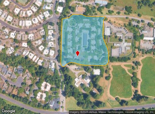
10 Jeannette Prandi Way, San Rafael, CA 94903


NEARBY LISTINGS FOR SALE OR LEASE
Property Detail
10 Jeannette Prandi Way
164-640-02
Marin
Taxexempt
California
X
7.53 AC
06097C1100F
Lucas Valley
2025
North Bay/Santa Rosa
2025
San Rafael, CA
107000
DEMOGRAPHICS near 10 Jeannette Prandi Way
1 Mile
3 Mile
5 Mile
2024 Total Population
4,959
47,219
107,897
2029 Population
4,798
45,923
104,890
Pop Growth 2024-2029
(3.25%)
(2.74%)
(2.79%)
Average Age
48
46
45
2024 Total Households
1,851
18,818
43,683
HH Growth 2024-2029
(3.40%)
(2.82%)
(2.85%)
Median Household Inc
$156,004
$111,768
$112,879
Avg Household Size
2.60
2.40
2.40
2024 Avg HH Vehicles
2.00
2.00
2.00
Median Home Value
$1,119,432
$1,027,290
$1,044,545
Median Year Built
1961
1967
1965
Nearby Places
Map Layers
Map Styles
 Street
 Aerial
- Restaurants
- Banks
- Shops
- Fitness
- Groceries
PUBLIC TRANSPORTATION
COMMUTER RAIL
Marin Civic Center Smart (Main Line - Sonoma Marin Area Rail Transit)
DRIVE
WALK
Distance
Marin Civic Center Smart (Main Line - Sonoma Marin Area Rail Transit)
6 min
3.4 mi
Novato Hamilton Smart (Main Line - Sonoma Marin Area Rail Transit)
DRIVE
WALK
Distance
Novato Hamilton Smart (Main Line - Sonoma Marin Area Rail Transit)
10 min
5.3 mi
AIRPORT
Metro Oakland International
DRIVE
WALK
Distance
Metro Oakland International
50 min
36.6 mi
Freight Ports
Port of Richmond
DRIVE
WALK
Distance
Port of Richmond
28 min
17.3 mi
Nearby Properties
Address
Land Use
TOTAL SIZE
Lot Size
Zoning
Address
Land Use
TOTAL SIZE
Lot Size
Zoning
283,663 SF
27.98 AC
Address
Land Use
TOTAL SIZE
Lot Size
Zoning
23.79 AC
Address
Land Use
TOTAL SIZE
Lot Size
Zoning
221,660 SF
9.69 AC
PC
Address
Land Use
TOTAL SIZE
Lot Size
Zoning
16.43 AC
Address
Land Use
TOTAL SIZE
Lot Size
Zoning
146,832 SF
5.50 AC
Address
Land Use
TOTAL SIZE
Lot Size
Zoning
167,392 SF
12.79 AC
Address
Land Use
TOTAL SIZE
Lot Size
Zoning
132,040 SF
11.74 AC
Address
Land Use
TOTAL SIZE
Lot Size
Zoning
11.63 AC
Address
Land Use
TOTAL SIZE
Lot Size
Zoning
75,888 SF
10.99 AC
Address
Land Use
TOTAL SIZE
Lot Size
Zoning
195,460 SF
6.10 AC
Address
Land Use
TOTAL SIZE
Lot Size
Zoning
85,066 SF
1.29 AC
Address
Land Use
TOTAL SIZE
Lot Size
Zoning
48,603 SF
2.54 AC
Address
Land Use
TOTAL SIZE
Lot Size
Zoning
192,037 SF
511.90 AC
Address
Land Use
TOTAL SIZE
Lot Size
Zoning
139,073 SF
8.98 AC
Address
Land Use
TOTAL SIZE
Lot Size
Zoning
33,641 SF
1.60 AC
Address
Land Use
TOTAL SIZE
Lot Size
Zoning
6.39 AC
Address
Land Use
TOTAL SIZE
Lot Size
Zoning
142,341 SF
5.83 AC
Address
Land Use
TOTAL SIZE
Lot Size
Zoning
94,625 SF
8.96 AC
Address
Land Use
TOTAL SIZE
Lot Size
Zoning
132,813 SF
6.75 AC
Address
Land Use
TOTAL SIZE
Lot Size
Zoning
77,030 SF
3.34 AC
Address
Land Use
TOTAL SIZE
Lot Size
Zoning
124,196 SF
9.77 AC
Address
Land Use
TOTAL SIZE
Lot Size
Zoning
49,986 SF
1.71 AC
Address
Land Use
TOTAL SIZE
Lot Size
Zoning
71,268 SF
5.52 AC
Address
Land Use
TOTAL SIZE
Lot Size
Zoning
Address
Land Use
TOTAL SIZE
Lot Size
Zoning
110,000 SF
8.13 AC
Address
Land Use
TOTAL SIZE
Lot Size
Zoning
268,590 SF
2.12 AC
Address
Land Use
TOTAL SIZE
Lot Size
Zoning
88,401 SF
1.72 AC
Address
Land Use
TOTAL SIZE
Lot Size
Zoning
105,000 SF
8.60 AC
Address
Land Use
TOTAL SIZE
Lot Size
Zoning
45,686 SF
2.22 AC
Address
Land Use
TOTAL SIZE
Lot Size
Zoning
44.55 AC
The World's #1 Commercial Real Estate Marketplace
Connect with us
© 2026 CoStar Group
The information above has been obtained from sources believed reliable. While we do not doubt its accuracy we have not verified it and make no guarantee, warranty or representation about it. It is your responsibility to independently confirm its accuracy and completeness. Any projections, opinions, assumptions, or estimates used are for example only and do not represent the current or future performance of the property. The value of this transaction to you depends on tax and other factors which should be evaluated by your tax, financial, and legal advisors. You and your advisors should conduct a careful, independent investigation of the property to determine to your satisfaction the suitability of the property for your needs.