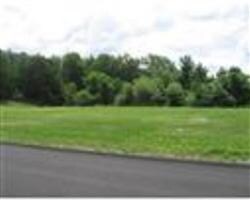
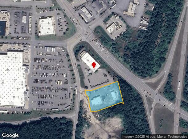
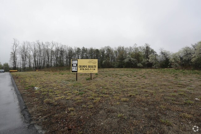
Property Record
10 Jungle Rd, Leominster, MA 01453
NEARBY LISTINGS FOR SALE OR LEASE
Property Detail
10 Jungle Rd
LEOM-000300-000013A
Worcester
Commercialacreage
Massachusetts
X
1.41 AC
25027C0451F
Fitchburg/Leominster
2025
Boston
2025
Worcester, MA-CT
709204
DEMOGRAPHICS near 10 Jungle Rd
1 Mile
3 Mile
5 Mile
2024 Total Population
2,858
27,060
57,915
2029 Population
2,840
26,871
57,603
Pop Growth 2024-2029
(0.63%)
(0.70%)
(0.54%)
Average Age
42
41
42
2024 Total Households
1,134
10,540
22,430
HH Growth 2024-2029
(0.71%)
(0.73%)
(0.57%)
Median Household Inc
$80,219
$74,185
$81,374
Avg Household Size
2.30
2.40
2.40
2024 Avg HH Vehicles
2.00
2.00
2.00
Median Home Value
$271,224
$331,797
$358,922
Median Year Built
1982
1967
1965
Nearby Places
- Restaurants
- Banks
- Shops
- Fitness
- Groceries
PUBLIC TRANSPORTATION
COMMUTER RAIL
North Leominster (Fitchburg/South Acton Line - Massachusetts Bay Transportation Authority Commuter Rail (Purple Line))
DRIVE
WALK
Distance
North Leominster (Fitchburg/South Acton Line - Massachusetts Bay Transportation Authority Commuter Rail (Purple Line))
7 min
4.4 mi
Shirley (Fitchburg/South Acton Line - Massachusetts Bay Transportation Authority Commuter Rail (Purple Line))
DRIVE
WALK
Distance
Shirley (Fitchburg/South Acton Line - Massachusetts Bay Transportation Authority Commuter Rail (Purple Line))
14 min
8.4 mi
AIRPORT
Worcester Regional
DRIVE
WALK
Distance
Worcester Regional
34 min
23.3 mi
Freight Ports
Port of Boston
DRIVE
WALK
Distance
Port of Boston
69 min
45.3 mi
SALE & LEASE HISTORY
LISTING DATE
SALE/LEASE

Sep 24, 2016
For Sale
Jun 01, 2017
For Sale
Nearby Properties
Address
Land Use
TOTAL SIZE
Lot Size
Zoning
Address
Land Use
TOTAL SIZE
Lot Size
Zoning
120.52 AC
Address
Land Use
TOTAL SIZE
Lot Size
Zoning
24.35 AC
Address
Land Use
TOTAL SIZE
Lot Size
Zoning
45,066 SF
18.52 AC
Address
Land Use
TOTAL SIZE
Lot Size
Zoning
552,952 SF
27.44 AC
Address
Land Use
TOTAL SIZE
Lot Size
Zoning
20.30 AC
Address
Land Use
TOTAL SIZE
Lot Size
Zoning
47,173 SF
0.76 AC
Address
Land Use
TOTAL SIZE
Lot Size
Zoning
9.30 AC
Address
Land Use
TOTAL SIZE
Lot Size
Zoning
68,822 SF
9.83 AC
Address
Land Use
TOTAL SIZE
Lot Size
Zoning
111,960 SF
4.75 AC
Address
Land Use
TOTAL SIZE
Lot Size
Zoning
171,063 SF
14.62 AC
Address
Land Use
TOTAL SIZE
Lot Size
Zoning
51,492 SF
9.34 AC
Address
Land Use
TOTAL SIZE
Lot Size
Zoning
Address
Land Use
TOTAL SIZE
Lot Size
Zoning
125,461 SF
11.27 AC
Address
Land Use
TOTAL SIZE
Lot Size
Zoning
107,828 SF
7.41 AC
Address
Land Use
TOTAL SIZE
Lot Size
Zoning
66.70 AC
Address
Land Use
TOTAL SIZE
Lot Size
Zoning
119,038 SF
12.17 AC
Address
Land Use
TOTAL SIZE
Lot Size
Zoning
102,628 SF
10.50 AC
Address
Land Use
TOTAL SIZE
Lot Size
Zoning
Address
Land Use
TOTAL SIZE
Lot Size
Zoning
118,587 SF
22.30 AC
Address
Land Use
TOTAL SIZE
Lot Size
Zoning
81,594 SF
1.59 AC
Address
Land Use
TOTAL SIZE
Lot Size
Zoning
36,386 SF
2.77 AC
Address
Land Use
TOTAL SIZE
Lot Size
Zoning
4.71 AC
Address
Land Use
TOTAL SIZE
Lot Size
Zoning
12.51 AC
Address
Land Use
TOTAL SIZE
Lot Size
Zoning
88,566 SF
29.46 AC
Address
Land Use
TOTAL SIZE
Lot Size
Zoning
72,948 SF
0.72 AC
Address
Land Use
TOTAL SIZE
Lot Size
Zoning
3,712 SF
7.58 AC
Address
Land Use
TOTAL SIZE
Lot Size
Zoning
Address
Land Use
TOTAL SIZE
Lot Size
Zoning
77,064 SF
6.04 AC
Address
Land Use
TOTAL SIZE
Lot Size
Zoning
59,587 SF
1.13 AC
Address
Land Use
TOTAL SIZE
Lot Size
Zoning
97,048 SF
6.85 AC
The World's #1 Commercial Real Estate Marketplace
Connect with us
© 2025 CoStar Group
The information above has been obtained from sources believed reliable. While we do not doubt its accuracy we have not verified it and make no guarantee, warranty or representation about it. It is your responsibility to independently confirm its accuracy and completeness. Any projections, opinions, assumptions, or estimates used are for example only and do not represent the current or future performance of the property. The value of this transaction to you depends on tax and other factors which should be evaluated by your tax, financial, and legal advisors. You and your advisors should conduct a careful, independent investigation of the property to determine to your satisfaction the suitability of the property for your needs.