Property Record
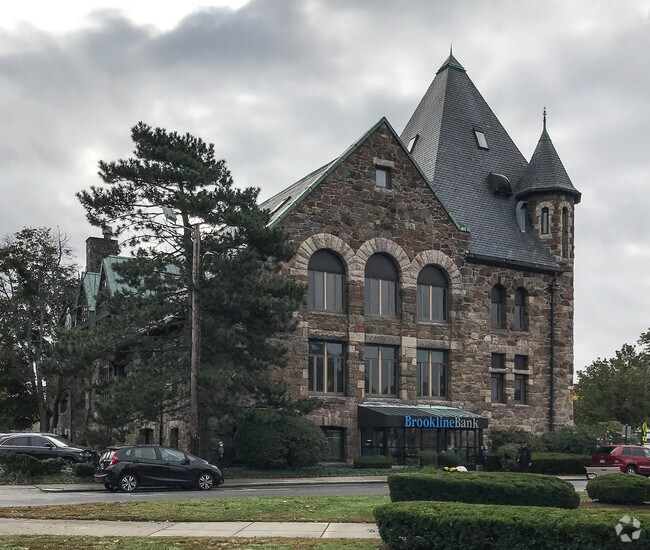
10 Langley Rd, Newton Center, MA 02459


Current Lease Availabilities
Property Detail
10 Langley Rd
NEWT-000061-000033-000002
MIDDLESEX
Officebuilding
Massachusetts
BU1
2
B and X Area of moderate flood hazard, usually the area between the limits of the 100-year and 500-year floods.
0.34 AC
2025
Newton/Brookline
2025
Boston
373600
Boston-Cambridge-Newton, MA-NH
39,516 SF
NEARBY LISTINGS FOR SALE OR LEASE
DEMOGRAPHICS near 10 Langley Rd
1 mile
3 mile
5 mile
2025 Total Population
16,743
176,665
557,034
2030 Population
17,222
182,072
573,458
Pop Growth 2025-2030
+ 2.86%
+ 3.06%
+ 2.95%
Average Age
42
40
39
2025 Total Households
5,771
69,046
219,924
HH Growth 2025-2030
+ 3.10%
+ 3.29%
+ 3.26%
Median Household Inc
$200,828
$137,194
$125,027
Avg Household Size
2.60
2.30
2.30
2025 Avg HH Vehicles
2.00
1.00
1.00
Median Home Value
$1,099,483
$1,043,807
$980,572
Median Year Built
1947
1949
1950
Nearby Places
Map Layers
Map Styles
 Street
 Aerial
Transit
 Traffic
 Biking
Places
Listings with unknown addresses are not visible on the map
- Restaurants
- Banks
- Shops
- Fitness
- Groceries
PUBLIC TRANSPORTATION
TRANSIT/SUBWAY
Newton Centre Station (Green Line - D - Massachusetts Bay Transportation Authority Subway (The T))
Drive
Walk
Distance
Newton Centre Station (Green Line - D - Massachusetts Bay Transportation Authority Subway (The T))
1 min
4 min
0.2 mi
Newton Highlands Station (Green Line - D - Massachusetts Bay Transportation Authority Subway (The T))
Drive
Walk
Distance
Newton Highlands Station (Green Line - D - Massachusetts Bay Transportation Authority Subway (The T))
2 min
20 min
1.0 mi
COMMUTER RAIL
Newtonville (Framingham/Worcester Line - Massachusetts Bay Transportation Authority Commuter Rail (Purple Line))
Drive
Walk
Distance
Newtonville (Framingham/Worcester Line - Massachusetts Bay Transportation Authority Commuter Rail (Purple Line))
7 min
3.5 mi
West Newton (Framingham/Worcester Line - Massachusetts Bay Transportation Authority Commuter Rail (Purple Line))
Drive
Walk
Distance
West Newton (Framingham/Worcester Line - Massachusetts Bay Transportation Authority Commuter Rail (Purple Line))
9 min
4.8 mi
AIRPORT
General Edward Lawrence Logan International
Drive
Walk
Distance
General Edward Lawrence Logan International
23 min
12.5 mi
Worcester Regional
Drive
Walk
Distance
Worcester Regional
61 min
41.9 mi
Freight Ports
Port of Boston
Drive
Walk
Distance
Port of Boston
21 min
10.9 mi
Nearby Properties
Address
Land Use
TOTAL SIZE
Lot Size
Zoning
Address
Land Use
TOTAL SIZE
Lot Size
Zoning
150,192 SF
10.27 AC
E
Address
Land Use
TOTAL SIZE
Lot Size
Zoning
30,845 SF
50.36 AC
SR1
Address
Land Use
TOTAL SIZE
Lot Size
Zoning
336,518 SF
6.15 AC
I-3
Address
Land Use
TOTAL SIZE
Lot Size
Zoning
387,550 SF
7.99 AC
MU1
Address
Land Use
TOTAL SIZE
Lot Size
Zoning
220,671 SF
2.52 AC
I-2
Address
Land Use
TOTAL SIZE
Lot Size
Zoning
176,625 SF
5.76 AC
I-3
Address
Land Use
TOTAL SIZE
Lot Size
Zoning
412,208 SF
7.93 AC
I
Address
Land Use
TOTAL SIZE
Lot Size
Zoning
30,170 SF
19 AC
SR2
Address
Land Use
TOTAL SIZE
Lot Size
Zoning
21.52 AC
Address
Land Use
TOTAL SIZE
Lot Size
Zoning
228,483 SF
7.57 AC
BU1
Address
Land Use
TOTAL SIZE
Lot Size
Zoning
317,049 SF
11.22 AC
M05
Address
Land Use
TOTAL SIZE
Lot Size
Zoning
1,050 SF
8.77 AC
BU4
Address
Land Use
TOTAL SIZE
Lot Size
Zoning
203,252 SF
236.88 AC
S40
Address
Land Use
TOTAL SIZE
Lot Size
Zoning
234,814 SF
4.06 AC
Address
Land Use
TOTAL SIZE
Lot Size
Zoning
157,828 SF
4.39 AC
E
Address
Land Use
TOTAL SIZE
Lot Size
Zoning
163,364 SF
3.08 AC
O10
Address
Land Use
TOTAL SIZE
Lot Size
Zoning
4.74 AC
NEBC
Address
Land Use
TOTAL SIZE
Lot Size
Zoning
179,834 SF
8.57 AC
PUB
Address
Land Use
TOTAL SIZE
Lot Size
Zoning
241,737 SF
4.67 AC
BU1
Address
Land Use
TOTAL SIZE
Lot Size
Zoning
25,744 SF
35.80 AC
S40
Address
Land Use
TOTAL SIZE
Lot Size
Zoning
76,800 SF
22.65 AC
MU1
Address
Land Use
TOTAL SIZE
Lot Size
Zoning
5,119 SF
119.98 AC
S15
Address
Land Use
TOTAL SIZE
Lot Size
Zoning
286,928 SF
2.89 AC
BU1
Address
Land Use
TOTAL SIZE
Lot Size
Zoning
215,662 SF
1.87 AC
A
Address
Land Use
TOTAL SIZE
Lot Size
Zoning
141,536 SF
7.89 AC
I
Address
Land Use
TOTAL SIZE
Lot Size
Zoning
151,232 SF
8.27 AC
PUB
Address
Land Use
TOTAL SIZE
Lot Size
Zoning
6.51 AC
PSCD
Address
Land Use
TOTAL SIZE
Lot Size
Zoning
220,500 SF
1.96 AC
NEBC
Address
Land Use
TOTAL SIZE
Lot Size
Zoning
108,818 SF
I-1
Address
Land Use
TOTAL SIZE
Lot Size
Zoning
208,500 SF
13.98 AC
I
The World's #1 Commercial Real Estate Marketplace
Connect with us
© 2026 CoStar Group
The information above has been obtained from sources believed reliable. While we do not doubt its accuracy we have not verified it and make no guarantee, warranty or representation about it. It is your responsibility to independently confirm its accuracy and completeness. Any projections, opinions, assumptions, or estimates used are for example only and do not represent the current or future performance of the property. The value of this transaction to you depends on tax and other factors which should be evaluated by your tax, financial, and legal advisors. You and your advisors should conduct a careful, independent investigation of the property to determine to your satisfaction the suitability of the property for your needs.