Property Record
10 Milland Dr, Mill Valley, CA 94941


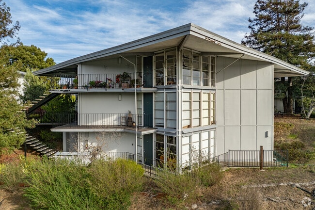
Property Detail
10 Milland Dr
043-151-19
OFFICIAL RECS 1676 PG 26
Multifamilydwelling
Marin
RMP148
California
B and X Area of moderate flood hazard, usually the area between the limits of the 100-year and 500-year floods.
4.75 AC
2025
Strawberry
2025
North Bay/Santa Rosa
125000
San Rafael, CA
62,142 SF
NEARBY LISTINGS FOR SALE OR LEASE
DEMOGRAPHICS near 10 Milland Dr
1 mile
3 mile
5 mile
2025 Total Population
10,877
58,261
90,451
2030 Population
10,795
57,620
89,584
Pop Growth 2025-2030
(0.75%)
(1.10%)
(0.96%)
Average Age
47
46
46
2025 Total Households
4,932
24,447
38,397
HH Growth 2025-2030
(0.67%)
(1.15%)
(0.98%)
Median Household Inc
$154,607
$199,070
$183,501
Avg Household Size
2.10
2.30
2.30
2025 Avg HH Vehicles
2.00
2.00
2.00
Median Home Value
$1,135,925
$1,131,309
$1,128,095
Median Year Built
1968
1965
1964
Nearby Places
Map Layers
Map Styles
 Street
 Aerial
Layers
 Traffic
 Biking
Places
Listings with unknown addresses are not visible on the map
- Restaurants
- Banks
- Shops
- Fitness
- Groceries
PUBLIC TRANSPORTATION
COMMUTER RAIL
Smart Larkspur (Main Line - Sonoma Marin Area Rail Transit)
Drive
Walk
Distance
Smart Larkspur (Main Line - Sonoma Marin Area Rail Transit)
9 min
4.7 mi
Smart San Rafael (Main Line - Sonoma Marin Area Rail Transit)
Drive
Walk
Distance
Smart San Rafael (Main Line - Sonoma Marin Area Rail Transit)
10 min
6.6 mi
AIRPORT
San Francisco International
Drive
Walk
Distance
San Francisco International
42 min
25.3 mi
Metro Oakland International
Drive
Walk
Distance
Metro Oakland International
47 min
34.2 mi
Freight Ports
Port of Richmond
Drive
Walk
Distance
Port of Richmond
25 min
14.9 mi
Nearby Properties
Address
Land Use
TOTAL SIZE
Lot Size
Zoning
Address
Land Use
TOTAL SIZE
Lot Size
Zoning
271,212 SF
15.87 AC
Address
Land Use
TOTAL SIZE
Lot Size
Zoning
257,091 SF
14.21 AC
Address
Land Use
TOTAL SIZE
Lot Size
Zoning
217,791 SF
4.51 AC
Address
Land Use
TOTAL SIZE
Lot Size
Zoning
Address
Land Use
TOTAL SIZE
Lot Size
Zoning
91,151 SF
3.15 AC
Address
Land Use
TOTAL SIZE
Lot Size
Zoning
64,780 SF
50 AC
Address
Land Use
TOTAL SIZE
Lot Size
Zoning
110,272 SF
10.69 AC
Address
Land Use
TOTAL SIZE
Lot Size
Zoning
218,521 SF
26.79 AC
Address
Land Use
TOTAL SIZE
Lot Size
Zoning
127,504 SF
8.49 AC
Address
Land Use
TOTAL SIZE
Lot Size
Zoning
115,264 SF
6.29 AC
Address
Land Use
TOTAL SIZE
Lot Size
Zoning
97,410 SF
5.97 AC
Address
Land Use
TOTAL SIZE
Lot Size
Zoning
100,900 SF
4.32 AC
Address
Land Use
TOTAL SIZE
Lot Size
Zoning
175,913 SF
19.81 AC
Address
Land Use
TOTAL SIZE
Lot Size
Zoning
Address
Land Use
TOTAL SIZE
Lot Size
Zoning
75,629 SF
2.80 AC
Address
Land Use
TOTAL SIZE
Lot Size
Zoning
189,422 SF
7.67 AC
Address
Land Use
TOTAL SIZE
Lot Size
Zoning
100,000 SF
6.30 AC
Address
Land Use
TOTAL SIZE
Lot Size
Zoning
65,933 SF
3.11 AC
Address
Land Use
TOTAL SIZE
Lot Size
Zoning
23,156 SF
3.71 AC
Address
Land Use
TOTAL SIZE
Lot Size
Zoning
18.30 AC
Address
Land Use
TOTAL SIZE
Lot Size
Zoning
175,802 SF
10.87 AC
Address
Land Use
TOTAL SIZE
Lot Size
Zoning
159,300 SF
23.62 AC
Address
Land Use
TOTAL SIZE
Lot Size
Zoning
25,371 SF
2.15 AC
Address
Land Use
TOTAL SIZE
Lot Size
Zoning
74,993 SF
0.78 AC
Address
Land Use
TOTAL SIZE
Lot Size
Zoning
83,323 SF
7.58 AC
Address
Land Use
TOTAL SIZE
Lot Size
Zoning
51,474 SF
3.69 AC
Address
Land Use
TOTAL SIZE
Lot Size
Zoning
92,278 SF
49.10 AC
Address
Land Use
TOTAL SIZE
Lot Size
Zoning
72,126 SF
4.36 AC
Address
Land Use
TOTAL SIZE
Lot Size
Zoning
79,070 SF
3.85 AC
Address
Land Use
TOTAL SIZE
Lot Size
Zoning
36,566 SF
3.84 AC
The World's #1 Commercial Real Estate Marketplace
Connect with us
© 2026 CoStar Group
The information above has been obtained from sources believed reliable. While we do not doubt its accuracy we have not verified it and make no guarantee, warranty or representation about it. It is your responsibility to independently confirm its accuracy and completeness. Any projections, opinions, assumptions, or estimates used are for example only and do not represent the current or future performance of the property. The value of this transaction to you depends on tax and other factors which should be evaluated by your tax, financial, and legal advisors. You and your advisors should conduct a careful, independent investigation of the property to determine to your satisfaction the suitability of the property for your needs.