Property Record
10 Millenium Dr, Cataumet, MA 02534


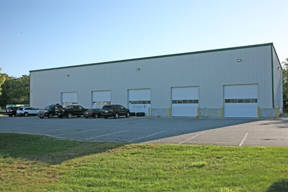
Property Detail
10 Millenium Dr
Commercialbuilding
BARNSTABLE
B-2
Massachusetts
B and X Area of moderate flood hazard, usually the area between the limits of the 100-year and 500-year floods.
1.03 AC
2025
Cape Cod
2025
Other Market Areas
014002
Barnstable Town, MA
9,750 SF
BOUR-000520-000000-000081
NEARBY LISTINGS FOR SALE OR LEASE
DEMOGRAPHICS near 10 Millenium Dr
1 mile
3 mile
5 mile
2025 Total Population
453
7,805
19,257
2030 Population
397
7,560
18,723
Pop Growth 2025-2030
(12.36%)
(3.14%)
(2.77%)
Average Age
51
49
49
2025 Total Households
203
3,365
8,293
HH Growth 2025-2030
(12.81%)
(3.74%)
(3.12%)
Median Household Inc
$97,806
$99,294
$99,064
Avg Household Size
2.10
2.20
2.20
2025 Avg HH Vehicles
2.00
2.00
2.00
Median Home Value
$754,716
$717,289
$678,188
Median Year Built
1982
1976
1979
Nearby Places
Map Layers
Map Styles
 Street
 Aerial
Transit
 Traffic
 Biking
Places
Listings with unknown addresses are not visible on the map
- Restaurants
- Banks
- Shops
- Fitness
- Groceries
PUBLIC TRANSPORTATION
COMMUTER RAIL
Drive
Walk
Distance
10 min
6.1 mi
Drive
Walk
Distance
16 min
9.1 mi
AIRPORT
Martha's Vineyard
Drive
Walk
Distance
Martha's Vineyard
82 min
26.1 mi
Freight Ports
Port of New Bedford Harbor
Drive
Walk
Distance
Port of New Bedford Harbor
46 min
33.4 mi
SALE & LEASE HISTORY
LISTING DATE
SALE/LEASE

Oct 04, 2017
For Lease
Nearby Properties
Address
Land Use
TOTAL SIZE
Lot Size
Zoning
Address
Land Use
TOTAL SIZE
Lot Size
Zoning
22,000 SF
749.29 AC
GD
Address
Land Use
TOTAL SIZE
Lot Size
Zoning
53,202 SF
29.20 AC
PU
Address
Land Use
TOTAL SIZE
Lot Size
Zoning
11.20 AC
Address
Land Use
TOTAL SIZE
Lot Size
Zoning
5.06 AC
R-80
Address
Land Use
TOTAL SIZE
Lot Size
Zoning
17.50 AC
Address
Land Use
TOTAL SIZE
Lot Size
Zoning
1,199 SF
3.70 AC
R40
Address
Land Use
TOTAL SIZE
Lot Size
Zoning
2.82 AC
Address
Land Use
TOTAL SIZE
Lot Size
Zoning
21,711 SF
157.40 AC
AGAA
Address
Land Use
TOTAL SIZE
Lot Size
Zoning
57,806 SF
14.39 AC
LIA
Address
Land Use
TOTAL SIZE
Lot Size
Zoning
15.80 AC
Address
Land Use
TOTAL SIZE
Lot Size
Zoning
4.10 AC
R-80
Address
Land Use
TOTAL SIZE
Lot Size
Zoning
8.91 AC
R-80
Address
Land Use
TOTAL SIZE
Lot Size
Zoning
3,172 SF
2.23 AC
R40
Address
Land Use
TOTAL SIZE
Lot Size
Zoning
25,713 SF
4.70 AC
M
Address
Land Use
TOTAL SIZE
Lot Size
Zoning
Address
Land Use
TOTAL SIZE
Lot Size
Zoning
1.41 AC
R40
Address
Land Use
TOTAL SIZE
Lot Size
Zoning
10.02 AC
R40
Address
Land Use
TOTAL SIZE
Lot Size
Zoning
5,597 SF
1.37 AC
R40
Address
Land Use
TOTAL SIZE
Lot Size
Zoning
1.56 AC
R40
Address
Land Use
TOTAL SIZE
Lot Size
Zoning
10,000 SF
80.22 AC
AGAA
Address
Land Use
TOTAL SIZE
Lot Size
Zoning
38,800 SF
5.24 AC
B-4
Address
Land Use
TOTAL SIZE
Lot Size
Zoning
5,332 SF
1.55 AC
R40
Address
Land Use
TOTAL SIZE
Lot Size
Zoning
2.70 AC
R40
Address
Land Use
TOTAL SIZE
Lot Size
Zoning
3,429 SF
1.24 AC
R40
Address
Land Use
TOTAL SIZE
Lot Size
Zoning
6,853 SF
4.30 AC
R40
Address
Land Use
TOTAL SIZE
Lot Size
Zoning
118.50 AC
R40
Address
Land Use
TOTAL SIZE
Lot Size
Zoning
5.18 AC
R-80
Address
Land Use
TOTAL SIZE
Lot Size
Zoning
5,150 SF
2.41 AC
R40
Address
Land Use
TOTAL SIZE
Lot Size
Zoning
6,491 SF
8.37 AC
R-80
Address
Land Use
TOTAL SIZE
Lot Size
Zoning
1,568 SF
1.72 AC
R40
The World's #1 Commercial Real Estate Marketplace
Connect with us
© 2026 CoStar Group
The information above has been obtained from sources believed reliable. While we do not doubt its accuracy we have not verified it and make no guarantee, warranty or representation about it. It is your responsibility to independently confirm its accuracy and completeness. Any projections, opinions, assumptions, or estimates used are for example only and do not represent the current or future performance of the property. The value of this transaction to you depends on tax and other factors which should be evaluated by your tax, financial, and legal advisors. You and your advisors should conduct a careful, independent investigation of the property to determine to your satisfaction the suitability of the property for your needs.