Property Record
10 Muzzey St, Lexington, MA 02421
NEARBY LISTINGS FOR SALE OR LEASE
Property Detail
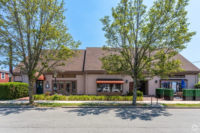
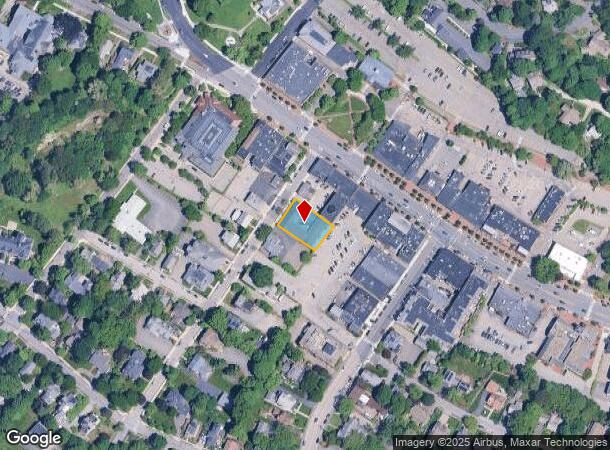
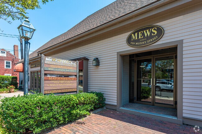
10 Muzzey St
LEXI-000049-000000-000039-000001
Lexington Mews
Commercialcondominium
Middlesex
X
Massachusetts
25017C0403F
39-1
2025
131 SF
2025
Lexington/Arlington
358400
Boston
2,486 SF
Boston-Cambridge-Newton, MA-NH
DEMOGRAPHICS near 10 Muzzey St
1 Mile
3 Mile
5 Mile
2024 Total Population
8,488
64,445
206,781
2029 Population
8,469
63,898
204,898
Pop Growth 2024-2029
(0.22%)
(0.85%)
(0.91%)
Average Age
44
43
42
2024 Total Households
2,954
23,765
78,182
HH Growth 2024-2029
(0.41%)
(1.01%)
(1.04%)
Median Household Inc
$217,930
$163,655
$136,578
Avg Household Size
2.80
2.60
2.50
2024 Avg HH Vehicles
2.00
2.00
2.00
Median Home Value
$1,084,622
$904,479
$835,446
Median Year Built
1960
1965
1961
Nearby Places
Map Layers
Map Styles
 Street
 Aerial
- Restaurants
- Banks
- Shops
- Fitness
- Groceries
PUBLIC TRANSPORTATION
COMMUTER RAIL
Waverley (Fitchburg/South Acton Line - Massachusetts Bay Transportation Authority Commuter Rail (Purple Line))
DRIVE
WALK
Distance
Waverley (Fitchburg/South Acton Line - Massachusetts Bay Transportation Authority Commuter Rail (Purple Line))
11 min
5.3 mi
Belmont Center (Fitchburg/South Acton Line - Massachusetts Bay Transportation Authority Commuter Rail (Purple Line))
DRIVE
WALK
Distance
Belmont Center (Fitchburg/South Acton Line - Massachusetts Bay Transportation Authority Commuter Rail (Purple Line))
11 min
5.4 mi
AIRPORT
General Edward Lawrence Logan International
DRIVE
WALK
Distance
General Edward Lawrence Logan International
30 min
15.4 mi
Freight Ports
Port of Boston
DRIVE
WALK
Distance
Port of Boston
30 min
16.8 mi
SALE & LEASE HISTORY
LISTING DATE
SALE/LEASE

Sep 04, 2019
For Sale
Oct 26, 2019
For Lease
Nov 16, 2021
For Lease
Nov 01, 2025
For Lease
Nov 01, 2021
For Sale
Jun 28, 2021
For Sale
Feb 23, 2024
For Sale
Dec 17, 2021
For Sale
Dec 01, 2021
For Lease
Aug 19, 2019
For Lease
Nearby Properties
Address
Land Use
TOTAL SIZE
Lot Size
Zoning
Address
Land Use
TOTAL SIZE
Lot Size
Zoning
776,099 SF
35.70 AC
Address
Land Use
TOTAL SIZE
Lot Size
Zoning
561,437 SF
33.53 AC
Address
Land Use
TOTAL SIZE
Lot Size
Zoning
472,329 SF
22.11 AC
CD
Address
Land Use
TOTAL SIZE
Lot Size
Zoning
190,308 SF
17.46 AC
CD
Address
Land Use
TOTAL SIZE
Lot Size
Zoning
198,051 SF
11.56 AC
CR
Address
Land Use
TOTAL SIZE
Lot Size
Zoning
25,000 SF
25.73 AC
RD
Address
Land Use
TOTAL SIZE
Lot Size
Zoning
37.77 AC
PD
Address
Land Use
TOTAL SIZE
Lot Size
Zoning
23.91 AC
IG
Address
Land Use
TOTAL SIZE
Lot Size
Zoning
262,278 SF
3.80 AC
PD
Address
Land Use
TOTAL SIZE
Lot Size
Zoning
292,150 SF
17.76 AC
Address
Land Use
TOTAL SIZE
Lot Size
Zoning
342,677 SF
56.46 AC
ND
Address
Land Use
TOTAL SIZE
Lot Size
Zoning
21.99 AC
Address
Land Use
TOTAL SIZE
Lot Size
Zoning
11.25 AC
CR
Address
Land Use
TOTAL SIZE
Lot Size
Zoning
11.70 AC
BG
Address
Land Use
TOTAL SIZE
Lot Size
Zoning
120,704 SF
15.03 AC
CD
Address
Land Use
TOTAL SIZE
Lot Size
Zoning
25.50 AC
BG
Address
Land Use
TOTAL SIZE
Lot Size
Zoning
208,900 SF
25.26 AC
Address
Land Use
TOTAL SIZE
Lot Size
Zoning
100,271 SF
13.25 AC
CM
Address
Land Use
TOTAL SIZE
Lot Size
Zoning
11.25 AC
CR
Address
Land Use
TOTAL SIZE
Lot Size
Zoning
6.69 AC
PD
Address
Land Use
TOTAL SIZE
Lot Size
Zoning
276,000 SF
16.90 AC
RO
Address
Land Use
TOTAL SIZE
Lot Size
Zoning
9.82 AC
PD
Address
Land Use
TOTAL SIZE
Lot Size
Zoning
216,224 SF
5.71 AC
NPD
Address
Land Use
TOTAL SIZE
Lot Size
Zoning
134,932 SF
8.69 AC
ND
Address
Land Use
TOTAL SIZE
Lot Size
Zoning
28.03 AC
IR
Address
Land Use
TOTAL SIZE
Lot Size
Zoning
242,454 SF
4.28 AC
IG
Address
Land Use
TOTAL SIZE
Lot Size
Zoning
160,722 SF
15.63 AC
ND
Address
Land Use
TOTAL SIZE
Lot Size
Zoning
300,720 SF
16.16 AC
IG
Address
Land Use
TOTAL SIZE
Lot Size
Zoning
71.34 AC
R-1
Address
Land Use
TOTAL SIZE
Lot Size
Zoning
145,298 SF
20 AC
RS
The World's #1 Commercial Real Estate Marketplace
Connect with us
© 2026 CoStar Group
The information above has been obtained from sources believed reliable. While we do not doubt its accuracy we have not verified it and make no guarantee, warranty or representation about it. It is your responsibility to independently confirm its accuracy and completeness. Any projections, opinions, assumptions, or estimates used are for example only and do not represent the current or future performance of the property. The value of this transaction to you depends on tax and other factors which should be evaluated by your tax, financial, and legal advisors. You and your advisors should conduct a careful, independent investigation of the property to determine to your satisfaction the suitability of the property for your needs.