Property Record
10 N Main St, Spanish Fork, UT 84660

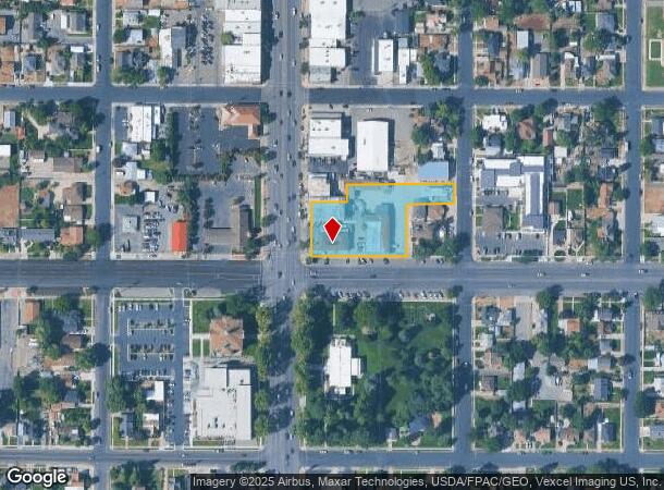
NEARBY LISTINGS FOR SALE OR LEASE
Property Detail
10 N Main St
Provo-Orem-Lehi, UT
COM AT NE COR LOT 1, BLK 47, PLAT A, SPANISH FORK CITY SUR; S 55 FT; W 132 FT; S 143 FT; W 264 FT TO SW COR OF SD BLK; N 148.5 FT; E 99 FT; N 49.5 FT TO N LINE OF LOT 2; E 297 FT TO BEG.
07-047-0003
Utah
Storebuilding
Utah
2024
1
2025
1.25 AC
003204
Utah County
28,217 SF
Salt Lake City
DEMOGRAPHICS near 10 N Main St
1 mile
3 mile
5 mile
2024 Total Population
13,453
51,329
98,143
2029 Population
15,597
60,125
114,968
Pop Growth 2024-2029
+ 15.94%
+ 17.14%
+ 17.14%
Average Age
32
31
32
2024 Total Households
4,172
13,868
27,100
HH Growth 2024-2029
+ 16.30%
+ 17.48%
+ 17.46%
Median Household Inc
$71,903
$93,510
$91,973
Avg Household Size
3.20
3.70
3.60
2024 Avg HH Vehicles
2.00
3.00
3.00
Median Home Value
$350,432
$412,686
$447,111
Median Year Built
1975
2002
2001
Nearby Places
Map Layers
Map Styles
 Street
 Aerial
Transit
 Traffic
 Biking
Places
Listings with unknown addresses are not visible on the map
- Restaurants
- Banks
- Shops
- Fitness
- Groceries
PUBLIC TRANSPORTATION
COMMUTER RAIL
Drive
Walk
Distance
14 min
8.7 mi
Drive
Walk
Distance
14 min
8.7 mi
AIRPORT
Provo Municipal
Drive
Walk
Distance
Provo Municipal
17 min
10.6 mi
Nearby Properties
Address
Land Use
TOTAL SIZE
Lot Size
Zoning
Address
Land Use
TOTAL SIZE
Lot Size
Zoning
44,552 SF
29.78 AC
Address
Land Use
TOTAL SIZE
Lot Size
Zoning
565,605 SF
20 AC
Address
Land Use
TOTAL SIZE
Lot Size
Zoning
92,323 SF
8.96 AC
Address
Land Use
TOTAL SIZE
Lot Size
Zoning
263,859 SF
12.80 AC
Address
Land Use
TOTAL SIZE
Lot Size
Zoning
281,008 SF
16.65 AC
Address
Land Use
TOTAL SIZE
Lot Size
Zoning
281,008 SF
14.84 AC
Address
Land Use
TOTAL SIZE
Lot Size
Zoning
204,890 SF
15.28 AC
Address
Land Use
TOTAL SIZE
Lot Size
Zoning
271,536 SF
11.80 AC
Address
Land Use
TOTAL SIZE
Lot Size
Zoning
170,774 SF
9.70 AC
Address
Land Use
TOTAL SIZE
Lot Size
Zoning
243,888 SF
32.23 AC
Address
Land Use
TOTAL SIZE
Lot Size
Zoning
159,679 SF
12.91 AC
Address
Land Use
TOTAL SIZE
Lot Size
Zoning
322,432 SF
29.36 AC
Address
Land Use
TOTAL SIZE
Lot Size
Zoning
184,079 SF
11.47 AC
Address
Land Use
TOTAL SIZE
Lot Size
Zoning
149,046 SF
12.10 AC
Address
Land Use
TOTAL SIZE
Lot Size
Zoning
134,564 SF
8.03 AC
Address
Land Use
TOTAL SIZE
Lot Size
Zoning
124,255 SF
9.87 AC
Address
Land Use
TOTAL SIZE
Lot Size
Zoning
112,094 SF
10.34 AC
Address
Land Use
TOTAL SIZE
Lot Size
Zoning
729,831 SF
66.60 AC
RA5
Address
Land Use
TOTAL SIZE
Lot Size
Zoning
120,141 SF
7.71 AC
Address
Land Use
TOTAL SIZE
Lot Size
Zoning
96,665 SF
22.25 AC
Address
Land Use
TOTAL SIZE
Lot Size
Zoning
171,101 SF
11.65 AC
Address
Land Use
TOTAL SIZE
Lot Size
Zoning
93,850 SF
6.61 AC
Address
Land Use
TOTAL SIZE
Lot Size
Zoning
181,993 SF
5.01 AC
Address
Land Use
TOTAL SIZE
Lot Size
Zoning
71,691 SF
5.52 AC
Address
Land Use
TOTAL SIZE
Lot Size
Zoning
96,879 SF
7.91 AC
Address
Land Use
TOTAL SIZE
Lot Size
Zoning
82,610 SF
2.46 AC
Address
Land Use
TOTAL SIZE
Lot Size
Zoning
82,610 SF
2.02 AC
Address
Land Use
TOTAL SIZE
Lot Size
Zoning
110,762 SF
6.08 AC
Address
Land Use
TOTAL SIZE
Lot Size
Zoning
62,203 SF
2.13 AC
Address
Land Use
TOTAL SIZE
Lot Size
Zoning
37,031 SF
4.73 AC
The World's #1 Commercial Real Estate Marketplace
Connect with us
© 2026 CoStar Group
The information above has been obtained from sources believed reliable. While we do not doubt its accuracy we have not verified it and make no guarantee, warranty or representation about it. It is your responsibility to independently confirm its accuracy and completeness. Any projections, opinions, assumptions, or estimates used are for example only and do not represent the current or future performance of the property. The value of this transaction to you depends on tax and other factors which should be evaluated by your tax, financial, and legal advisors. You and your advisors should conduct a careful, independent investigation of the property to determine to your satisfaction the suitability of the property for your needs.