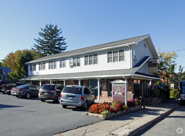
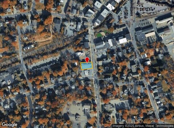
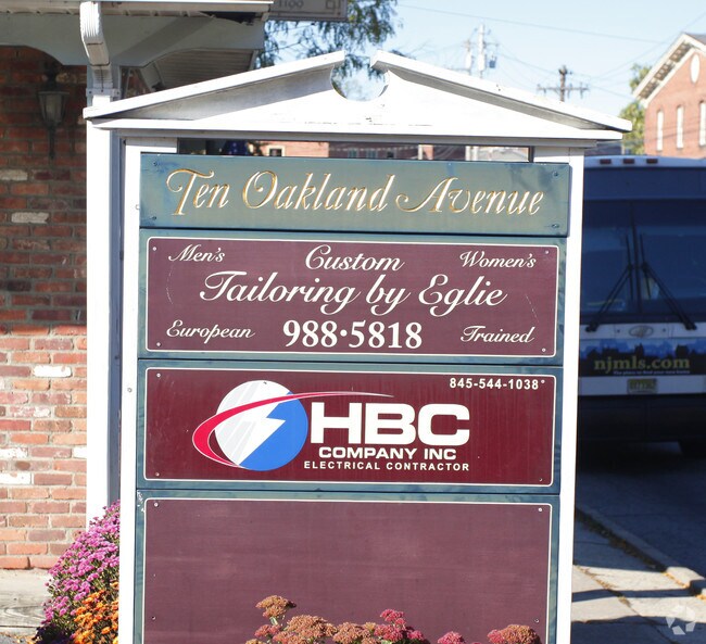
Property Record
10 Oakland Ave, Warwick, NY 10990
NEARBY LISTINGS FOR SALE OR LEASE
-
-
View all Warwick listings for lease on LoopNet.com
Property Detail
10 Oakland Ave
335405-210-000-0009-008.220-0000
Orange
Commercialnec
New York
X
8.220
36071C0463E
0.19 AC
2024
Monroe
2024
Northern New Jersey
014602
New York-Jersey City-White Plains, NY-NJ
5,642 SF
DEMOGRAPHICS near 10 Oakland Ave
1 Mile
3 Mile
5 Mile
2024 Total Population
5,100
12,603
28,984
2029 Population
5,148
12,758
29,315
Pop Growth 2024-2029
+ 0.94%
+ 1.23%
+ 1.14%
Average Age
45
45
43
2024 Total Households
2,186
5,079
11,289
HH Growth 2024-2029
+ 1.05%
+ 1.30%
+ 1.25%
Median Household Inc
$106,397
$120,182
$115,744
Avg Household Size
2.30
2.40
2.50
2024 Avg HH Vehicles
2.00
2.00
2.00
Median Home Value
$380,468
$424,353
$370,235
Median Year Built
1969
1978
1973
Nearby Places
- Restaurants
- Banks
- Shops
- Fitness
- Groceries
PUBLIC TRANSPORTATION
AIRPORT
New York Stewart International
DRIVE
WALK
Distance
New York Stewart International
42 min
27.4 mi
Freight Ports
Port Newark Container Terminal
DRIVE
WALK
Distance
Port Newark Container Terminal
84 min
58.7 mi
SALE & LEASE HISTORY
LISTING DATE
SALE/LEASE

Sep 25, 2016
For Lease
Nearby Properties
Address
Land Use
TOTAL SIZE
Lot Size
Zoning
Address
Land Use
TOTAL SIZE
Lot Size
Zoning
139,701 SF
2.80 AC
00401
Address
Land Use
TOTAL SIZE
Lot Size
Zoning
219,579 SF
34 AC
00220
Address
Land Use
TOTAL SIZE
Lot Size
Zoning
272,000 SF
52.10 AC
00215
Address
Land Use
TOTAL SIZE
Lot Size
Zoning
127,993 SF
11.80 AC
00401
Address
Land Use
TOTAL SIZE
Lot Size
Zoning
63,516 SF
12.30 AC
00401
Address
Land Use
TOTAL SIZE
Lot Size
Zoning
104,100 SF
117.60 AC
00215
Address
Land Use
TOTAL SIZE
Lot Size
Zoning
390 SF
2.10 AC
205
Address
Land Use
TOTAL SIZE
Lot Size
Zoning
96,621 SF
10.20 AC
00450
Address
Land Use
TOTAL SIZE
Lot Size
Zoning
47,951 SF
15.90 AC
00215
Address
Land Use
TOTAL SIZE
Lot Size
Zoning
63,094 SF
22.70 AC
00450
Address
Land Use
TOTAL SIZE
Lot Size
Zoning
64,183 SF
38.90 AC
00750
Address
Land Use
TOTAL SIZE
Lot Size
Zoning
67,401 SF
389.20 AC
00230
Address
Land Use
TOTAL SIZE
Lot Size
Zoning
63,198 SF
5.80 AC
00205
Address
Land Use
TOTAL SIZE
Lot Size
Zoning
22,099 SF
706.60 AC
00240
Address
Land Use
TOTAL SIZE
Lot Size
Zoning
11.20 AC
00230
Address
Land Use
TOTAL SIZE
Lot Size
Zoning
477 SF
0.97 AC
00710
Address
Land Use
TOTAL SIZE
Lot Size
Zoning
0.30 AC
00215
Address
Land Use
TOTAL SIZE
Lot Size
Zoning
33,394 SF
3.40 AC
00210
Address
Land Use
TOTAL SIZE
Lot Size
Zoning
33,394 SF
3.40 AC
00210
Address
Land Use
TOTAL SIZE
Lot Size
Zoning
87,168 SF
5.30 AC
00210
Address
Land Use
TOTAL SIZE
Lot Size
Zoning
84,367 SF
7.60 AC
00210
Address
Land Use
TOTAL SIZE
Lot Size
Zoning
84,858 SF
4.10 AC
00210
Address
Land Use
TOTAL SIZE
Lot Size
Zoning
16,420 SF
0.28 AC
00210
Address
Land Use
TOTAL SIZE
Lot Size
Zoning
0.40 AC
00710
Address
Land Use
TOTAL SIZE
Lot Size
Zoning
3,120 SF
0.03 AC
DN
Address
Land Use
TOTAL SIZE
Lot Size
Zoning
35,938 SF
6.40 AC
00220
Address
Land Use
TOTAL SIZE
Lot Size
Zoning
144,206 SF
29.20 AC
00710
Address
Land Use
TOTAL SIZE
Lot Size
Zoning
0.28 AC
00215
Address
Land Use
TOTAL SIZE
Lot Size
Zoning
26,599 SF
2.40 AC
00205
Address
Land Use
TOTAL SIZE
Lot Size
Zoning
2 AC
00210
The World's #1 Commercial Real Estate Marketplace
Connect with us
© 2025 CoStar Group
The information above has been obtained from sources believed reliable. While we do not doubt its accuracy we have not verified it and make no guarantee, warranty or representation about it. It is your responsibility to independently confirm its accuracy and completeness. Any projections, opinions, assumptions, or estimates used are for example only and do not represent the current or future performance of the property. The value of this transaction to you depends on tax and other factors which should be evaluated by your tax, financial, and legal advisors. You and your advisors should conduct a careful, independent investigation of the property to determine to your satisfaction the suitability of the property for your needs.