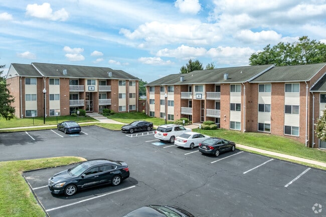
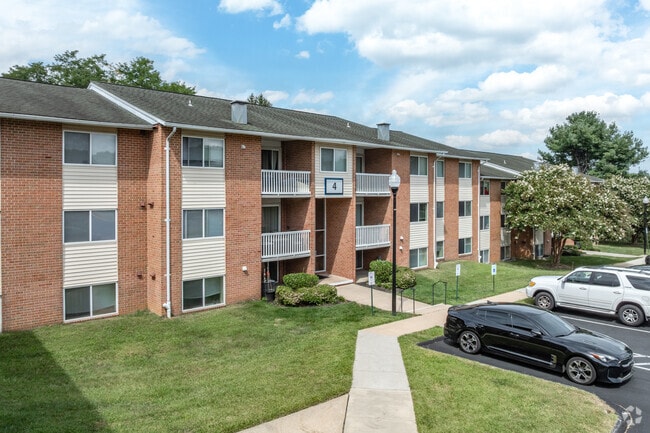
Property Record
10 Poolside Ct, Catonsville, MD 21228
Property Detail
10 Poolside Ct
01-1900011528
18.718 AC WESTERLEE
Nightclub
BALTIMORE
DR3.5
Maryland
B and X Area of moderate flood hazard, usually the area between the limits of the 100-year and 500-year floods.
18.72 AC
2024
Outer W Baltimore County
2025
Baltimore
400800
Baltimore-Columbia-Towson, MD
2,960 SF
NEARBY LISTINGS FOR SALE OR LEASE
DEMOGRAPHICS near 10 Poolside Ct
1 mile
3 mile
5 mile
2025 Total Population
9,086
97,696
248,079
2030 Population
9,007
98,132
247,479
Pop Growth 2025-2030
(0.87%)
+ 0.45%
(0.24%)
Average Age
42
40
41
2025 Total Households
3,385
36,300
93,548
HH Growth 2025-2030
(0.89%)
+ 0.46%
(0.38%)
Median Household Inc
$112,901
$93,521
$88,488
Avg Household Size
2.60
2.60
2.50
2025 Avg HH Vehicles
2.00
2.00
2.00
Median Home Value
$416,866
$383,044
$361,229
Median Year Built
1979
1976
1968
Nearby Places
Map Layers
Map Styles
 Street
 Aerial
Layers
 Traffic
 Biking
Places
Listings with unknown addresses are not visible on the map
- Restaurants
- Banks
- Shops
- Fitness
- Groceries
PUBLIC TRANSPORTATION
COMMUTER RAIL
Halethorpe Marc Nb (PENN - WASHINGTON - Maryland Transit Administration)
Drive
Walk
Distance
Halethorpe Marc Nb (PENN - WASHINGTON - Maryland Transit Administration)
12 min
6.8 mi
Halethorpe Marc Sb (PENN - WASHINGTON - Maryland Transit Administration)
Drive
Walk
Distance
Halethorpe Marc Sb (PENN - WASHINGTON - Maryland Transit Administration)
12 min
6.8 mi
AIRPORT
Baltimore/Washington International Thurgood Marshall
Drive
Walk
Distance
Baltimore/Washington International Thurgood Marshall
20 min
11.2 mi
Freight Ports
Port of Baltimore
Drive
Walk
Distance
Port of Baltimore
21 min
11.9 mi
Nearby Properties
Address
Land Use
TOTAL SIZE
Lot Size
Zoning
Address
Land Use
TOTAL SIZE
Lot Size
Zoning
1,809,709 SF
50 AC
DR3.5
Address
Land Use
TOTAL SIZE
Lot Size
Zoning
883,140 SF
57.77 AC
MLR
Address
Land Use
TOTAL SIZE
Lot Size
Zoning
33,342 SF
94.97 AC
RA15
Address
Land Use
TOTAL SIZE
Lot Size
Zoning
608,642 SF
56.37 AC
DR3.5
Address
Land Use
TOTAL SIZE
Lot Size
Zoning
48,414 SF
19.18 AC
RA15
Address
Land Use
TOTAL SIZE
Lot Size
Zoning
31,590 SF
18.89 AC
RA15
Address
Land Use
TOTAL SIZE
Lot Size
Zoning
271,096 SF
6 AC
02
Address
Land Use
TOTAL SIZE
Lot Size
Zoning
278,271 SF
55.16 AC
DR5.5
Address
Land Use
TOTAL SIZE
Lot Size
Zoning
233,082 SF
10.98 AC
Address
Land Use
TOTAL SIZE
Lot Size
Zoning
36,399 SF
25.30 AC
RA15
Address
Land Use
TOTAL SIZE
Lot Size
Zoning
26.14 AC
DR16
Address
Land Use
TOTAL SIZE
Lot Size
Zoning
184,320 SF
13.37 AC
DR5.5
Address
Land Use
TOTAL SIZE
Lot Size
Zoning
16.75 AC
MLR02
Address
Land Use
TOTAL SIZE
Lot Size
Zoning
48,168 SF
14.91 AC
RA15
Address
Land Use
TOTAL SIZE
Lot Size
Zoning
16.70 AC
Address
Land Use
TOTAL SIZE
Lot Size
Zoning
26.88 AC
DR16
Address
Land Use
TOTAL SIZE
Lot Size
Zoning
29.14 AC
DR16
Address
Land Use
TOTAL SIZE
Lot Size
Zoning
19.10 AC
DR16
Address
Land Use
TOTAL SIZE
Lot Size
Zoning
131,176 SF
33.97 AC
BMCT
Address
Land Use
TOTAL SIZE
Lot Size
Zoning
204,875 SF
5.81 AC
POR
Address
Land Use
TOTAL SIZE
Lot Size
Zoning
118,460 SF
17.85 AC
O2
Address
Land Use
TOTAL SIZE
Lot Size
Zoning
23,962 SF
17.31 AC
BRCS2
Address
Land Use
TOTAL SIZE
Lot Size
Zoning
156,834 SF
10.26 AC
DR5.5
Address
Land Use
TOTAL SIZE
Lot Size
Zoning
165,860 SF
3.35 AC
BLCCC
Address
Land Use
TOTAL SIZE
Lot Size
Zoning
23.78 AC
DR5.5
Address
Land Use
TOTAL SIZE
Lot Size
Zoning
129,423 SF
38.77 AC
DR5.5
Address
Land Use
TOTAL SIZE
Lot Size
Zoning
117,444 SF
19.97 AC
POR
Address
Land Use
TOTAL SIZE
Lot Size
Zoning
22.99 AC
DR16
Address
Land Use
TOTAL SIZE
Lot Size
Zoning
91,716 SF
15.07 AC
POR
The World's #1 Commercial Real Estate Marketplace
Connect with us
© 2026 CoStar Group
The information above has been obtained from sources believed reliable. While we do not doubt its accuracy we have not verified it and make no guarantee, warranty or representation about it. It is your responsibility to independently confirm its accuracy and completeness. Any projections, opinions, assumptions, or estimates used are for example only and do not represent the current or future performance of the property. The value of this transaction to you depends on tax and other factors which should be evaluated by your tax, financial, and legal advisors. You and your advisors should conduct a careful, independent investigation of the property to determine to your satisfaction the suitability of the property for your needs.