Property Record
10 Poulson Ave, Essington, PA 19029


NEARBY LISTINGS FOR SALE OR LEASE
Property Detail
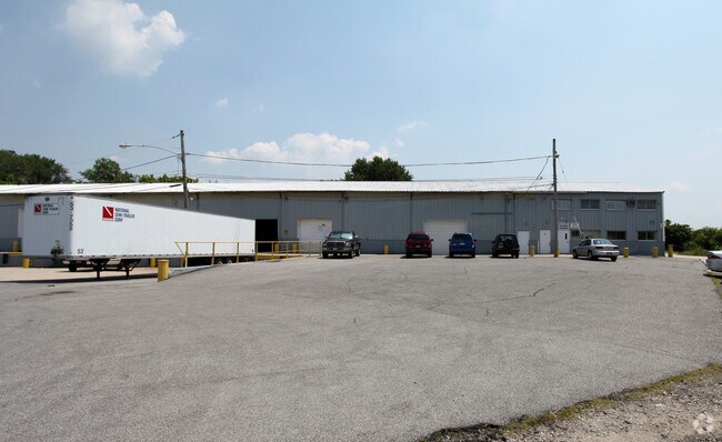
10 Poulson Ave
45-00-01312-04
1 STY BLDG 18 540SF LOT 5
Lightindustrial
Delaware
AE
Pennsylvania
34015C0056F
5
2024
0.43 AC
2025
Delaware County
403701
Philadelphia
7,280 SF
Philadelphia-Camden-Wilmington, PA-NJ-DE-MD
DEMOGRAPHICS near 10 Poulson Ave
1 Mile
3 Mile
5 Mile
2024 Total Population
4,041
57,332
217,687
2029 Population
4,038
57,087
216,621
Pop Growth 2024-2029
(0.07%)
(0.43%)
(0.49%)
Average Age
43
40
39
2024 Total Households
1,732
22,795
83,024
HH Growth 2024-2029
(0.12%)
(0.43%)
(0.56%)
Median Household Inc
$48,201
$68,896
$63,627
Avg Household Size
2.30
2.50
2.50
2024 Avg HH Vehicles
2.00
2.00
2.00
Median Home Value
$172,016
$187,628
$190,067
Median Year Built
1956
1954
1955
Nearby Places
Map Layers
Map Styles
 Street
 Aerial
- Restaurants
- Banks
- Shops
- Fitness
- Groceries
PUBLIC TRANSPORTATION
COMMUTER RAIL
Prospect Park (R2 - Southeastern Pennsylvania Transportation Authority Regional Rail (SEPTA Regional Rail))
DRIVE
WALK
Distance
Prospect Park (R2 - Southeastern Pennsylvania Transportation Authority Regional Rail (SEPTA Regional Rail))
6 min
2.5 mi
Norwood (R2 - Southeastern Pennsylvania Transportation Authority Regional Rail (SEPTA Regional Rail))
DRIVE
WALK
Distance
Norwood (R2 - Southeastern Pennsylvania Transportation Authority Regional Rail (SEPTA Regional Rail))
7 min
2.8 mi
AIRPORT
Philadelphia International
DRIVE
WALK
Distance
Philadelphia International
9 min
3.5 mi
Trenton Mercer
DRIVE
WALK
Distance
Trenton Mercer
67 min
46.2 mi
Freight Ports
Broadway Terminal - Pier 5
DRIVE
WALK
Distance
Broadway Terminal - Pier 5
25 min
15.3 mi
Nearby Properties
Address
Land Use
TOTAL SIZE
Lot Size
Zoning
Address
Land Use
TOTAL SIZE
Lot Size
Zoning
653.90 AC
Address
Land Use
TOTAL SIZE
Lot Size
Zoning
762,100 SF
Address
Land Use
TOTAL SIZE
Lot Size
Zoning
995,943 SF
212.65 AC
Address
Land Use
TOTAL SIZE
Lot Size
Zoning
89,456 SF
27.06 AC
Address
Land Use
TOTAL SIZE
Lot Size
Zoning
175,978 SF
15.95 AC
Address
Land Use
TOTAL SIZE
Lot Size
Zoning
161,141 SF
170.40 AC
Address
Land Use
TOTAL SIZE
Lot Size
Zoning
164,182 SF
Address
Land Use
TOTAL SIZE
Lot Size
Zoning
47.40 AC
C2
Address
Land Use
TOTAL SIZE
Lot Size
Zoning
301,971 SF
80.80 AC
Address
Land Use
TOTAL SIZE
Lot Size
Zoning
112,896 SF
95 AC
Address
Land Use
TOTAL SIZE
Lot Size
Zoning
975.62 AC
Address
Land Use
TOTAL SIZE
Lot Size
Zoning
800,029 SF
112.10 AC
Address
Land Use
TOTAL SIZE
Lot Size
Zoning
156,079 SF
13.44 AC
Address
Land Use
TOTAL SIZE
Lot Size
Zoning
241,578 SF
14 AC
Address
Land Use
TOTAL SIZE
Lot Size
Zoning
96,500 SF
6.11 AC
CMX3
Address
Land Use
TOTAL SIZE
Lot Size
Zoning
40.25 AC
M
Address
Land Use
TOTAL SIZE
Lot Size
Zoning
64,995 SF
132 AC
Address
Land Use
TOTAL SIZE
Lot Size
Zoning
16,990 SF
221.09 AC
SPPOA
Address
Land Use
TOTAL SIZE
Lot Size
Zoning
34.58 AC
Address
Land Use
TOTAL SIZE
Lot Size
Zoning
86.10 AC
Address
Land Use
TOTAL SIZE
Lot Size
Zoning
107,530 SF
Address
Land Use
TOTAL SIZE
Lot Size
Zoning
187,056 SF
16 AC
Address
Land Use
TOTAL SIZE
Lot Size
Zoning
343,204 SF
11.86 AC
Address
Land Use
TOTAL SIZE
Lot Size
Zoning
142,188 SF
15.05 AC
Address
Land Use
TOTAL SIZE
Lot Size
Zoning
994 AC
R3
Address
Land Use
TOTAL SIZE
Lot Size
Zoning
110,424 SF
5.32 AC
Address
Land Use
TOTAL SIZE
Lot Size
Zoning
212,231 SF
28 AC
Address
Land Use
TOTAL SIZE
Lot Size
Zoning
108,637 SF
Address
Land Use
TOTAL SIZE
Lot Size
Zoning
5,175 SF
25.95 AC
Address
Land Use
TOTAL SIZE
Lot Size
Zoning
150,450 SF
9 AC
The World's #1 Commercial Real Estate Marketplace
Connect with us
© 2026 CoStar Group
The information above has been obtained from sources believed reliable. While we do not doubt its accuracy we have not verified it and make no guarantee, warranty or representation about it. It is your responsibility to independently confirm its accuracy and completeness. Any projections, opinions, assumptions, or estimates used are for example only and do not represent the current or future performance of the property. The value of this transaction to you depends on tax and other factors which should be evaluated by your tax, financial, and legal advisors. You and your advisors should conduct a careful, independent investigation of the property to determine to your satisfaction the suitability of the property for your needs.