Property Record
10 Route 12 Rd, Groton, CT 06340
NEARBY LISTINGS FOR SALE OR LEASE
Property Detail
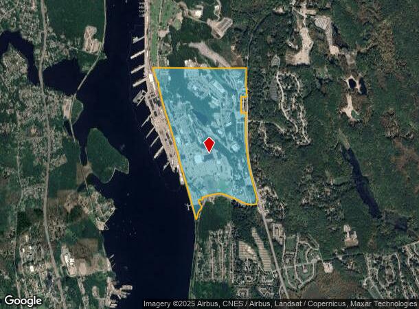
10 Route 12 Rd
178010265199 E
New London
Federalproperty
Connecticut
X
e
09011C0364J
270.18 AC
2025
New London
2025
Hartford
702700
Norwich-New London, CT
50,876 SF
DEMOGRAPHICS near 10 Route 12 Rd
1 Mile
3 Mile
5 Mile
2024 Total Population
2,685
37,069
78,230
2029 Population
2,716
36,961
78,073
Pop Growth 2024-2029
+ 1.15%
(0.29%)
(0.20%)
Average Age
36
37
39
2024 Total Households
1,081
13,702
31,353
HH Growth 2024-2029
+ 1.11%
(0.28%)
(0.23%)
Median Household Inc
$75,573
$66,233
$68,922
Avg Household Size
2.40
2.30
2.20
2024 Avg HH Vehicles
2.00
2.00
2.00
Median Home Value
$272,522
$250,969
$239,472
Median Year Built
1978
1967
1968
Nearby Places
Map Layers
Map Styles
 Street
 Aerial
- Restaurants
- Banks
- Shops
- Fitness
- Groceries
PUBLIC TRANSPORTATION
COMMUTER RAIL
New London (Shore Line East - Shore Line East)
DRIVE
WALK
Distance
New London (Shore Line East - Shore Line East)
11 min
5.7 mi
Mystic Amtrak (Northeast Regional - Amtrak)
DRIVE
WALK
Distance
Mystic Amtrak (Northeast Regional - Amtrak)
18 min
9.3 mi
Freight Ports
Port of Davisville, RI
DRIVE
WALK
Distance
Port of Davisville, RI
71 min
51.7 mi
Nearby Properties
Address
Land Use
TOTAL SIZE
Lot Size
Zoning
Address
Land Use
TOTAL SIZE
Lot Size
Zoning
8,712 SF
RU-20
Address
Land Use
TOTAL SIZE
Lot Size
Zoning
49.32 AC
R-3
Address
Land Use
TOTAL SIZE
Lot Size
Zoning
251.73 AC
RM40
Address
Land Use
TOTAL SIZE
Lot Size
Zoning
11,880 SF
35.66 AC
RM
Address
Land Use
TOTAL SIZE
Lot Size
Zoning
54.80 AC
INST
Address
Land Use
TOTAL SIZE
Lot Size
Zoning
13.68 AC
CR
Address
Land Use
TOTAL SIZE
Lot Size
Zoning
21.84 AC
C-2
Address
Land Use
TOTAL SIZE
Lot Size
Zoning
73,446 SF
69.87 AC
R-12
Address
Land Use
TOTAL SIZE
Lot Size
Zoning
55,766 SF
1.33 AC
R-4
Address
Land Use
TOTAL SIZE
Lot Size
Zoning
69,658 SF
16.31 AC
VR-10
Address
Land Use
TOTAL SIZE
Lot Size
Zoning
79,535 SF
3.03 AC
R-2
Address
Land Use
TOTAL SIZE
Lot Size
Zoning
204,329 SF
17.92 AC
CR
Address
Land Use
TOTAL SIZE
Lot Size
Zoning
135,113 SF
2.51 AC
LI-O
Address
Land Use
TOTAL SIZE
Lot Size
Zoning
9.41 AC
R-4
Address
Land Use
TOTAL SIZE
Lot Size
Zoning
5.65 AC
R-2
Address
Land Use
TOTAL SIZE
Lot Size
Zoning
33.50 AC
R-12
Address
Land Use
TOTAL SIZE
Lot Size
Zoning
70,318 SF
5.20 AC
C-G
Address
Land Use
TOTAL SIZE
Lot Size
Zoning
52,065 SF
12.40 AC
CN
Address
Land Use
TOTAL SIZE
Lot Size
Zoning
12.55 AC
C-2
Address
Land Use
TOTAL SIZE
Lot Size
Zoning
18.76 AC
INST
Address
Land Use
TOTAL SIZE
Lot Size
Zoning
7,112 SF
R-12
Address
Land Use
TOTAL SIZE
Lot Size
Zoning
0.54 AC
CBD-1
Address
Land Use
TOTAL SIZE
Lot Size
Zoning
64,040 SF
4.57 AC
OS
Address
Land Use
TOTAL SIZE
Lot Size
Zoning
56,961 SF
3.43 AC
RM
Address
Land Use
TOTAL SIZE
Lot Size
Zoning
99,569 SF
1.40 AC
R-4
Address
Land Use
TOTAL SIZE
Lot Size
Zoning
50,876 SF
57.34 AC
R-12
Address
Land Use
TOTAL SIZE
Lot Size
Zoning
21,870 SF
18.86 AC
RM
Address
Land Use
TOTAL SIZE
Lot Size
Zoning
7.31 AC
R-1
Address
Land Use
TOTAL SIZE
Lot Size
Zoning
2.22 AC
R-4
Address
Land Use
TOTAL SIZE
Lot Size
Zoning
83,470 SF
14.67 AC
CR
The World's #1 Commercial Real Estate Marketplace
Connect with us
© 2025 CoStar Group
The information above has been obtained from sources believed reliable. While we do not doubt its accuracy we have not verified it and make no guarantee, warranty or representation about it. It is your responsibility to independently confirm its accuracy and completeness. Any projections, opinions, assumptions, or estimates used are for example only and do not represent the current or future performance of the property. The value of this transaction to you depends on tax and other factors which should be evaluated by your tax, financial, and legal advisors. You and your advisors should conduct a careful, independent investigation of the property to determine to your satisfaction the suitability of the property for your needs.