Property Record
10 Southcliff Pkwy, Fairview, NC 28730
NEARBY LISTINGS FOR SALE OR LEASE
Property Detail
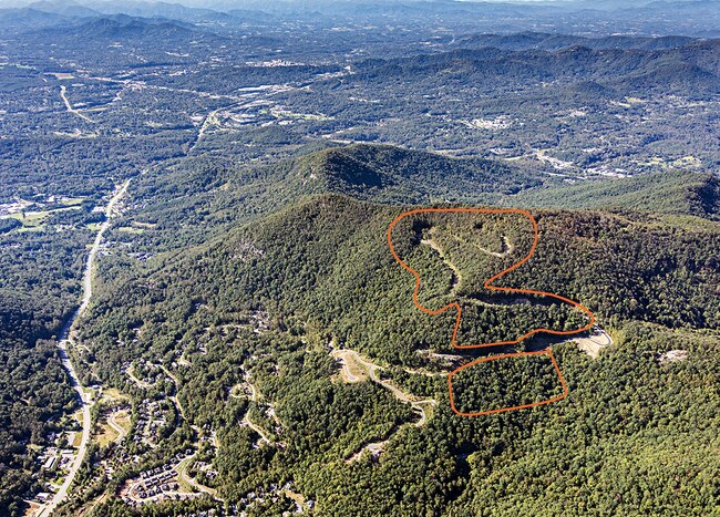
10 Southcliff Pkwy
Asheville, NC
Southcliff
9677-51-6477-00000
SUBDIV: SOUTHCLIFF BLOCK: LOT: 701 SECTION: PLAT: 0140-0080
Officebuilding
Buncombe
X
North Carolina
3700967700J
701
2024
1.01 AC
2025
Buncombe County
003204
Asheville
2,182 SF
DEMOGRAPHICS near 10 Southcliff Pkwy
1 Mile
3 Mile
5 Mile
2024 Total Population
1,470
10,960
44,992
2029 Population
1,533
11,437
46,697
Pop Growth 2024-2029
+ 4.29%
+ 4.35%
+ 3.79%
Average Age
43
45
44
2024 Total Households
607
4,656
19,661
HH Growth 2024-2029
+ 3.62%
+ 3.82%
+ 3.22%
Median Household Inc
$85,961
$82,580
$66,907
Avg Household Size
2.30
2.30
2.20
2024 Avg HH Vehicles
2.00
2.00
2.00
Median Home Value
$365,941
$381,481
$331,107
Median Year Built
2000
1995
1989
Nearby Places
Map Layers
Map Styles
 Street
 Aerial
- Restaurants
- Banks
- Shops
- Fitness
- Groceries
PUBLIC TRANSPORTATION
AIRPORT
Asheville Regional
DRIVE
WALK
Distance
Asheville Regional
25 min
14.9 mi
Freight Ports
North Charleston Terminal
DRIVE
WALK
Distance
North Charleston Terminal
293 min
255.7 mi
SALE & LEASE HISTORY
LISTING DATE
SALE/LEASE

Nov 12, 2018
For Sale
Nearby Properties
Address
Land Use
TOTAL SIZE
Lot Size
Zoning
Address
Land Use
TOTAL SIZE
Lot Size
Zoning
316,968 SF
102.56 AC
PS
Address
Land Use
TOTAL SIZE
Lot Size
Zoning
93,321 SF
30.95 AC
NS
Address
Land Use
TOTAL SIZE
Lot Size
Zoning
74,409 SF
22.20 AC
NS
Address
Land Use
TOTAL SIZE
Lot Size
Zoning
90,832 SF
1,103.09 AC
CR
Address
Land Use
TOTAL SIZE
Lot Size
Zoning
75,979 SF
10.40 AC
R-3
Address
Land Use
TOTAL SIZE
Lot Size
Zoning
33,037 SF
5.80 AC
RIVER
Address
Land Use
TOTAL SIZE
Lot Size
Zoning
31,494 SF
256 AC
PS
Address
Land Use
TOTAL SIZE
Lot Size
Zoning
26,618 SF
2.88 AC
HB
Address
Land Use
TOTAL SIZE
Lot Size
Zoning
8,260 SF
2.03 AC
LODG EXP
Address
Land Use
TOTAL SIZE
Lot Size
Zoning
20,158 SF
3.27 AC
HB
Address
Land Use
TOTAL SIZE
Lot Size
Zoning
48,113 SF
9.55 AC
OU
Address
Land Use
TOTAL SIZE
Lot Size
Zoning
13,766 SF
2.17 AC
HB
Address
Land Use
TOTAL SIZE
Lot Size
Zoning
18,596 SF
6.47 AC
R-2
Address
Land Use
TOTAL SIZE
Lot Size
Zoning
4,820 SF
195.28 AC
OU
Address
Land Use
TOTAL SIZE
Lot Size
Zoning
11,974 SF
114.95 AC
R-LD
Address
Land Use
TOTAL SIZE
Lot Size
Zoning
47,440 SF
4.14 AC
OU
Address
Land Use
TOTAL SIZE
Lot Size
Zoning
24,728 SF
22.70 AC
OU
Address
Land Use
TOTAL SIZE
Lot Size
Zoning
17,125 SF
1.93 AC
NS
Address
Land Use
TOTAL SIZE
Lot Size
Zoning
17,920 SF
3.66 AC
OU
Address
Land Use
TOTAL SIZE
Lot Size
Zoning
12,871 SF
7.54 AC
OU
Address
Land Use
TOTAL SIZE
Lot Size
Zoning
16,902 SF
9.88 AC
OU
Address
Land Use
TOTAL SIZE
Lot Size
Zoning
6,788 SF
131.72 AC
OU
Address
Land Use
TOTAL SIZE
Lot Size
Zoning
5,473 SF
7.72 AC
R-LD
Address
Land Use
TOTAL SIZE
Lot Size
Zoning
6,215 SF
49.97 AC
OU
Address
Land Use
TOTAL SIZE
Lot Size
Zoning
13,259 SF
49 AC
OU
Address
Land Use
TOTAL SIZE
Lot Size
Zoning
9,824 SF
1.51 AC
OU
Address
Land Use
TOTAL SIZE
Lot Size
Zoning
9,503 SF
4 AC
OU
Address
Land Use
TOTAL SIZE
Lot Size
Zoning
8,734 SF
3.88 AC
OU
Address
Land Use
TOTAL SIZE
Lot Size
Zoning
10,843 SF
14.84 AC
OU
Address
Land Use
TOTAL SIZE
Lot Size
Zoning
7,341 SF
1.85 AC
OU
The World's #1 Commercial Real Estate Marketplace
Connect with us
© 2025 CoStar Group
The information above has been obtained from sources believed reliable. While we do not doubt its accuracy we have not verified it and make no guarantee, warranty or representation about it. It is your responsibility to independently confirm its accuracy and completeness. Any projections, opinions, assumptions, or estimates used are for example only and do not represent the current or future performance of the property. The value of this transaction to you depends on tax and other factors which should be evaluated by your tax, financial, and legal advisors. You and your advisors should conduct a careful, independent investigation of the property to determine to your satisfaction the suitability of the property for your needs.