Property Record
10 State Rd, Bath, ME 04530


Property Detail
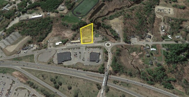
10 State Rd
BTTH-000031-000000-000066
Sagadahoc
Commercialnec
Maine
C4
66
A Areas with a 1% annual chance of flooding and a 26% chance of flooding over the life of a 30-year mortgage.
2.91 AC
2025
Sagadahoc County
2025
Portland/South Portland
970600
Portland-South Portland, ME
4,176 SF
NEARBY LISTINGS FOR SALE OR LEASE
DEMOGRAPHICS near 10 State Rd
1 mile
3 mile
5 mile
2025 Total Population
4,295
11,134
19,011
2030 Population
4,310
11,233
19,369
Pop Growth 2025-2030
+ 0.35%
+ 0.89%
+ 1.88%
Average Age
41
44
44
2025 Total Households
2,030
5,193
8,623
HH Growth 2025-2030
+ 0.34%
+ 0.85%
+ 1.91%
Median Household Inc
$57,946
$74,921
$73,497
Avg Household Size
2.10
2.10
2.10
2025 Avg HH Vehicles
2.00
2.00
2.00
Median Home Value
$313,655
$339,191
$332,998
Median Year Built
1946
1949
1972
Nearby Places
Map Layers
Map Styles
 Street
 Aerial
Transit
 Traffic
 Biking
Places
Listings with unknown addresses are not visible on the map
- Restaurants
- Banks
- Shops
- Fitness
- Groceries
PUBLIC TRANSPORTATION
COMMUTER RAIL
Drive
Walk
Distance
11 min
8.0 mi
AIRPORT
Portland International Jetport
Drive
Walk
Distance
Portland International Jetport
52 min
38.8 mi
Freight Ports
Portland, ME
Drive
Walk
Distance
Portland, ME
46 min
35.8 mi
SALE & LEASE HISTORY
LISTING DATE
SALE/LEASE

Nov 24, 2020
For Sale
Nearby Properties
Address
Land Use
TOTAL SIZE
Lot Size
Zoning
Address
Land Use
TOTAL SIZE
Lot Size
Zoning
180,000 SF
26.95 AC
S
Address
Land Use
TOTAL SIZE
Lot Size
Zoning
16 AC
I
Address
Land Use
TOTAL SIZE
Lot Size
Zoning
43,434 SF
127 AC
R1
Address
Land Use
TOTAL SIZE
Lot Size
Zoning
116,612 SF
2.53 AC
R1
Address
Land Use
TOTAL SIZE
Lot Size
Zoning
61,453 SF
2.90 AC
C4
Address
Land Use
TOTAL SIZE
Lot Size
Zoning
67.39 AC
Address
Land Use
TOTAL SIZE
Lot Size
Zoning
84,327 SF
5.48 AC
S
Address
Land Use
TOTAL SIZE
Lot Size
Zoning
56,594 SF
C4
Address
Land Use
TOTAL SIZE
Lot Size
Zoning
160,000 SF
49.64 AC
GI
Address
Land Use
TOTAL SIZE
Lot Size
Zoning
56,848 SF
1.91 AC
C1
Address
Land Use
TOTAL SIZE
Lot Size
Zoning
53,478 SF
6.08 AC
C2
Address
Land Use
TOTAL SIZE
Lot Size
Zoning
206,533 SF
28 AC
Address
Land Use
TOTAL SIZE
Lot Size
Zoning
22,688 SF
1.20 AC
C1
Address
Land Use
TOTAL SIZE
Lot Size
Zoning
900 SF
100.78 AC
Address
Land Use
TOTAL SIZE
Lot Size
Zoning
1,623 SF
22.23 AC
PH
Address
Land Use
TOTAL SIZE
Lot Size
Zoning
38,528 SF
3.40 AC
C3
Address
Land Use
TOTAL SIZE
Lot Size
Zoning
35,840 SF
9.65 AC
C3
Address
Land Use
TOTAL SIZE
Lot Size
Zoning
6.80 AC
C2
Address
Land Use
TOTAL SIZE
Lot Size
Zoning
20,604 SF
2.60 AC
M
Address
Land Use
TOTAL SIZE
Lot Size
Zoning
39,194 SF
0.59 AC
C1
Address
Land Use
TOTAL SIZE
Lot Size
Zoning
45,228 SF
7.40 AC
Address
Land Use
TOTAL SIZE
Lot Size
Zoning
12,533 SF
29 AC
R3
Address
Land Use
TOTAL SIZE
Lot Size
Zoning
1.78 AC
R2
Address
Land Use
TOTAL SIZE
Lot Size
Zoning
33,758 SF
5.40 AC
R1
Address
Land Use
TOTAL SIZE
Lot Size
Zoning
25,512 SF
1.50 AC
C1
Address
Land Use
TOTAL SIZE
Lot Size
Zoning
60,115 SF
6.43 AC
R2
Address
Land Use
TOTAL SIZE
Lot Size
Zoning
24,432 SF
0.59 AC
C1
Address
Land Use
TOTAL SIZE
Lot Size
Zoning
34,188 SF
C4
Address
Land Use
TOTAL SIZE
Lot Size
Zoning
Address
Land Use
TOTAL SIZE
Lot Size
Zoning
2,400 SF
7.29 AC
C2
The World's #1 Commercial Real Estate Marketplace
Connect with us
© 2026 CoStar Group
The information above has been obtained from sources believed reliable. While we do not doubt its accuracy we have not verified it and make no guarantee, warranty or representation about it. It is your responsibility to independently confirm its accuracy and completeness. Any projections, opinions, assumptions, or estimates used are for example only and do not represent the current or future performance of the property. The value of this transaction to you depends on tax and other factors which should be evaluated by your tax, financial, and legal advisors. You and your advisors should conduct a careful, independent investigation of the property to determine to your satisfaction the suitability of the property for your needs.