Property Record
10 Ste Ave, Lancaster, CA 93535

This Property Is For Sale
Property Detail
10 Ste Ave
Los Angeles-Long Beach-Glendale, CA
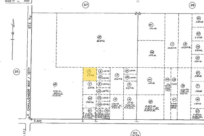
2.5 MORE OR LESS ACS NW 1/4 OF NW 1/4 OF SE 1/4 OF SW 1/4 OF SEC 25 T 8N R 12W
3145-031-003
LOS ANGELES
Residentialacreage
California
LCA2
25
C and X Area of minimal flood hazard, usually depicted on FIRMs as above the 500-year flood level.
2.56 AC
2024
Antelope Valley
2025
Los Angeles
900508
NEARBY LISTINGS FOR SALE OR LEASE
DEMOGRAPHICS near 10 Ste Ave
1 mile
3 mile
5 mile
2024 Total Population
36
3,749
79,390
2029 Population
38
3,843
79,122
Pop Growth 2024-2029
+ 5.56%
+ 2.51%
(0.34%)
Average Age
40
38
36
2024 Total Households
12
1,217
23,832
HH Growth 2024-2029
+ 8.33%
+ 3.29%
(0.42%)
Median Household Inc
$55,000
$51,835
$60,742
Avg Household Size
3.20
3.00
3.20
2024 Avg HH Vehicles
3.00
2.00
2.00
Median Home Value
$450,000
$115,540
$328,819
Median Year Built
1979
1980
1981
Nearby Places
Map Layers
Map Styles
 Street
 Aerial
Transit
 Traffic
 Biking
Places
Listings with unknown addresses are not visible on the map
- Restaurants
- Banks
- Shops
- Fitness
- Groceries
PUBLIC TRANSPORTATION
COMMUTER RAIL
Lancaster (Antelope Valley Line - Southern California Regional Rail Authority (Metrolink))
Drive
Walk
Distance
Lancaster (Antelope Valley Line - Southern California Regional Rail Authority (Metrolink))
8 min
5.5 mi
Nearby Properties
Address
Land Use
TOTAL SIZE
Lot Size
Zoning
Address
Land Use
TOTAL SIZE
Lot Size
Zoning
552,178 SF
17.77 AC
LRHI*
Address
Land Use
TOTAL SIZE
Lot Size
Zoning
Address
Land Use
TOTAL SIZE
Lot Size
Zoning
552,178 SF
4.70 AC
LRHI
Address
Land Use
TOTAL SIZE
Lot Size
Zoning
27,070 SF
17.12 AC
LRHI
Address
Land Use
TOTAL SIZE
Lot Size
Zoning
44,015 SF
7.16 AC
LRHI
Address
Land Use
TOTAL SIZE
Lot Size
Zoning
58.68 AC
LCD22*
Address
Land Use
TOTAL SIZE
Lot Size
Zoning
81.54 AC
LCD22*
Address
Land Use
TOTAL SIZE
Lot Size
Zoning
77.36 AC
LCD22*
Address
Land Use
TOTAL SIZE
Lot Size
Zoning
26,720 SF
2.82 AC
LRLI
Address
Land Use
TOTAL SIZE
Lot Size
Zoning
10,512 SF
33.67 AC
LRHI
Address
Land Use
TOTAL SIZE
Lot Size
Zoning
17.50 AC
LCD21*
Address
Land Use
TOTAL SIZE
Lot Size
Zoning
51.10 AC
LCD21*
Address
Land Use
TOTAL SIZE
Lot Size
Zoning
35.05 AC
LCD21*
Address
Land Use
TOTAL SIZE
Lot Size
Zoning
1,000 SF
9.53 AC
LRHI
Address
Land Use
TOTAL SIZE
Lot Size
Zoning
11,657 SF
3.19 AC
LRHI
Address
Land Use
TOTAL SIZE
Lot Size
Zoning
10,248 SF
2.53 AC
LRHI
Address
Land Use
TOTAL SIZE
Lot Size
Zoning
4,900 SF
2.23 AC
LRHI
Address
Land Use
TOTAL SIZE
Lot Size
Zoning
19,050 SF
9.78 AC
LRHI
Address
Land Use
TOTAL SIZE
Lot Size
Zoning
39.23 AC
LCD2
Address
Land Use
TOTAL SIZE
Lot Size
Zoning
6,000 SF
1.09 AC
LRHI
Address
Land Use
TOTAL SIZE
Lot Size
Zoning
37.64 AC
LCD2
Address
Land Use
TOTAL SIZE
Lot Size
Zoning
Address
Land Use
TOTAL SIZE
Lot Size
Zoning
15,000 SF
1.26 AC
LRLI
Address
Land Use
TOTAL SIZE
Lot Size
Zoning
6,400 SF
0.33 AC
LRLI
Address
Land Use
TOTAL SIZE
Lot Size
Zoning
39.37 AC
LCA2
Address
Land Use
TOTAL SIZE
Lot Size
Zoning
76.89 AC
LCD2
Address
Land Use
TOTAL SIZE
Lot Size
Zoning
26.87 AC
LRD21*
Address
Land Use
TOTAL SIZE
Lot Size
Zoning
3,750 SF
0.93 AC
LRC*
Address
Land Use
TOTAL SIZE
Lot Size
Zoning
18.50 AC
LRMHP
Address
Land Use
TOTAL SIZE
Lot Size
Zoning
7.54 AC
LRLI
The World's #1 Commercial Real Estate Marketplace
Connect with us
© 2026 CoStar Group
The information above has been obtained from sources believed reliable. While we do not doubt its accuracy we have not verified it and make no guarantee, warranty or representation about it. It is your responsibility to independently confirm its accuracy and completeness. Any projections, opinions, assumptions, or estimates used are for example only and do not represent the current or future performance of the property. The value of this transaction to you depends on tax and other factors which should be evaluated by your tax, financial, and legal advisors. You and your advisors should conduct a careful, independent investigation of the property to determine to your satisfaction the suitability of the property for your needs.