Property Record
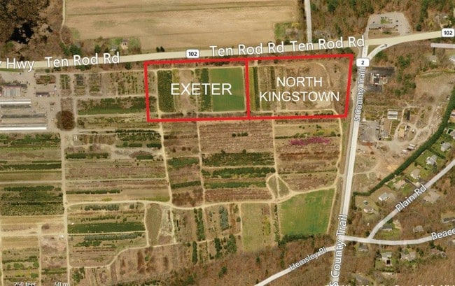
10 Ten Rod Rd, Exeter, RI 02822

Property Detail
10 Ten Rod Rd
EXET-000039-000001-000002
WASHINGTON
Residentialacreage
Rhode Island
SPLT
2
B and X Area of moderate flood hazard, usually the area between the limits of the 100-year and 500-year floods.
19.65 AC
2025
Washington County
2025
Providence
050500
Providence-Warwick, RI-MA
NEARBY LISTINGS FOR SALE OR LEASE
-
-
View all Exeter listings for sale on LoopNet.com
DEMOGRAPHICS near 10 Ten Rod Rd
1 mile
3 mile
5 mile
2025 Total Population
1,706
8,770
31,314
2030 Population
1,632
8,530
30,803
Pop Growth 2025-2030
(4.34%)
(2.74%)
(1.63%)
Average Age
43
43
43
2025 Total Households
608
3,245
12,210
HH Growth 2025-2030
(4.77%)
(3.14%)
(2.03%)
Median Household Inc
$116,360
$116,166
$117,834
Avg Household Size
2.80
2.60
2.50
2025 Avg HH Vehicles
2.00
2.00
2.00
Median Home Value
$622,507
$610,732
$587,428
Median Year Built
1986
1980
1976
Nearby Places
Map Layers
Map Styles
 Street
 Aerial
Layers
 Traffic
 Biking
Places
Listings with unknown addresses are not visible on the map
- Restaurants
- Banks
- Shops
- Fitness
- Groceries
PUBLIC TRANSPORTATION
COMMUTER RAIL
Wickford Junction (Providence/Stoughton Line - MBTA)
Drive
Walk
Distance
Wickford Junction (Providence/Stoughton Line - MBTA)
3 min
1.7 mi
Kingston Amtrak Station (Northeast Regional - Amtrak)
Drive
Walk
Distance
Kingston Amtrak Station (Northeast Regional - Amtrak)
14 min
8.2 mi
AIRPORT
Rhode Island Tf Green International
Drive
Walk
Distance
Rhode Island Tf Green International
25 min
15.1 mi
Freight Ports
Port of Davisville, RI
Drive
Walk
Distance
Port of Davisville, RI
17 min
8.0 mi
SALE & LEASE HISTORY
LISTING DATE
SALE/LEASE

Sep 24, 2016
For Sale
Nearby Properties
Address
Land Use
TOTAL SIZE
Lot Size
Zoning
Address
Land Use
TOTAL SIZE
Lot Size
Zoning
141,701 SF
12 AC
WJ
Address
Land Use
TOTAL SIZE
Lot Size
Zoning
5,280 SF
469.40 AC
PD
Address
Land Use
TOTAL SIZE
Lot Size
Zoning
13.28 AC
GB
Address
Land Use
TOTAL SIZE
Lot Size
Zoning
125,393 SF
15.33 AC
GB
Address
Land Use
TOTAL SIZE
Lot Size
Zoning
237,726 SF
3.36 AC
WJ
Address
Land Use
TOTAL SIZE
Lot Size
Zoning
42,533 SF
12.60 AC
GB
Address
Land Use
TOTAL SIZE
Lot Size
Zoning
49,367 SF
14.27 AC
P
Address
Land Use
TOTAL SIZE
Lot Size
Zoning
3.08 AC
GB
Address
Land Use
TOTAL SIZE
Lot Size
Zoning
120 AC
LI
Address
Land Use
TOTAL SIZE
Lot Size
Zoning
23,840 SF
7 AC
PD
Address
Land Use
TOTAL SIZE
Lot Size
Zoning
39,060 SF
8.71 AC
RR
Address
Land Use
TOTAL SIZE
Lot Size
Zoning
31,152 SF
5.36 AC
M/LI
Address
Land Use
TOTAL SIZE
Lot Size
Zoning
Address
Land Use
TOTAL SIZE
Lot Size
Zoning
51,760 SF
136.97 AC
F1
Address
Land Use
TOTAL SIZE
Lot Size
Zoning
34.59 AC
GB
Address
Land Use
TOTAL SIZE
Lot Size
Zoning
26,114 SF
3.60 AC
GB
Address
Land Use
TOTAL SIZE
Lot Size
Zoning
23,408 SF
2.30 AC
WJ
Address
Land Use
TOTAL SIZE
Lot Size
Zoning
13,203 SF
1.66 AC
GB
Address
Land Use
TOTAL SIZE
Lot Size
Zoning
50,559 SF
PBD
Address
Land Use
TOTAL SIZE
Lot Size
Zoning
44,706 SF
3.76 AC
GB
Address
Land Use
TOTAL SIZE
Lot Size
Zoning
4,162 SF
96.40 AC
RU-4
Address
Land Use
TOTAL SIZE
Lot Size
Zoning
3.76 AC
NR
Address
Land Use
TOTAL SIZE
Lot Size
Zoning
43,168 SF
7.35 AC
LI
Address
Land Use
TOTAL SIZE
Lot Size
Zoning
9.56 AC
CVD
Address
Land Use
TOTAL SIZE
Lot Size
Zoning
3,409 SF
162.20 AC
RU-4
Address
Land Use
TOTAL SIZE
Lot Size
Zoning
24,602 SF
2.66 AC
WJ
Address
Land Use
TOTAL SIZE
Lot Size
Zoning
4,728 SF
0.90 AC
CH
Address
Land Use
TOTAL SIZE
Lot Size
Zoning
54.31 AC
OS
Address
Land Use
TOTAL SIZE
Lot Size
Zoning
6,157 SF
6.43 AC
RU-4
Address
Land Use
TOTAL SIZE
Lot Size
Zoning
728 SF
75.83 AC
LI
The World's #1 Commercial Real Estate Marketplace
Connect with us
© 2026 CoStar Group
The information above has been obtained from sources believed reliable. While we do not doubt its accuracy we have not verified it and make no guarantee, warranty or representation about it. It is your responsibility to independently confirm its accuracy and completeness. Any projections, opinions, assumptions, or estimates used are for example only and do not represent the current or future performance of the property. The value of this transaction to you depends on tax and other factors which should be evaluated by your tax, financial, and legal advisors. You and your advisors should conduct a careful, independent investigation of the property to determine to your satisfaction the suitability of the property for your needs.