Property Record
10 Unknown, Anytowne, OR 00000

Property Detail
10 Unknown
Eugene-Springfield, OR
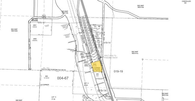
PARTITION PLAT 2022-P3072 PCL 3 TL 00903
0667293
LANE
Industrialgeneral
Oregon
RI
900
2025
2.07 AC
2025
Lane County
003600
Portland
10,368 SF
NEARBY LISTINGS FOR SALE OR LEASE
DEMOGRAPHICS near 10 Unknown
1 mile
3 mile
5 mile
2025 Total Population
831
15,107
123,183
2030 Population
817
15,072
122,518
Pop Growth 2025-2030
(1.68%)
(0.23%)
(0.54%)
Average Age
46
43
38
2025 Total Households
332
6,451
50,340
HH Growth 2025-2030
(1.81%)
(0.39%)
(0.64%)
Median Household Inc
$101,910
$87,629
$63,734
Avg Household Size
2.40
2.30
2.30
2025 Avg HH Vehicles
2.00
2.00
2.00
Median Home Value
$493,181
$496,004
$455,828
Median Year Built
1967
1973
1974
Nearby Places
Map Layers
Map Styles
 Street
 Aerial
Transit
 Traffic
 Biking
Places
Listings with unknown addresses are not visible on the map
- Restaurants
- Banks
- Shops
- Fitness
- Groceries
PUBLIC TRANSPORTATION
COMMUTER RAIL
Eugene (Amtrak Cascades - Amtrak, Coast Starlight - Amtrak)
Drive
Walk
Distance
Eugene (Amtrak Cascades - Amtrak, Coast Starlight - Amtrak)
12 min
5.9 mi
AIRPORT
Mahlon Sweet Field
Drive
Walk
Distance
Mahlon Sweet Field
27 min
16.0 mi
Freight Ports
Port of Coos Bay, OR
Drive
Walk
Distance
Port of Coos Bay, OR
159 min
110.2 mi
SALE & LEASE HISTORY
LISTING DATE
SALE/LEASE

Nov 14, 2016
For Sale
Nearby Properties
Address
Land Use
TOTAL SIZE
Lot Size
Zoning
Address
Land Use
TOTAL SIZE
Lot Size
Zoning
121.46 AC
E25
Address
Land Use
TOTAL SIZE
Lot Size
Zoning
33.20 AC
HI
Address
Land Use
TOTAL SIZE
Lot Size
Zoning
Address
Land Use
TOTAL SIZE
Lot Size
Zoning
Address
Land Use
TOTAL SIZE
Lot Size
Zoning
35.91 AC
HI
Address
Land Use
TOTAL SIZE
Lot Size
Zoning
7.11 AC
LMI
Address
Land Use
TOTAL SIZE
Lot Size
Zoning
Address
Land Use
TOTAL SIZE
Lot Size
Zoning
17.43 AC
LMI
Address
Land Use
TOTAL SIZE
Lot Size
Zoning
9.19 AC
E25
Address
Land Use
TOTAL SIZE
Lot Size
Zoning
0.99 AC
MUC
Address
Land Use
TOTAL SIZE
Lot Size
Zoning
5.89 AC
LMI
Address
Land Use
TOTAL SIZE
Lot Size
Zoning
Address
Land Use
TOTAL SIZE
Lot Size
Zoning
17.55 AC
LMI
Address
Land Use
TOTAL SIZE
Lot Size
Zoning
4.62 AC
LMI
Address
Land Use
TOTAL SIZE
Lot Size
Zoning
17.81 AC
LMI
Address
Land Use
TOTAL SIZE
Lot Size
Zoning
4.67 AC
LMI
Address
Land Use
TOTAL SIZE
Lot Size
Zoning
7.06 AC
HI
Address
Land Use
TOTAL SIZE
Lot Size
Zoning
5.62 AC
RI
Address
Land Use
TOTAL SIZE
Lot Size
Zoning
3,474 SF
1.27 AC
LMI
Address
Land Use
TOTAL SIZE
Lot Size
Zoning
74.11 AC
BK
Address
Land Use
TOTAL SIZE
Lot Size
Zoning
1.51 AC
LMI
Address
Land Use
TOTAL SIZE
Lot Size
Zoning
20.15 AC
LMI
Address
Land Use
TOTAL SIZE
Lot Size
Zoning
6.64 AC
LMI
Address
Land Use
TOTAL SIZE
Lot Size
Zoning
9.13 AC
LMI
Address
Land Use
TOTAL SIZE
Lot Size
Zoning
5 AC
E25
Address
Land Use
TOTAL SIZE
Lot Size
Zoning
6.29 AC
HI
Address
Land Use
TOTAL SIZE
Lot Size
Zoning
0.83 AC
LMI
Address
Land Use
TOTAL SIZE
Lot Size
Zoning
9.67 AC
LMI
Address
Land Use
TOTAL SIZE
Lot Size
Zoning
7.87 AC
R-1
Address
Land Use
TOTAL SIZE
Lot Size
Zoning
The World's #1 Commercial Real Estate Marketplace
Connect with us
© 2026 CoStar Group
The information above has been obtained from sources believed reliable. While we do not doubt its accuracy we have not verified it and make no guarantee, warranty or representation about it. It is your responsibility to independently confirm its accuracy and completeness. Any projections, opinions, assumptions, or estimates used are for example only and do not represent the current or future performance of the property. The value of this transaction to you depends on tax and other factors which should be evaluated by your tax, financial, and legal advisors. You and your advisors should conduct a careful, independent investigation of the property to determine to your satisfaction the suitability of the property for your needs.