Property Record
10 Unknown, Anytowne, OR 00000


Property Detail
10 Unknown
Eugene-Springfield, OR
PARTITION PLAT 2004-P1795 PCL 2 TL 00606
1737517
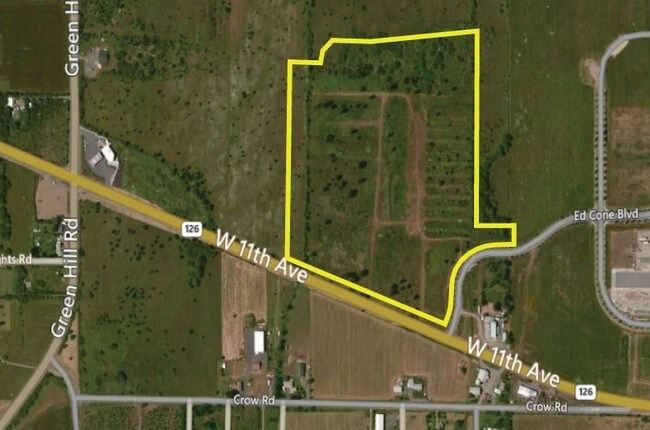
LANE
Industrialacreage
Oregon
E-1
606
B and X Area of moderate flood hazard, usually the area between the limits of the 100-year and 500-year floods.
33.41 AC
2025
Lane County
2025
Portland
0025041035
NEARBY LISTINGS FOR SALE OR LEASE
DEMOGRAPHICS near 10 Unknown
1 mile
3 mile
5 mile
2025 Total Population
174
35,172
90,752
2030 Population
176
34,708
89,632
Pop Growth 2025-2030
+ 1.15%
(1.32%)
(1.23%)
Average Age
44
41
42
2025 Total Households
70
12,824
36,371
HH Growth 2025-2030
+ 1.43%
(1.45%)
(1.35%)
Median Household Inc
$67,500
$66,689
$67,013
Avg Household Size
2.30
2.50
2.30
2025 Avg HH Vehicles
2.00
2.00
2.00
Median Home Value
$761,904
$352,007
$407,641
Median Year Built
1986
1984
1976
Nearby Places
Map Layers
Map Styles
 Street
 Aerial
Transit
 Traffic
 Biking
Places
Listings with unknown addresses are not visible on the map
- Restaurants
- Banks
- Shops
- Fitness
- Groceries
PUBLIC TRANSPORTATION
COMMUTER RAIL
Eugene (Amtrak Cascades - Amtrak, Coast Starlight - Amtrak)
Drive
Walk
Distance
Eugene (Amtrak Cascades - Amtrak, Coast Starlight - Amtrak)
12 min
5.9 mi
AIRPORT
Mahlon Sweet Field
Drive
Walk
Distance
Mahlon Sweet Field
12 min
5.6 mi
Freight Ports
Port of Coos Bay, OR
Drive
Walk
Distance
Port of Coos Bay, OR
141 min
102.5 mi
SALE & LEASE HISTORY
LISTING DATE
SALE/LEASE

Sep 24, 2016
For Sale
Aug 07, 2017
For Sale
Nearby Properties
Address
Land Use
TOTAL SIZE
Lot Size
Zoning
Address
Land Use
TOTAL SIZE
Lot Size
Zoning
44.56 AC
PL
Address
Land Use
TOTAL SIZE
Lot Size
Zoning
Address
Land Use
TOTAL SIZE
Lot Size
Zoning
12.12 AC
C-2
Address
Land Use
TOTAL SIZE
Lot Size
Zoning
45.78 AC
I-3
Address
Land Use
TOTAL SIZE
Lot Size
Zoning
75.36 AC
PL
Address
Land Use
TOTAL SIZE
Lot Size
Zoning
14.14 AC
R-1
Address
Land Use
TOTAL SIZE
Lot Size
Zoning
19.65 AC
C-2
Address
Land Use
TOTAL SIZE
Lot Size
Zoning
3,324 SF
8.70 AC
NR
Address
Land Use
TOTAL SIZE
Lot Size
Zoning
27.47 AC
R-1
Address
Land Use
TOTAL SIZE
Lot Size
Zoning
12.07 AC
NR
Address
Land Use
TOTAL SIZE
Lot Size
Zoning
29.96 AC
AG
Address
Land Use
TOTAL SIZE
Lot Size
Zoning
Address
Land Use
TOTAL SIZE
Lot Size
Zoning
33.70 AC
R-1
Address
Land Use
TOTAL SIZE
Lot Size
Zoning
37.58 AC
PL
Address
Land Use
TOTAL SIZE
Lot Size
Zoning
13.14 AC
I-2
Address
Land Use
TOTAL SIZE
Lot Size
Zoning
4.97 AC
I-3
Address
Land Use
TOTAL SIZE
Lot Size
Zoning
10.50 AC
C-2
Address
Land Use
TOTAL SIZE
Lot Size
Zoning
5.13 AC
I-3
Address
Land Use
TOTAL SIZE
Lot Size
Zoning
3.12 AC
I-2
Address
Land Use
TOTAL SIZE
Lot Size
Zoning
12.30 AC
C-2
Address
Land Use
TOTAL SIZE
Lot Size
Zoning
Address
Land Use
TOTAL SIZE
Lot Size
Zoning
16.18 AC
E-1
Address
Land Use
TOTAL SIZE
Lot Size
Zoning
11.13 AC
C-2
Address
Land Use
TOTAL SIZE
Lot Size
Zoning
8.13 AC
R-1
Address
Land Use
TOTAL SIZE
Lot Size
Zoning
25.02 AC
PL
Address
Land Use
TOTAL SIZE
Lot Size
Zoning
560 SF
11.02 AC
I-2
Address
Land Use
TOTAL SIZE
Lot Size
Zoning
2.32 AC
E-2
Address
Land Use
TOTAL SIZE
Lot Size
Zoning
13.55 AC
R-1
Address
Land Use
TOTAL SIZE
Lot Size
Zoning
9.46 AC
C-2
Address
Land Use
TOTAL SIZE
Lot Size
Zoning
3,980 SF
85.16 AC
AG
The World's #1 Commercial Real Estate Marketplace
Connect with us
© 2026 CoStar Group
The information above has been obtained from sources believed reliable. While we do not doubt its accuracy we have not verified it and make no guarantee, warranty or representation about it. It is your responsibility to independently confirm its accuracy and completeness. Any projections, opinions, assumptions, or estimates used are for example only and do not represent the current or future performance of the property. The value of this transaction to you depends on tax and other factors which should be evaluated by your tax, financial, and legal advisors. You and your advisors should conduct a careful, independent investigation of the property to determine to your satisfaction the suitability of the property for your needs.