Property Record
10 Upper Ty Ty Rd, Tifton, GA 31793

Save to a Folder
{{folder.Name}}
{{folder.ListingIds.length}} Properties
{{folder.ListingIds.length}} Property
Create a New Folder
Property Detail
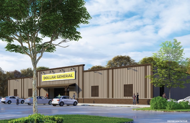
10 Upper Ty Ty Rd
0032-087
LL 247 WHIDDON MILL RD
Wholesaleoutletdiscountstore
TIFT
B and X Area of moderate flood hazard, usually the area between the limits of the 100-year and 500-year floods.
Georgia
2025
2.40 AC
2025
Valdosta/Lake Park
960301
Other Market Areas
9,230 SF
Tifton, GA
NEARBY LISTINGS FOR SALE OR LEASE
DEMOGRAPHICS near 10 Upper Ty Ty Rd
1 mile
3 mile
5 mile
2025 Total Population
1,386
8,381
28,212
2030 Population
1,410
8,477
28,588
Pop Growth 2025-2030
+ 1.73%
+ 1.15%
+ 1.33%
Average Age
36
38
38
2025 Total Households
494
3,209
10,990
HH Growth 2025-2030
+ 1.82%
+ 1.12%
+ 1.35%
Median Household Inc
$71,999
$67,736
$55,530
Avg Household Size
2.40
2.40
2.40
2025 Avg HH Vehicles
2.00
2.00
2.00
Median Home Value
$202,857
$205,642
$174,530
Median Year Built
1994
1982
1980
Nearby Places
Map Layers
Map Styles
 Street
 Aerial
Layers
 Traffic
 Biking
Places
Listings with unknown addresses are not visible on the map
- Restaurants
- Banks
- Shops
- Fitness
- Groceries
SALE & LEASE HISTORY
LISTING DATE
SALE/LEASE

Sep 28, 2020
For Sale
Nearby Properties
Address
Land Use
TOTAL SIZE
Lot Size
Zoning
Address
Land Use
TOTAL SIZE
Lot Size
Zoning
1,907.64 AC
Address
Land Use
TOTAL SIZE
Lot Size
Zoning
209,412 SF
41 AC
Address
Land Use
TOTAL SIZE
Lot Size
Zoning
247,016 SF
16.14 AC
Address
Land Use
TOTAL SIZE
Lot Size
Zoning
150,938 SF
17.90 AC
Address
Land Use
TOTAL SIZE
Lot Size
Zoning
145,489 SF
14.51 AC
Address
Land Use
TOTAL SIZE
Lot Size
Zoning
88,320 SF
6.65 AC
Address
Land Use
TOTAL SIZE
Lot Size
Zoning
247,745 SF
42.21 AC
Address
Land Use
TOTAL SIZE
Lot Size
Zoning
232,083 SF
21.49 AC
Address
Land Use
TOTAL SIZE
Lot Size
Zoning
85,562 SF
11.53 AC
Address
Land Use
TOTAL SIZE
Lot Size
Zoning
71,356 SF
3.30 AC
Address
Land Use
TOTAL SIZE
Lot Size
Zoning
2,140 SF
4.82 AC
Address
Land Use
TOTAL SIZE
Lot Size
Zoning
62,821 SF
2.58 AC
Address
Land Use
TOTAL SIZE
Lot Size
Zoning
3,528 SF
149.24 AC
Address
Land Use
TOTAL SIZE
Lot Size
Zoning
53,031 SF
5.73 AC
Address
Land Use
TOTAL SIZE
Lot Size
Zoning
51,245 SF
3.76 AC
Address
Land Use
TOTAL SIZE
Lot Size
Zoning
9,528 SF
5.70 AC
Address
Land Use
TOTAL SIZE
Lot Size
Zoning
57,397 SF
45.60 AC
Address
Land Use
TOTAL SIZE
Lot Size
Zoning
53,776 SF
4.74 AC
Address
Land Use
TOTAL SIZE
Lot Size
Zoning
59,160 SF
1.34 AC
Address
Land Use
TOTAL SIZE
Lot Size
Zoning
66,240 SF
3.36 AC
Address
Land Use
TOTAL SIZE
Lot Size
Zoning
47,337 SF
2.24 AC
Address
Land Use
TOTAL SIZE
Lot Size
Zoning
5,136 SF
5.18 AC
Address
Land Use
TOTAL SIZE
Lot Size
Zoning
94,280 SF
30 AC
Address
Land Use
TOTAL SIZE
Lot Size
Zoning
47,104 SF
2.67 AC
Address
Land Use
TOTAL SIZE
Lot Size
Zoning
1,360 SF
3.95 AC
Address
Land Use
TOTAL SIZE
Lot Size
Zoning
53,376 SF
5.81 AC
Address
Land Use
TOTAL SIZE
Lot Size
Zoning
233,703 SF
11.20 AC
Address
Land Use
TOTAL SIZE
Lot Size
Zoning
44,488 SF
1.65 AC
Address
Land Use
TOTAL SIZE
Lot Size
Zoning
48,600 SF
3.54 AC
Address
Land Use
TOTAL SIZE
Lot Size
Zoning
15,000 SF
14.67 AC
The World's #1 Commercial Real Estate Marketplace
Connect with us
© 2026 CoStar Group
The information above has been obtained from sources believed reliable. While we do not doubt its accuracy we have not verified it and make no guarantee, warranty or representation about it. It is your responsibility to independently confirm its accuracy and completeness. Any projections, opinions, assumptions, or estimates used are for example only and do not represent the current or future performance of the property. The value of this transaction to you depends on tax and other factors which should be evaluated by your tax, financial, and legal advisors. You and your advisors should conduct a careful, independent investigation of the property to determine to your satisfaction the suitability of the property for your needs.