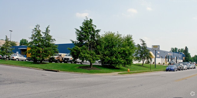
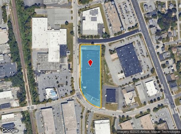
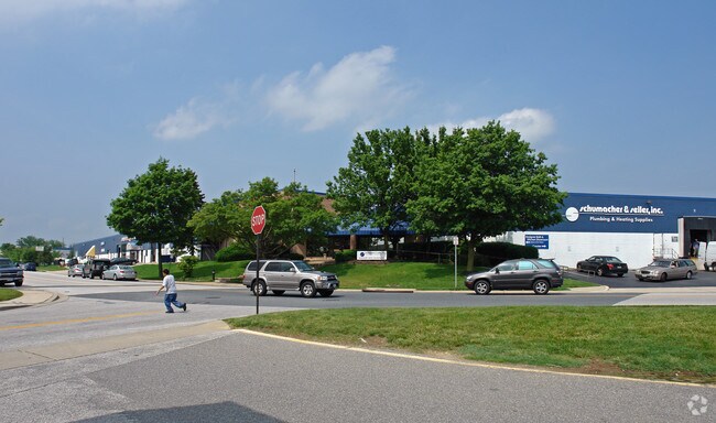
Property Record
10 W Aylesbury Rd, Lutherville Timonium, MD 21093

NEARBY LISTINGS FOR SALE OR LEASE
Property Detail
10 W Aylesbury Rd
Baltimore-Columbia-Towson, MD
Plat B Of Northampton
08-0803025630
3 AC ES AYLESBURY RD
Warehouse
Baltimore
X
Maryland
2400100245G
7
2024
3 AC
2025
Rt 83 Corridor South
408800
Baltimore
82,593 SF
DEMOGRAPHICS near 10 W Aylesbury Rd
1 Mile
3 Mile
5 Mile
2024 Total Population
9,098
78,471
170,147
2029 Population
8,932
77,852
167,933
Pop Growth 2024-2029
(1.82%)
(0.79%)
(1.30%)
Average Age
42
42
41
2024 Total Households
3,444
32,369
68,946
HH Growth 2024-2029
(1.95%)
(0.67%)
(1.30%)
Median Household Inc
$129,516
$91,795
$93,478
Avg Household Size
2.60
2.20
2.30
2024 Avg HH Vehicles
2.00
2.00
2.00
Median Home Value
$401,930
$425,411
$401,400
Median Year Built
1959
1975
1969
Nearby Places
Map Layers
Map Styles
 Street
 Aerial
- Restaurants
- Banks
- Shops
- Fitness
- Groceries
PUBLIC TRANSPORTATION
TRANSIT/SUBWAY
Timonium Business Park (Hunt Valley & BWI Marshall - Maryland Transit Administration Light Rail (Baltimore Light Rail), Timonium & Cromwell - Maryland Transit Administration Light Rail (Baltimore Light Rail))
DRIVE
WALK
Distance
Timonium Business Park (Hunt Valley & BWI Marshall - Maryland Transit Administration Light Rail (Baltimore Light Rail), Timonium & Cromwell - Maryland Transit Administration Light Rail (Baltimore Light Rail))
0 min
4 min
0.1 mi
Lutherville (Hunt Valley & BWI Marshall - Maryland Transit Administration Light Rail (Baltimore Light Rail), Timonium & Cromwell - Maryland Transit Administration Light Rail (Baltimore Light Rail))
DRIVE
WALK
Distance
Lutherville (Hunt Valley & BWI Marshall - Maryland Transit Administration Light Rail (Baltimore Light Rail), Timonium & Cromwell - Maryland Transit Administration Light Rail (Baltimore Light Rail))
2 min
8 min
0.5 mi
AIRPORT
Baltimore/Washington International Thurgood Marshall
DRIVE
WALK
Distance
Baltimore/Washington International Thurgood Marshall
38 min
24.6 mi
Freight Ports
Port of Baltimore
DRIVE
WALK
Distance
Port of Baltimore
31 min
16.3 mi
SALE & LEASE HISTORY
LISTING DATE
SALE/LEASE

Apr 01, 2021
For Lease
Nearby Properties
Address
Land Use
TOTAL SIZE
Lot Size
Zoning
Address
Land Use
TOTAL SIZE
Lot Size
Zoning
940,291 SF
23.80 AC
BMCT
Address
Land Use
TOTAL SIZE
Lot Size
Zoning
217,147 SF
5.08 AC
MLIM
Address
Land Use
TOTAL SIZE
Lot Size
Zoning
712,387 SF
2.20 AC
BM-CT
Address
Land Use
TOTAL SIZE
Lot Size
Zoning
720,989 SF
32.65 AC
Address
Land Use
TOTAL SIZE
Lot Size
Zoning
723,067 SF
80.37 AC
OR2
Address
Land Use
TOTAL SIZE
Lot Size
Zoning
731,797 SF
5.32 AC
RAE2
Address
Land Use
TOTAL SIZE
Lot Size
Zoning
296,575 SF
0.01 AC
DR16
Address
Land Use
TOTAL SIZE
Lot Size
Zoning
561,042 SF
38.91 AC
DR2
Address
Land Use
TOTAL SIZE
Lot Size
Zoning
38.89 AC
DR16
Address
Land Use
TOTAL SIZE
Lot Size
Zoning
13,468 SF
32.08 AC
DR16
Address
Land Use
TOTAL SIZE
Lot Size
Zoning
189,300 SF
1.83 AC
BM
Address
Land Use
TOTAL SIZE
Lot Size
Zoning
643,976 SF
4.54 AC
RAE2
Address
Land Use
TOTAL SIZE
Lot Size
Zoning
28.74 AC
DR16
Address
Land Use
TOTAL SIZE
Lot Size
Zoning
12.75 AC
DR16
Address
Land Use
TOTAL SIZE
Lot Size
Zoning
0.01 AC
DR5,5
Address
Land Use
TOTAL SIZE
Lot Size
Zoning
318,948 SF
7.35 AC
BM
Address
Land Use
TOTAL SIZE
Lot Size
Zoning
585,866 SF
1.24 AC
BM-CT
Address
Land Use
TOTAL SIZE
Lot Size
Zoning
184,968 SF
4.25 AC
Address
Land Use
TOTAL SIZE
Lot Size
Zoning
362,686 SF
88.84 AC
MR
Address
Land Use
TOTAL SIZE
Lot Size
Zoning
523,464 SF
3.43 AC
RAE2
Address
Land Use
TOTAL SIZE
Lot Size
Zoning
2.70 AC
BM-CT
Address
Land Use
TOTAL SIZE
Lot Size
Zoning
330,145 SF
16.20 AC
Address
Land Use
TOTAL SIZE
Lot Size
Zoning
26.73 AC
DR16
Address
Land Use
TOTAL SIZE
Lot Size
Zoning
2.88 AC
Address
Land Use
TOTAL SIZE
Lot Size
Zoning
4.94 AC
DR16
Address
Land Use
TOTAL SIZE
Lot Size
Zoning
178,200 SF
5.58 AC
BR-CR
Address
Land Use
TOTAL SIZE
Lot Size
Zoning
176,584 SF
31 AC
Address
Land Use
TOTAL SIZE
Lot Size
Zoning
10.63 AC
DR16
Address
Land Use
TOTAL SIZE
Lot Size
Zoning
2.75 AC
BM-CT
Address
Land Use
TOTAL SIZE
Lot Size
Zoning
157,062 SF
22 AC
The World's #1 Commercial Real Estate Marketplace
Connect with us
© 2025 CoStar Group
The information above has been obtained from sources believed reliable. While we do not doubt its accuracy we have not verified it and make no guarantee, warranty or representation about it. It is your responsibility to independently confirm its accuracy and completeness. Any projections, opinions, assumptions, or estimates used are for example only and do not represent the current or future performance of the property. The value of this transaction to you depends on tax and other factors which should be evaluated by your tax, financial, and legal advisors. You and your advisors should conduct a careful, independent investigation of the property to determine to your satisfaction the suitability of the property for your needs.