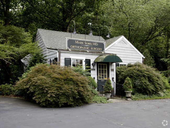
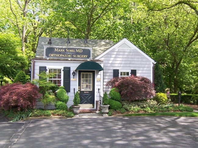
Property Record
10 W Main St, Freehold, NJ 07728

NEARBY LISTINGS FOR SALE OR LEASE
Property Detail
10 W Main St
20-00002-0000-00001
Monmouth
Officebuilding
New Jersey
AE
1
34025C0152F
0.56 AC
2024
Eastern Monmouth
2025
Northern New Jersey
803300
New York-Jersey City-White Plains, NY-NJ
724 SF
DEMOGRAPHICS near 10 W Main St
1 Mile
3 Mile
5 Mile
2024 Total Population
1,248
15,280
78,605
2029 Population
1,235
15,114
77,508
Pop Growth 2024-2029
(1.04%)
(1.09%)
(1.40%)
Average Age
42
41
42
2024 Total Households
391
4,734
26,416
HH Growth 2024-2029
(1.28%)
(1.29%)
(1.62%)
Median Household Inc
$212,500
$204,218
$166,608
Avg Household Size
3.10
3.10
2.90
2024 Avg HH Vehicles
3.00
2.00
2.00
Median Home Value
$836,614
$800,254
$663,920
Median Year Built
1978
1984
1979
Nearby Places
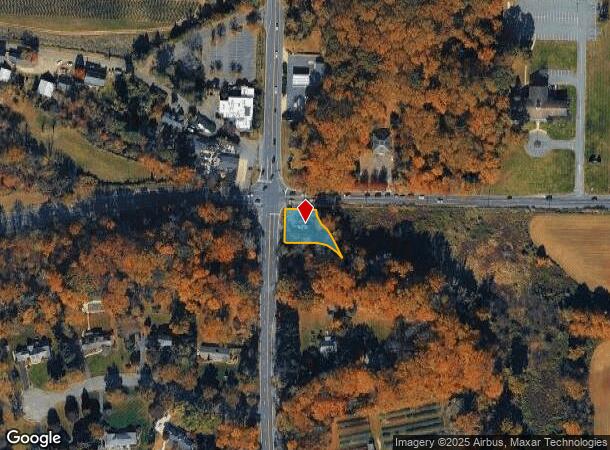
Map Layers
Map Styles
 Street
 Aerial
- Restaurants
- Banks
- Shops
- Fitness
- Groceries
PUBLIC TRANSPORTATION
COMMUTER RAIL
Hazlet (North Jersey Coast Line - NJ Transit Commuter Rail (NJ Transit))
DRIVE
WALK
Distance
Hazlet (North Jersey Coast Line - NJ Transit Commuter Rail (NJ Transit))
10 min
5.6 mi
Aberdeen Matawan (North Jersey Coast Line - NJ Transit Commuter Rail (NJ Transit))
DRIVE
WALK
Distance
Aberdeen Matawan (North Jersey Coast Line - NJ Transit Commuter Rail (NJ Transit))
10 min
6.1 mi
AIRPORT
Newark Liberty International
DRIVE
WALK
Distance
Newark Liberty International
49 min
33.4 mi
Trenton Mercer
DRIVE
WALK
Distance
Trenton Mercer
63 min
39.6 mi
Freight Ports
New York Container Terminal
DRIVE
WALK
Distance
New York Container Terminal
42 min
28.7 mi
Nearby Properties
Address
Land Use
TOTAL SIZE
Lot Size
Zoning
Address
Land Use
TOTAL SIZE
Lot Size
Zoning
134.82 AC
OL1
Address
Land Use
TOTAL SIZE
Lot Size
Zoning
197,568 SF
1.39 AC
Address
Land Use
TOTAL SIZE
Lot Size
Zoning
164,700 SF
136.76 AC
R220
Address
Land Use
TOTAL SIZE
Lot Size
Zoning
9,810 SF
205 AC
R220
Address
Land Use
TOTAL SIZE
Lot Size
Zoning
256,384 SF
75.23 AC
P
Address
Land Use
TOTAL SIZE
Lot Size
Zoning
226.79 AC
OL1
Address
Land Use
TOTAL SIZE
Lot Size
Zoning
896 SF
135.37 AC
P
Address
Land Use
TOTAL SIZE
Lot Size
Zoning
676 SF
133.39 AC
P
Address
Land Use
TOTAL SIZE
Lot Size
Zoning
132.51 AC
P
Address
Land Use
TOTAL SIZE
Lot Size
Zoning
46 AC
CF
Address
Land Use
TOTAL SIZE
Lot Size
Zoning
22.95 AC
A-1
Address
Land Use
TOTAL SIZE
Lot Size
Zoning
1,686 SF
122.17 AC
P
Address
Land Use
TOTAL SIZE
Lot Size
Zoning
2,860 SF
115.57 AC
P
Address
Land Use
TOTAL SIZE
Lot Size
Zoning
7,500 SF
110.90 AC
P
Address
Land Use
TOTAL SIZE
Lot Size
Zoning
98,617 SF
10 AC
A/LC
Address
Land Use
TOTAL SIZE
Lot Size
Zoning
13,365 SF
3 AC
AG
Address
Land Use
TOTAL SIZE
Lot Size
Zoning
24.41 AC
P
Address
Land Use
TOTAL SIZE
Lot Size
Zoning
78.88 AC
P
Address
Land Use
TOTAL SIZE
Lot Size
Zoning
3,917 SF
66.41 AC
P
Address
Land Use
TOTAL SIZE
Lot Size
Zoning
2,719 SF
67 AC
P
Address
Land Use
TOTAL SIZE
Lot Size
Zoning
1,410 SF
101.77 AC
R40B
Address
Land Use
TOTAL SIZE
Lot Size
Zoning
71.40 AC
P
Address
Land Use
TOTAL SIZE
Lot Size
Zoning
37,208 SF
16.80 AC
OL2
Address
Land Use
TOTAL SIZE
Lot Size
Zoning
411 AC
ROS
Address
Land Use
TOTAL SIZE
Lot Size
Zoning
27.87 AC
A-1
Address
Land Use
TOTAL SIZE
Lot Size
Zoning
60,436 SF
9.23 AC
C-2
Address
Land Use
TOTAL SIZE
Lot Size
Zoning
1,560 SF
11.69 AC
R4R
Address
Land Use
TOTAL SIZE
Lot Size
Zoning
23,074 SF
11.32 AC
R40A
Address
Land Use
TOTAL SIZE
Lot Size
Zoning
16,803 SF
19.87 AC
R302
Address
Land Use
TOTAL SIZE
Lot Size
Zoning
30,350 SF
7.02 AC
C2
The World's #1 Commercial Real Estate Marketplace
Connect with us
© 2025 CoStar Group
The information above has been obtained from sources believed reliable. While we do not doubt its accuracy we have not verified it and make no guarantee, warranty or representation about it. It is your responsibility to independently confirm its accuracy and completeness. Any projections, opinions, assumptions, or estimates used are for example only and do not represent the current or future performance of the property. The value of this transaction to you depends on tax and other factors which should be evaluated by your tax, financial, and legal advisors. You and your advisors should conduct a careful, independent investigation of the property to determine to your satisfaction the suitability of the property for your needs.