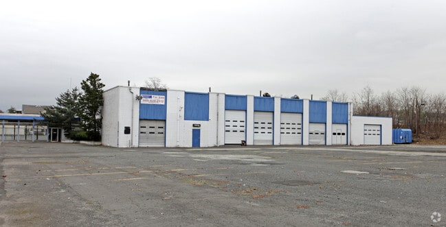
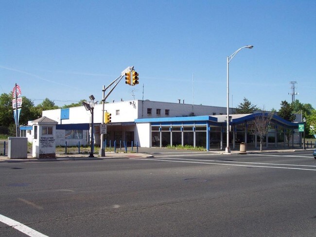
Property Record
10 W Westfield Ave W, Roselle Park, NJ 07204

NEARBY LISTINGS FOR SALE OR LEASE
Property Detail
10 W Westfield Ave W
Newark, NJ
Roselle Pk Borough
15-00610-0000-00003
ADDITIONAL LOTS: PILOT
Commercialnec
Union
AH
New Jersey
34013C0150F
3.1
2024
1.81 AC
2025
Parkway Cranford Corridor
033900
Northern New Jersey
16,170 SF
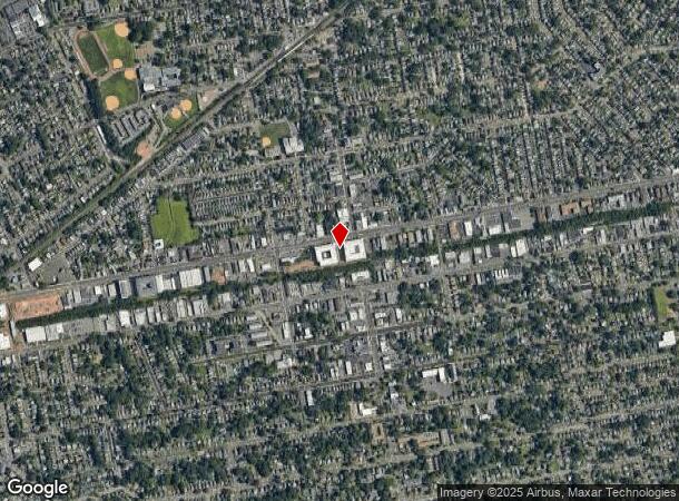
DEMOGRAPHICS near 10 W Westfield Ave W
1 Mile
3 Mile
5 Mile
2024 Total Population
30,384
226,421
520,090
2029 Population
29,823
222,359
509,103
Pop Growth 2024-2029
(1.85%)
(1.79%)
(2.11%)
Average Age
40
40
39
2024 Total Households
10,794
80,895
184,080
HH Growth 2024-2029
(1.98%)
(1.83%)
(2.16%)
Median Household Inc
$83,107
$80,492
$78,346
Avg Household Size
2.70
2.70
2.70
2024 Avg HH Vehicles
2.00
2.00
2.00
Median Home Value
$349,845
$400,746
$414,941
Median Year Built
1951
1954
1955
Nearby Places
Map Layers
Map Styles
 Street
 Aerial
- Restaurants
- Banks
- Shops
- Fitness
- Groceries
PUBLIC TRANSPORTATION
COMMUTER RAIL
Roselle Park (Raritan Valley Line - NJ Transit Commuter Rail (NJ Transit))
DRIVE
WALK
Distance
Roselle Park (Raritan Valley Line - NJ Transit Commuter Rail (NJ Transit))
1 min
10 min
0.6 mi
Cranford (Raritan Valley Line - NJ Transit Commuter Rail (NJ Transit))
DRIVE
WALK
Distance
Cranford (Raritan Valley Line - NJ Transit Commuter Rail (NJ Transit))
7 min
2.4 mi
AIRPORT
Newark Liberty International
DRIVE
WALK
Distance
Newark Liberty International
16 min
10.4 mi
LaGuardia
DRIVE
WALK
Distance
LaGuardia
50 min
29.6 mi
John F Kennedy International
DRIVE
WALK
Distance
John F Kennedy International
51 min
34.2 mi
Freight Ports
New York Container Terminal
DRIVE
WALK
Distance
New York Container Terminal
13 min
6.9 mi
SALE & LEASE HISTORY
LISTING DATE
SALE/LEASE

Sep 25, 2016
For Lease
Feb 15, 2018
For Sale
Nearby Properties
Address
Land Use
TOTAL SIZE
Lot Size
Zoning
Address
Land Use
TOTAL SIZE
Lot Size
Zoning
11.36 AC
Address
Land Use
TOTAL SIZE
Lot Size
Zoning
Address
Land Use
TOTAL SIZE
Lot Size
Zoning
Address
Land Use
TOTAL SIZE
Lot Size
Zoning
5.89 AC
Address
Land Use
TOTAL SIZE
Lot Size
Zoning
149.68 AC
Address
Land Use
TOTAL SIZE
Lot Size
Zoning
107.41 AC
Address
Land Use
TOTAL SIZE
Lot Size
Zoning
Address
Land Use
TOTAL SIZE
Lot Size
Zoning
2.21 AC
Address
Land Use
TOTAL SIZE
Lot Size
Zoning
12.46 AC
Address
Land Use
TOTAL SIZE
Lot Size
Zoning
0.83 AC
Address
Land Use
TOTAL SIZE
Lot Size
Zoning
90.28 AC
Address
Land Use
TOTAL SIZE
Lot Size
Zoning
1.01 AC
Address
Land Use
TOTAL SIZE
Lot Size
Zoning
21.25 AC
Address
Land Use
TOTAL SIZE
Lot Size
Zoning
8.43 AC
Address
Land Use
TOTAL SIZE
Lot Size
Zoning
2.22 AC
Address
Land Use
TOTAL SIZE
Lot Size
Zoning
29.03 AC
IL
Address
Land Use
TOTAL SIZE
Lot Size
Zoning
1 SF
117.50 AC
Address
Land Use
TOTAL SIZE
Lot Size
Zoning
151.20 AC
O
Address
Land Use
TOTAL SIZE
Lot Size
Zoning
0.82 AC
Address
Land Use
TOTAL SIZE
Lot Size
Zoning
0.79 AC
Address
Land Use
TOTAL SIZE
Lot Size
Zoning
2.47 AC
Address
Land Use
TOTAL SIZE
Lot Size
Zoning
Address
Land Use
TOTAL SIZE
Lot Size
Zoning
5.48 AC
Address
Land Use
TOTAL SIZE
Lot Size
Zoning
2.29 AC
Address
Land Use
TOTAL SIZE
Lot Size
Zoning
5.73 AC
Address
Land Use
TOTAL SIZE
Lot Size
Zoning
7.51 AC
Address
Land Use
TOTAL SIZE
Lot Size
Zoning
Address
Land Use
TOTAL SIZE
Lot Size
Zoning
2.45 AC
Address
Land Use
TOTAL SIZE
Lot Size
Zoning
34.49 AC
Address
Land Use
TOTAL SIZE
Lot Size
Zoning
2.50 AC
The World's #1 Commercial Real Estate Marketplace
Connect with us
© 2026 CoStar Group
The information above has been obtained from sources believed reliable. While we do not doubt its accuracy we have not verified it and make no guarantee, warranty or representation about it. It is your responsibility to independently confirm its accuracy and completeness. Any projections, opinions, assumptions, or estimates used are for example only and do not represent the current or future performance of the property. The value of this transaction to you depends on tax and other factors which should be evaluated by your tax, financial, and legal advisors. You and your advisors should conduct a careful, independent investigation of the property to determine to your satisfaction the suitability of the property for your needs.