Property Record
10 Watson Rd, Barnstead, NH 03218
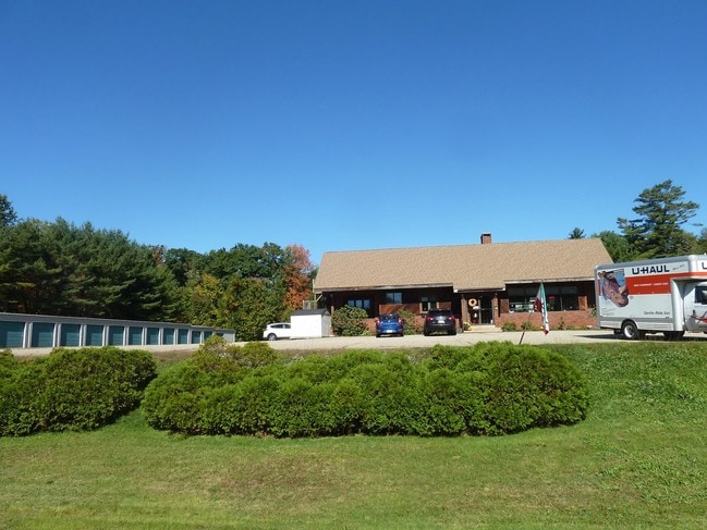

This Property Is For Sale
Property Detail
10 Watson Rd
BRND-000002-000000-000065-000001
Belknap
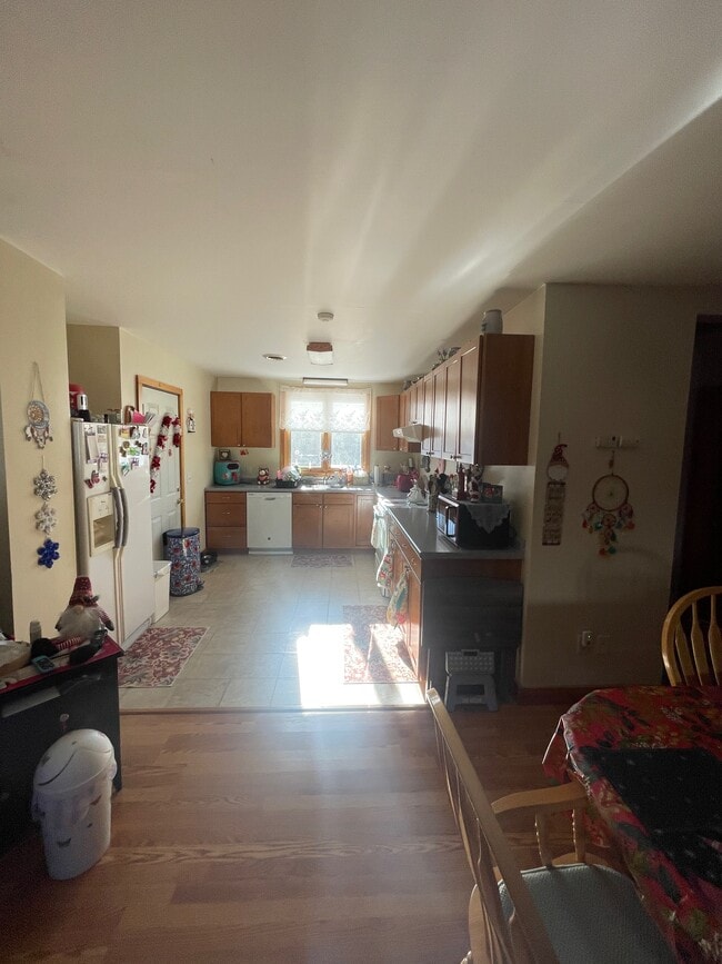
Commercialbuilding
New Hampshire
301 CO
65
2025
1.75 AC
2025
Concord/New Hampshire North Area
965700
Other Market Areas
3,247 SF
Laconia, NH
NEARBY LISTINGS FOR SALE OR LEASE
DEMOGRAPHICS near 10 Watson Rd
1 mile
3 mile
5 mile
2025 Total Population
487
3,283
9,850
2030 Population
491
3,344
10,006
Pop Growth 2025-2030
+ 0.82%
+ 1.86%
+ 1.58%
Average Age
45
43
42
2025 Total Households
189
1,287
3,877
HH Growth 2025-2030
+ 1.06%
+ 1.79%
+ 1.47%
Median Household Inc
$98,570
$92,891
$93,062
Avg Household Size
2.50
2.50
2.50
2025 Avg HH Vehicles
2.00
2.00
2.00
Median Home Value
$369,317
$347,510
$347,542
Median Year Built
1980
1978
1979
Nearby Places
Map Layers
Map Styles
 Street
 Aerial
Transit
 Traffic
 Biking
Places
Listings with unknown addresses are not visible on the map
- Restaurants
- Banks
- Shops
- Fitness
- Groceries
PUBLIC TRANSPORTATION
AIRPORT
Portsmouth International at Pease
Drive
Walk
Distance
Portsmouth International at Pease
61 min
34.4 mi
Manchester Boston Regional
Drive
Walk
Distance
Manchester Boston Regional
64 min
37.2 mi
Freight Ports
Portland, ME
Drive
Walk
Distance
Portland, ME
106 min
69.4 mi
Nearby Properties
Address
Land Use
TOTAL SIZE
Lot Size
Zoning
Address
Land Use
TOTAL SIZE
Lot Size
Zoning
17 AC
SUBURB
Address
Land Use
TOTAL SIZE
Lot Size
Zoning
83,390 SF
21.44 AC
101 RE
Address
Land Use
TOTAL SIZE
Lot Size
Zoning
101 RE
Address
Land Use
TOTAL SIZE
Lot Size
Zoning
6.64 AC
LIGHT
Address
Land Use
TOTAL SIZE
Lot Size
Zoning
109.85 AC
101 RE
Address
Land Use
TOTAL SIZE
Lot Size
Zoning
864 SF
16.50 AC
205 L
Address
Land Use
TOTAL SIZE
Lot Size
Zoning
10.68 AC
LIGHT
Address
Land Use
TOTAL SIZE
Lot Size
Zoning
82,400 SF
11.20 AC
LIGHT
Address
Land Use
TOTAL SIZE
Lot Size
Zoning
5.21 AC
URBAN
Address
Land Use
TOTAL SIZE
Lot Size
Zoning
28,047 SF
1.07 AC
LIGHT
Address
Land Use
TOTAL SIZE
Lot Size
Zoning
8.68 AC
LIGHT
Address
Land Use
TOTAL SIZE
Lot Size
Zoning
Address
Land Use
TOTAL SIZE
Lot Size
Zoning
Address
Land Use
TOTAL SIZE
Lot Size
Zoning
9,422 SF
1.75 AC
301 CO
Address
Land Use
TOTAL SIZE
Lot Size
Zoning
11,084 SF
1.36 AC
LIGHT
Address
Land Use
TOTAL SIZE
Lot Size
Zoning
Address
Land Use
TOTAL SIZE
Lot Size
Zoning
5.54 AC
301 CO
Address
Land Use
TOTAL SIZE
Lot Size
Zoning
16,050 SF
8.10 AC
LIGHT
Address
Land Use
TOTAL SIZE
Lot Size
Zoning
95 AC
RURAL
Address
Land Use
TOTAL SIZE
Lot Size
Zoning
2,437 SF
2.20 AC
204 U
Address
Land Use
TOTAL SIZE
Lot Size
Zoning
19,364 SF
13.95 AC
LIGHT
Address
Land Use
TOTAL SIZE
Lot Size
Zoning
22,506 SF
0.44 AC
LIGHT
Address
Land Use
TOTAL SIZE
Lot Size
Zoning
5.32 AC
205 L
Address
Land Use
TOTAL SIZE
Lot Size
Zoning
10,486 SF
2.50 AC
RURAL
Address
Land Use
TOTAL SIZE
Lot Size
Zoning
5,118 SF
0.60 AC
LIGHT
Address
Land Use
TOTAL SIZE
Lot Size
Zoning
3,821 SF
32 AC
202 LI
Address
Land Use
TOTAL SIZE
Lot Size
Zoning
5,082 SF
4.27 AC
400 VI
Address
Land Use
TOTAL SIZE
Lot Size
Zoning
5,476 SF
0.13 AC
COMMER
Address
Land Use
TOTAL SIZE
Lot Size
Zoning
1.16 AC
301 CO
Address
Land Use
TOTAL SIZE
Lot Size
Zoning
8,085 SF
0.85 AC
LIGHT
The World's #1 Commercial Real Estate Marketplace
Connect with us
© 2026 CoStar Group
The information above has been obtained from sources believed reliable. While we do not doubt its accuracy we have not verified it and make no guarantee, warranty or representation about it. It is your responsibility to independently confirm its accuracy and completeness. Any projections, opinions, assumptions, or estimates used are for example only and do not represent the current or future performance of the property. The value of this transaction to you depends on tax and other factors which should be evaluated by your tax, financial, and legal advisors. You and your advisors should conduct a careful, independent investigation of the property to determine to your satisfaction the suitability of the property for your needs.