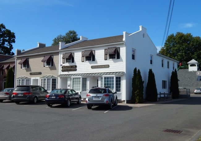
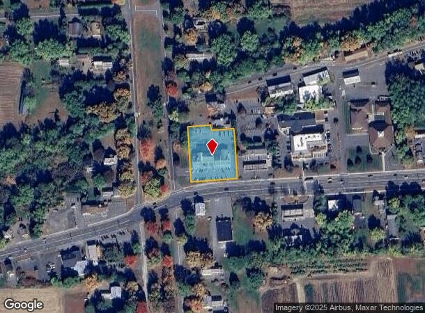
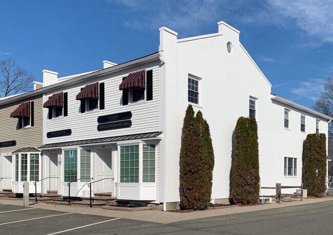
Property Record
100 Russell St, Hadley, MA 01035
Current Lease Availabilities
NEARBY LISTINGS FOR SALE OR LEASE
Property Detail
100 Russell St
HADL-000004H-000059B
Elmwood
Officecondo
Hampshire
2025
Massachusetts
2025
Hampshire County
821400
Hartford
1,820 SF
Springfield, MA
DEMOGRAPHICS near 100 Russell St
1 Mile
3 Mile
5 Mile
2024 Total Population
1,159
18,259
56,358
2029 Population
891
14,647
47,720
Pop Growth 2024-2029
(23.12%)
(19.78%)
(15.33%)
Average Age
43
41
36
2024 Total Households
496
7,826
17,663
HH Growth 2024-2029
(23.19%)
(22.13%)
(21.94%)
Median Household Inc
$99,332
$78,615
$76,283
Avg Household Size
2.30
2.00
2.10
2024 Avg HH Vehicles
2.00
2.00
2.00
Median Home Value
$415,625
$394,626
$386,559
Median Year Built
1950
1953
1958
Nearby Places
- Restaurants
- Banks
- Shops
- Fitness
- Groceries
PUBLIC TRANSPORTATION
COMMUTER RAIL
Northampton (Valley Flyer - Amtrak, Vermonter - Amtrak)
DRIVE
WALK
Distance
Northampton (Valley Flyer - Amtrak, Vermonter - Amtrak)
8 min
2.9 mi
AIRPORT
Bradley International
DRIVE
WALK
Distance
Bradley International
56 min
32.3 mi
Freight Ports
Albany, NY Port
DRIVE
WALK
Distance
Albany, NY Port
116 min
94.3 mi
Nearby Properties
Address
Land Use
TOTAL SIZE
Lot Size
Zoning
Address
Land Use
TOTAL SIZE
Lot Size
Zoning
185,998 SF
32.09 AC
I
Address
Land Use
TOTAL SIZE
Lot Size
Zoning
9,424 SF
17.24 AC
AR
Address
Land Use
TOTAL SIZE
Lot Size
Zoning
18.04 AC
URB
Address
Land Use
TOTAL SIZE
Lot Size
Zoning
5.65 AC
URC
Address
Land Use
TOTAL SIZE
Lot Size
Zoning
5.84 AC
URC
Address
Land Use
TOTAL SIZE
Lot Size
Zoning
17.40 AC
SC
Address
Land Use
TOTAL SIZE
Lot Size
Zoning
84,480 SF
6.15 AC
I
Address
Land Use
TOTAL SIZE
Lot Size
Zoning
373,881 SF
46.52 AC
B
Address
Land Use
TOTAL SIZE
Lot Size
Zoning
61,650 SF
12.37 AC
B
Address
Land Use
TOTAL SIZE
Lot Size
Zoning
12.23 AC
HB
Address
Land Use
TOTAL SIZE
Lot Size
Zoning
7.58 AC
HB
Address
Land Use
TOTAL SIZE
Lot Size
Zoning
94,035 SF
4.20 AC
I
Address
Land Use
TOTAL SIZE
Lot Size
Zoning
10.37 AC
HB
Address
Land Use
TOTAL SIZE
Lot Size
Zoning
0.12 AC
URC
Address
Land Use
TOTAL SIZE
Lot Size
Zoning
55,964 SF
0.36 AC
URC
Address
Land Use
TOTAL SIZE
Lot Size
Zoning
2.69 AC
URC
Address
Land Use
TOTAL SIZE
Lot Size
Zoning
21.77 AC
GI
Address
Land Use
TOTAL SIZE
Lot Size
Zoning
127,994 SF
8.46 AC
B
Address
Land Use
TOTAL SIZE
Lot Size
Zoning
139,648 SF
13.09 AC
B
Address
Land Use
TOTAL SIZE
Lot Size
Zoning
359,938 SF
38.84 AC
I
Address
Land Use
TOTAL SIZE
Lot Size
Zoning
1.77 AC
URC
Address
Land Use
TOTAL SIZE
Lot Size
Zoning
88,144 SF
0.35 AC
CB
Address
Land Use
TOTAL SIZE
Lot Size
Zoning
1.47 AC
URC
Address
Land Use
TOTAL SIZE
Lot Size
Zoning
115,090 SF
14.09 AC
B
Address
Land Use
TOTAL SIZE
Lot Size
Zoning
85,816 SF
6.80 AC
URB
Address
Land Use
TOTAL SIZE
Lot Size
Zoning
98,482 SF
1.03 AC
CB
Address
Land Use
TOTAL SIZE
Lot Size
Zoning
59,471 SF
35 AC
LGT
Address
Land Use
TOTAL SIZE
Lot Size
Zoning
2.51 AC
URC
Address
Land Use
TOTAL SIZE
Lot Size
Zoning
4.19 AC
HB
Address
Land Use
TOTAL SIZE
Lot Size
Zoning
13,608 SF
11 AC
RR
The World's #1 Commercial Real Estate Marketplace
Connect with us
© 2025 CoStar Group
The information above has been obtained from sources believed reliable. While we do not doubt its accuracy we have not verified it and make no guarantee, warranty or representation about it. It is your responsibility to independently confirm its accuracy and completeness. Any projections, opinions, assumptions, or estimates used are for example only and do not represent the current or future performance of the property. The value of this transaction to you depends on tax and other factors which should be evaluated by your tax, financial, and legal advisors. You and your advisors should conduct a careful, independent investigation of the property to determine to your satisfaction the suitability of the property for your needs.