Property Record
100 Abruzzi Dr, Chester, MD 21619
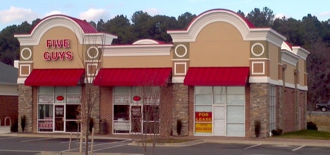

Property Detail
100 Abruzzi Dr
04-090624
LOT 2A - 3.256 ACRE RTS 50/301 SHAMROCK ROAD 2BD LIMITED PART SUBDIV
Restaurantbuilding
Queen Annes
TC
Maryland
C and X Area of minimal flood hazard, usually depicted on FIRMs as above the 500-year flood level.
2a
2025
8.86 AC
2025
Queen Anne's County
811000
Baltimore
5,124 SF
Baltimore-Columbia-Towson, MD
NEARBY LISTINGS FOR SALE OR LEASE
DEMOGRAPHICS near 100 Abruzzi Dr
1 mile
3 mile
5 mile
2025 Total Population
2,099
12,751
20,513
2030 Population
2,255
13,591
21,854
Pop Growth 2025-2030
+ 7.43%
+ 6.59%
+ 6.54%
Average Age
45
44
43
2025 Total Households
907
5,206
8,141
HH Growth 2025-2030
+ 7.39%
+ 6.67%
+ 6.61%
Median Household Inc
$79,878
$110,015
$119,366
Avg Household Size
2.30
2.40
2.50
2025 Avg HH Vehicles
2.00
2.00
2.00
Median Home Value
$535,131
$482,477
$478,263
Median Year Built
1996
1994
1992
Nearby Places
Map Layers
Map Styles
 Street
 Aerial
Layers
 Traffic
 Biking
Places
Listings with unknown addresses are not visible on the map
- Restaurants
- Banks
- Shops
- Fitness
- Groceries
PUBLIC TRANSPORTATION
AIRPORT
Baltimore/Washington International Thurgood Marshall
Drive
Walk
Distance
Baltimore/Washington International Thurgood Marshall
54 min
33.7 mi
Freight Ports
Port of Baltimore
Drive
Walk
Distance
Port of Baltimore
60 min
35.5 mi
Nearby Properties
Address
Land Use
TOTAL SIZE
Lot Size
Zoning
Address
Land Use
TOTAL SIZE
Lot Size
Zoning
189,500 SF
45.83 AC
SE
Address
Land Use
TOTAL SIZE
Lot Size
Zoning
47,432 SF
35.88 AC
SIBE
Address
Land Use
TOTAL SIZE
Lot Size
Zoning
86,117 SF
1.67 AC
WVC
Address
Land Use
TOTAL SIZE
Lot Size
Zoning
47,388 SF
5.61 AC
TC
Address
Land Use
TOTAL SIZE
Lot Size
Zoning
74,465 SF
15.34 AC
SE
Address
Land Use
TOTAL SIZE
Lot Size
Zoning
53,028 SF
3.99 AC
Address
Land Use
TOTAL SIZE
Lot Size
Zoning
93,468 SF
9.53 AC
VC
Address
Land Use
TOTAL SIZE
Lot Size
Zoning
6,597 SF
19.53 AC
SE
Address
Land Use
TOTAL SIZE
Lot Size
Zoning
1,504 SF
42.74 AC
WVC
Address
Land Use
TOTAL SIZE
Lot Size
Zoning
45,151 SF
5.97 AC
TC
Address
Land Use
TOTAL SIZE
Lot Size
Zoning
40,500 SF
6.47 AC
WVC
Address
Land Use
TOTAL SIZE
Lot Size
Zoning
65,108 SF
2.72 AC
WVC
Address
Land Use
TOTAL SIZE
Lot Size
Zoning
95,510 SF
18.77 AC
UC
Address
Land Use
TOTAL SIZE
Lot Size
Zoning
1,484 SF
3.08 AC
TC
Address
Land Use
TOTAL SIZE
Lot Size
Zoning
33,214 SF
16 AC
SE
Address
Land Use
TOTAL SIZE
Lot Size
Zoning
5,678 SF
2.20 AC
UC
Address
Land Use
TOTAL SIZE
Lot Size
Zoning
113,414 SF
8.40 AC
SIBE
Address
Land Use
TOTAL SIZE
Lot Size
Zoning
16,200 SF
0.62 AC
SIBE
Address
Land Use
TOTAL SIZE
Lot Size
Zoning
8,976 SF
225.79 AC
CS
Address
Land Use
TOTAL SIZE
Lot Size
Zoning
1,740 SF
100 AC
CS
Address
Land Use
TOTAL SIZE
Lot Size
Zoning
6,000 SF
7.37 AC
CMPD
Address
Land Use
TOTAL SIZE
Lot Size
Zoning
9,470 SF
15.93 AC
SE
Address
Land Use
TOTAL SIZE
Lot Size
Zoning
37,800 SF
6.60 AC
WVC
Address
Land Use
TOTAL SIZE
Lot Size
Zoning
51,660 SF
2.15 AC
TC
Address
Land Use
TOTAL SIZE
Lot Size
Zoning
12,036 SF
1.54 AC
TC
Address
Land Use
TOTAL SIZE
Lot Size
Zoning
14,473 SF
1.73 AC
TC
Address
Land Use
TOTAL SIZE
Lot Size
Zoning
37,202 SF
3.23 AC
TC
Address
Land Use
TOTAL SIZE
Lot Size
Zoning
41,888 SF
4.41 AC
WVC
Address
Land Use
TOTAL SIZE
Lot Size
Zoning
8,040 SF
33.35 AC
SE
Address
Land Use
TOTAL SIZE
Lot Size
Zoning
1,488 SF
12.59 AC
WVC
The World's #1 Commercial Real Estate Marketplace
Connect with us
© 2026 CoStar Group
The information above has been obtained from sources believed reliable. While we do not doubt its accuracy we have not verified it and make no guarantee, warranty or representation about it. It is your responsibility to independently confirm its accuracy and completeness. Any projections, opinions, assumptions, or estimates used are for example only and do not represent the current or future performance of the property. The value of this transaction to you depends on tax and other factors which should be evaluated by your tax, financial, and legal advisors. You and your advisors should conduct a careful, independent investigation of the property to determine to your satisfaction the suitability of the property for your needs.