Property Record
100 Apache Dr, Byram, MS 39272
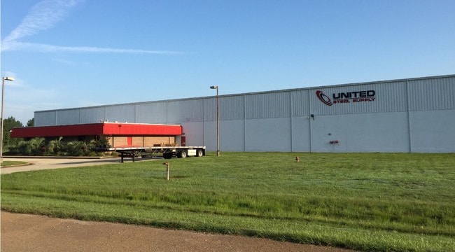


Property Detail
100 Apache Dr
Jackson, MS
400 FT N & S X 700 FT E & W BEG APPROX 485.31 FT W SE COR SW 1/4 NW 1/4 SEC 25 T4 R1W CONT 6.428 AC PT LOT 4
4851-0423-001
Hinds
Industrialgeneral
Mississippi
AE The base floodplain where base flood elevations are provided. AE Zones are now used on new format FIRMs instead of A1-A30 Zones.
4
2024
6.40 AC
2025
Outlying Hinds County
011103
Jackson
63,000 SF
NEARBY LISTINGS FOR SALE OR LEASE
DEMOGRAPHICS near 100 Apache Dr
1 mile
3 mile
5 mile
2025 Total Population
22
8,587
20,222
2030 Population
21
8,090
19,214
Pop Growth 2025-2030
(4.55%)
(5.79%)
(4.98%)
Average Age
41
38
40
2025 Total Households
10
3,432
7,942
HH Growth 2025-2030
(10.00%)
(6.15%)
(5.25%)
Median Household Inc
$67,500
$70,091
$76,446
Avg Household Size
2.00
2.40
2.50
2025 Avg HH Vehicles
2.00
2.00
2.00
Median Home Value
$150,000
$176,175
$195,378
Median Year Built
1995
1997
1994
Nearby Places
Map Layers
Map Styles
 Street
 Aerial
Layers
 Traffic
 Biking
Places
Listings with unknown addresses are not visible on the map
- Restaurants
- Banks
- Shops
- Fitness
- Groceries
PUBLIC TRANSPORTATION
AIRPORT
Jackson-Medgar Wiley Evers International
Drive
Walk
Distance
Jackson-Medgar Wiley Evers International
32 min
20.5 mi
SALE & LEASE HISTORY
LISTING DATE
SALE/LEASE

Jan 08, 2018
For Lease
Jan 08, 2018
For Sale
Nearby Properties
Address
Land Use
TOTAL SIZE
Lot Size
Zoning
Address
Land Use
TOTAL SIZE
Lot Size
Zoning
110,876 SF
8.80 AC
Address
Land Use
TOTAL SIZE
Lot Size
Zoning
489,330 SF
27.90 AC
Address
Land Use
TOTAL SIZE
Lot Size
Zoning
257,600 SF
25.90 AC
Address
Land Use
TOTAL SIZE
Lot Size
Zoning
288.50 AC
Address
Land Use
TOTAL SIZE
Lot Size
Zoning
232,136 SF
16.06 AC
Address
Land Use
TOTAL SIZE
Lot Size
Zoning
190,029 SF
24.47 AC
Address
Land Use
TOTAL SIZE
Lot Size
Zoning
31,980 SF
9.10 AC
Address
Land Use
TOTAL SIZE
Lot Size
Zoning
229,741 SF
17.28 AC
Address
Land Use
TOTAL SIZE
Lot Size
Zoning
Address
Land Use
TOTAL SIZE
Lot Size
Zoning
34,900 SF
6.60 AC
Address
Land Use
TOTAL SIZE
Lot Size
Zoning
136,190 SF
10.06 AC
Address
Land Use
TOTAL SIZE
Lot Size
Zoning
351,384 SF
16.69 AC
Address
Land Use
TOTAL SIZE
Lot Size
Zoning
45.60 AC
Address
Land Use
TOTAL SIZE
Lot Size
Zoning
134,417 SF
10 AC
Address
Land Use
TOTAL SIZE
Lot Size
Zoning
18,200 SF
1.66 AC
Address
Land Use
TOTAL SIZE
Lot Size
Zoning
25,880 SF
5.47 AC
Address
Land Use
TOTAL SIZE
Lot Size
Zoning
230,745 SF
18.40 AC
Address
Land Use
TOTAL SIZE
Lot Size
Zoning
Address
Land Use
TOTAL SIZE
Lot Size
Zoning
Address
Land Use
TOTAL SIZE
Lot Size
Zoning
173,863 SF
30.67 AC
Address
Land Use
TOTAL SIZE
Lot Size
Zoning
Address
Land Use
TOTAL SIZE
Lot Size
Zoning
222,160 SF
37.66 AC
Address
Land Use
TOTAL SIZE
Lot Size
Zoning
94,621 SF
23.37 AC
Address
Land Use
TOTAL SIZE
Lot Size
Zoning
29.50 AC
Address
Land Use
TOTAL SIZE
Lot Size
Zoning
68,315 SF
6.36 AC
Address
Land Use
TOTAL SIZE
Lot Size
Zoning
Address
Land Use
TOTAL SIZE
Lot Size
Zoning
12,500 SF
3.40 AC
Address
Land Use
TOTAL SIZE
Lot Size
Zoning
11,260 SF
1.86 AC
Address
Land Use
TOTAL SIZE
Lot Size
Zoning
37,542 SF
3.50 AC
Address
Land Use
TOTAL SIZE
Lot Size
Zoning
129,400 SF
11.80 AC
The World's #1 Commercial Real Estate Marketplace
Connect with us
© 2026 CoStar Group
The information above has been obtained from sources believed reliable. While we do not doubt its accuracy we have not verified it and make no guarantee, warranty or representation about it. It is your responsibility to independently confirm its accuracy and completeness. Any projections, opinions, assumptions, or estimates used are for example only and do not represent the current or future performance of the property. The value of this transaction to you depends on tax and other factors which should be evaluated by your tax, financial, and legal advisors. You and your advisors should conduct a careful, independent investigation of the property to determine to your satisfaction the suitability of the property for your needs.