Property Record
Myers Baker Rd, London, KY 40741

NEARBY LISTINGS FOR SALE OR LEASE
Property Detail
Myers Baker Rd
London, KY
Bacho Development
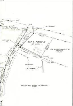
062-00-00-083.00
BACHO DEVELOPMENT PHASE II #8
Commercialnec
Laurel
X
Kentucky
21125C0230D
5.74 AC
2025
Corbin/London Area
2025
Other Market Areas
970500
DEMOGRAPHICS near Myers Baker Rd
1 Mile
3 Mile
5 Mile
2024 Total Population
2,960
15,964
28,443
2029 Population
3,023
16,238
28,957
Pop Growth 2024-2029
+ 2.13%
+ 1.72%
+ 1.81%
Average Age
41
41
40
2024 Total Households
1,228
6,533
11,133
HH Growth 2024-2029
+ 2.04%
+ 1.68%
+ 1.77%
Median Household Inc
$47,500
$49,753
$49,795
Avg Household Size
2.20
2.30
2.40
2024 Avg HH Vehicles
2.00
2.00
2.00
Median Home Value
$159,968
$166,595
$155,940
Median Year Built
1978
1986
1989
Nearby Places
- Restaurants
- Banks
- Shops
- Fitness
- Groceries
SALE & LEASE HISTORY
LISTING DATE
SALE/LEASE

Mar 19, 2018
For Sale
Nearby Properties
Address
Land Use
TOTAL SIZE
Lot Size
Zoning
Address
Land Use
TOTAL SIZE
Lot Size
Zoning
2,016 SF
55.45 AC
Address
Land Use
TOTAL SIZE
Lot Size
Zoning
0.50 AC
Address
Land Use
TOTAL SIZE
Lot Size
Zoning
59.21 AC
Address
Land Use
TOTAL SIZE
Lot Size
Zoning
29.91 AC
Address
Land Use
TOTAL SIZE
Lot Size
Zoning
13,744 SF
0.97 AC
Address
Land Use
TOTAL SIZE
Lot Size
Zoning
17.62 AC
Z02
Address
Land Use
TOTAL SIZE
Lot Size
Zoning
21.18 AC
Z02
Address
Land Use
TOTAL SIZE
Lot Size
Zoning
11.08 AC
Address
Land Use
TOTAL SIZE
Lot Size
Zoning
74,870 SF
0.80 AC
Z02
Address
Land Use
TOTAL SIZE
Lot Size
Zoning
21.84 AC
Address
Land Use
TOTAL SIZE
Lot Size
Zoning
19.50 AC
Address
Land Use
TOTAL SIZE
Lot Size
Zoning
20 AC
Z02
Address
Land Use
TOTAL SIZE
Lot Size
Zoning
19.60 AC
Address
Land Use
TOTAL SIZE
Lot Size
Zoning
3.03 AC
Address
Land Use
TOTAL SIZE
Lot Size
Zoning
32,832 SF
30.33 AC
Address
Land Use
TOTAL SIZE
Lot Size
Zoning
12.89 AC
Address
Land Use
TOTAL SIZE
Lot Size
Zoning
49,248 SF
1.93 AC
Address
Land Use
TOTAL SIZE
Lot Size
Zoning
8.55 AC
Address
Land Use
TOTAL SIZE
Lot Size
Zoning
235.61 AC
Address
Land Use
TOTAL SIZE
Lot Size
Zoning
19 AC
Address
Land Use
TOTAL SIZE
Lot Size
Zoning
19.03 AC
Address
Land Use
TOTAL SIZE
Lot Size
Zoning
377,771 SF
13.83 AC
Address
Land Use
TOTAL SIZE
Lot Size
Zoning
11.42 AC
Address
Land Use
TOTAL SIZE
Lot Size
Zoning
9,750 SF
6.92 AC
Z02
Address
Land Use
TOTAL SIZE
Lot Size
Zoning
0.14 AC
Address
Land Use
TOTAL SIZE
Lot Size
Zoning
0.65 AC
Address
Land Use
TOTAL SIZE
Lot Size
Zoning
50.55 AC
Address
Land Use
TOTAL SIZE
Lot Size
Zoning
0.88 AC
Z03
Address
Land Use
TOTAL SIZE
Lot Size
Zoning
0.53 AC
COMMERCIAL
Address
Land Use
TOTAL SIZE
Lot Size
Zoning
The World's #1 Commercial Real Estate Marketplace
Connect with us
© 2025 CoStar Group
The information above has been obtained from sources believed reliable. While we do not doubt its accuracy we have not verified it and make no guarantee, warranty or representation about it. It is your responsibility to independently confirm its accuracy and completeness. Any projections, opinions, assumptions, or estimates used are for example only and do not represent the current or future performance of the property. The value of this transaction to you depends on tax and other factors which should be evaluated by your tax, financial, and legal advisors. You and your advisors should conduct a careful, independent investigation of the property to determine to your satisfaction the suitability of the property for your needs.