Property Record
100 Batterson Rd, Providence, RI 02911
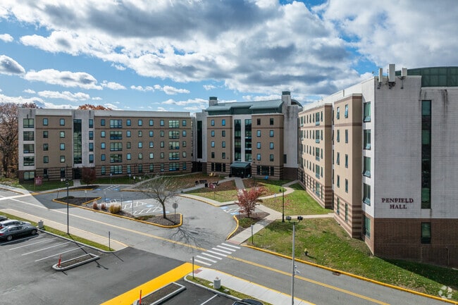

Property Detail
100 Batterson Rd
PROV-001270-000047-000000
PROVIDENCE
Stateproperty
Rhode Island
I-2
47
B and X Area of moderate flood hazard, usually the area between the limits of the 100-year and 500-year floods.
21.74 AC
0
Manton
2025
Providence
012000
Providence-Warwick, RI-MA
NEARBY LISTINGS FOR SALE OR LEASE
DEMOGRAPHICS near 100 Batterson Rd
1 mile
3 mile
5 mile
2025 Total Population
20,329
174,235
358,784
2030 Population
20,971
179,289
369,333
Pop Growth 2025-2030
+ 3.16%
+ 2.90%
+ 2.94%
Average Age
40
38
39
2025 Total Households
7,803
68,913
141,228
HH Growth 2025-2030
+ 3.22%
+ 3.12%
+ 3.15%
Median Household Inc
$81,128
$72,131
$73,054
Avg Household Size
2.40
2.40
2.40
2025 Avg HH Vehicles
2.00
1.00
2.00
Median Home Value
$330,108
$343,124
$370,119
Median Year Built
1957
1955
1951
Nearby Places
Map Layers
Map Styles
 Street
 Aerial
Layers
 Traffic
 Biking
Places
Listings with unknown addresses are not visible on the map
- Restaurants
- Banks
- Shops
- Fitness
- Groceries
PUBLIC TRANSPORTATION
COMMUTER RAIL
Providence (Providence/Stoughton Line - Massachusetts Bay Transportation Authority Commuter Rail (Purple Line))
Drive
Walk
Distance
Providence (Providence/Stoughton Line - Massachusetts Bay Transportation Authority Commuter Rail (Purple Line))
8 min
3.8 mi
Pawtucket/Central Falls (Foxboro Event Service - MBTA, Providence/Stoughton Line - MBTA)
Drive
Walk
Distance
Pawtucket/Central Falls (Foxboro Event Service - MBTA, Providence/Stoughton Line - MBTA)
11 min
6.0 mi
AIRPORT
Rhode Island Tf Green International
Drive
Walk
Distance
Rhode Island Tf Green International
23 min
12.1 mi
Freight Ports
Port of Davisville, RI
Drive
Walk
Distance
Port of Davisville, RI
38 min
24.5 mi
Nearby Properties
Address
Land Use
TOTAL SIZE
Lot Size
Zoning
Address
Land Use
TOTAL SIZE
Lot Size
Zoning
162,816 SF
16.52 AC
D-1-10
Address
Land Use
TOTAL SIZE
Lot Size
Zoning
8.93 AC
OS
Address
Land Use
TOTAL SIZE
Lot Size
Zoning
268,679 SF
8.64 AC
I-1-75
Address
Land Use
TOTAL SIZE
Lot Size
Zoning
12.90 AC
I-2
Address
Land Use
TOTAL SIZE
Lot Size
Zoning
20.05 AC
I-2
Address
Land Use
TOTAL SIZE
Lot Size
Zoning
254,488 SF
17.50 AC
IS
Address
Land Use
TOTAL SIZE
Lot Size
Zoning
314,273 SF
D-1-20
Address
Land Use
TOTAL SIZE
Lot Size
Zoning
28.92 AC
PS
Address
Land Use
TOTAL SIZE
Lot Size
Zoning
9.06 AC
PS
Address
Land Use
TOTAL SIZE
Lot Size
Zoning
3.44 AC
D-1-20
Address
Land Use
TOTAL SIZE
Lot Size
Zoning
123.25 AC
R40
Address
Land Use
TOTAL SIZE
Lot Size
Zoning
293,736 SF
1.24 AC
D-1-75
Address
Land Use
TOTAL SIZE
Lot Size
Zoning
91.15 AC
PUD
Address
Land Use
TOTAL SIZE
Lot Size
Zoning
Address
Land Use
TOTAL SIZE
Lot Size
Zoning
277,453 SF
1.83 AC
M-MU-9
Address
Land Use
TOTAL SIZE
Lot Size
Zoning
202,461 SF
1.64 AC
D-1-10
Address
Land Use
TOTAL SIZE
Lot Size
Zoning
270,505 SF
2.85 AC
D-1-75
Address
Land Use
TOTAL SIZE
Lot Size
Zoning
97,097 SF
0.99 AC
D-1-20
Address
Land Use
TOTAL SIZE
Lot Size
Zoning
301,035 SF
21.69 AC
15
Address
Land Use
TOTAL SIZE
Lot Size
Zoning
129,144 SF
3.60 AC
PS
Address
Land Use
TOTAL SIZE
Lot Size
Zoning
164,581 SF
5.73 AC
D-1-30
Address
Land Use
TOTAL SIZE
Lot Size
Zoning
548,944 SF
D-1-30
Address
Land Use
TOTAL SIZE
Lot Size
Zoning
1,792 SF
28.46 AC
Address
Land Use
TOTAL SIZE
Lot Size
Zoning
160,487 SF
0.84 AC
D-1-12
Address
Land Use
TOTAL SIZE
Lot Size
Zoning
159,028 SF
12.09 AC
RG
Address
Land Use
TOTAL SIZE
Lot Size
Zoning
161,714 SF
1.48 AC
M-MU-9
Address
Land Use
TOTAL SIZE
Lot Size
Zoning
136,906 SF
4.96 AC
PS
Address
Land Use
TOTAL SIZE
Lot Size
Zoning
96,639 SF
2.79 AC
C-2
Address
Land Use
TOTAL SIZE
Lot Size
Zoning
118,237 SF
2.90 AC
PS
Address
Land Use
TOTAL SIZE
Lot Size
Zoning
333,161 SF
25.85 AC
B1
The World's #1 Commercial Real Estate Marketplace
Connect with us
© 2026 CoStar Group
The information above has been obtained from sources believed reliable. While we do not doubt its accuracy we have not verified it and make no guarantee, warranty or representation about it. It is your responsibility to independently confirm its accuracy and completeness. Any projections, opinions, assumptions, or estimates used are for example only and do not represent the current or future performance of the property. The value of this transaction to you depends on tax and other factors which should be evaluated by your tax, financial, and legal advisors. You and your advisors should conduct a careful, independent investigation of the property to determine to your satisfaction the suitability of the property for your needs.