Property Record
100 Boeing Way, Titusville, FL 32780


NEARBY LISTINGS FOR SALE OR LEASE
Property Detail
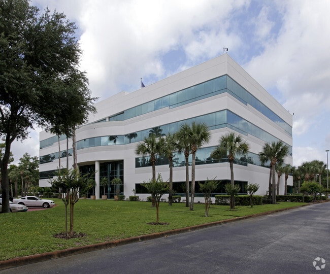
100 Boeing Way
23-35-01-25-0000H.0-0000.00
Vectorspace
Officebuilding
VECTORSPACE TRACT H
X
Brevard
12009C0220H
Florida
2024
15.08 AC
2025
Brevard County
061202
Orlando
83,661 SF
Palm Bay-Melbourne-Titusville, FL
DEMOGRAPHICS near 100 Boeing Way
1 Mile
3 Mile
5 Mile
2024 Total Population
236
15,438
55,143
2029 Population
259
16,746
60,070
Pop Growth 2024-2029
+ 9.75%
+ 8.47%
+ 8.93%
Average Age
49
42
44
2024 Total Households
107
6,380
23,210
HH Growth 2024-2029
+ 10.28%
+ 8.31%
+ 8.87%
Median Household Inc
$66,750
$70,108
$65,499
Avg Household Size
2.10
2.40
2.30
2024 Avg HH Vehicles
2.00
2.00
2.00
Median Home Value
$244,736
$222,162
$234,150
Median Year Built
1992
1987
1986
Nearby Places
Map Layers
Map Styles
 Street
 Aerial
- Restaurants
- Banks
- Shops
- Fitness
- Groceries
PUBLIC TRANSPORTATION
AIRPORT
Orlando International
DRIVE
WALK
Distance
Orlando International
48 min
37.8 mi
Melbourne Orlando International
DRIVE
WALK
Distance
Melbourne Orlando International
55 min
38.2 mi
Orlando Sanford International
DRIVE
WALK
Distance
Orlando Sanford International
70 min
46.6 mi
Freight Ports
Port Canaveral
DRIVE
WALK
Distance
Port Canaveral
27 min
17.6 mi
SALE & LEASE HISTORY
LISTING DATE
SALE/LEASE

Sep 25, 2016
For Lease
Sep 19, 2023
For Lease
Jun 03, 2024
For Lease
Nearby Properties
Address
Land Use
TOTAL SIZE
Lot Size
Zoning
Address
Land Use
TOTAL SIZE
Lot Size
Zoning
397,251 SF
21.32 AC
R2
Address
Land Use
TOTAL SIZE
Lot Size
Zoning
709,592 SF
201.35 AC
IU-1
Address
Land Use
TOTAL SIZE
Lot Size
Zoning
248,110 SF
12.77 AC
Address
Land Use
TOTAL SIZE
Lot Size
Zoning
97,548 SF
9.18 AC
Address
Land Use
TOTAL SIZE
Lot Size
Zoning
203,226 SF
511.04 AC
P
Address
Land Use
TOTAL SIZE
Lot Size
Zoning
242,724 SF
17.16 AC
R2
Address
Land Use
TOTAL SIZE
Lot Size
Zoning
152,096 SF
62.14 AC
PID
Address
Land Use
TOTAL SIZE
Lot Size
Zoning
105,543 SF
16.08 AC
RU19
Address
Land Use
TOTAL SIZE
Lot Size
Zoning
179,499 SF
67.33 AC
CC
Address
Land Use
TOTAL SIZE
Lot Size
Zoning
72,664 SF
6.44 AC
PID
Address
Land Use
TOTAL SIZE
Lot Size
Zoning
108,437 SF
15.15 AC
P
Address
Land Use
TOTAL SIZE
Lot Size
Zoning
141,221 SF
85 AC
IU
Address
Land Use
TOTAL SIZE
Lot Size
Zoning
3,000 SF
154.06 AC
R1B
Address
Land Use
TOTAL SIZE
Lot Size
Zoning
60,256 SF
8.44 AC
PID
Address
Land Use
TOTAL SIZE
Lot Size
Zoning
63,083 SF
18.93 AC
GU
Address
Land Use
TOTAL SIZE
Lot Size
Zoning
188,466 SF
10 AC
PID
Address
Land Use
TOTAL SIZE
Lot Size
Zoning
86,335 SF
8.71 AC
PID
Address
Land Use
TOTAL SIZE
Lot Size
Zoning
70,062 SF
10.01 AC
PID
Address
Land Use
TOTAL SIZE
Lot Size
Zoning
69,173 SF
5.24 AC
M1
Address
Land Use
TOTAL SIZE
Lot Size
Zoning
95,196 SF
9.32 AC
PID
Address
Land Use
TOTAL SIZE
Lot Size
Zoning
56,491 SF
16.45 AC
PID
Address
Land Use
TOTAL SIZE
Lot Size
Zoning
87,585 SF
5.86 AC
T
Address
Land Use
TOTAL SIZE
Lot Size
Zoning
205.05 AC
RMU
Address
Land Use
TOTAL SIZE
Lot Size
Zoning
59,557 SF
7.28 AC
BU1
Address
Land Use
TOTAL SIZE
Lot Size
Zoning
52,526 SF
5.15 AC
PID
Address
Land Use
TOTAL SIZE
Lot Size
Zoning
73,134 SF
9 AC
PIP
Address
Land Use
TOTAL SIZE
Lot Size
Zoning
44,147 SF
9.85 AC
CC
Address
Land Use
TOTAL SIZE
Lot Size
Zoning
43,381 SF
6.37 AC
P
Address
Land Use
TOTAL SIZE
Lot Size
Zoning
66,000 SF
5.15 AC
PID
The World's #1 Commercial Real Estate Marketplace
Connect with us
© 2026 CoStar Group
The information above has been obtained from sources believed reliable. While we do not doubt its accuracy we have not verified it and make no guarantee, warranty or representation about it. It is your responsibility to independently confirm its accuracy and completeness. Any projections, opinions, assumptions, or estimates used are for example only and do not represent the current or future performance of the property. The value of this transaction to you depends on tax and other factors which should be evaluated by your tax, financial, and legal advisors. You and your advisors should conduct a careful, independent investigation of the property to determine to your satisfaction the suitability of the property for your needs.