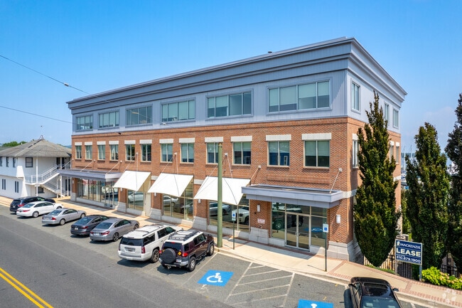
Property Record
100 Bourbon St, Havre De Grace, MD 21078


Current Lease Availabilities
Property Detail
100 Bourbon St
06-029973
11.32 ACRES 100 BOURBON STREET HAVRE DE GRACE PT 21/54
Warehouse
HARFORD
RB
Maryland
AE The base floodplain where base flood elevations are provided. AE Zones are now used on new format FIRMs instead of A1-A30 Zones.
11.32 AC
2025
Aberdeen
2025
Baltimore
306100
Baltimore-Columbia-Towson, MD
20,000 SF
NEARBY LISTINGS FOR SALE OR LEASE
DEMOGRAPHICS near 100 Bourbon St
1 mile
3 mile
5 mile
2025 Total Population
6,251
22,345
38,461
2030 Population
6,443
22,799
39,395
Pop Growth 2025-2030
+ 3.07%
+ 2.03%
+ 2.43%
Average Age
46
44
42
2025 Total Households
2,965
9,257
15,553
HH Growth 2025-2030
+ 3.14%
+ 2.21%
+ 2.53%
Median Household Inc
$60,541
$100,165
$90,112
Avg Household Size
2.00
2.40
2.40
2025 Avg HH Vehicles
2.00
2.00
2.00
Median Home Value
$299,999
$356,291
$333,224
Median Year Built
1961
1990
1985
Nearby Places
Map Layers
Map Styles
 Street
 Aerial
Layers
 Traffic
 Biking
Places
Listings with unknown addresses are not visible on the map
- Restaurants
- Banks
- Shops
- Fitness
- Groceries
PUBLIC TRANSPORTATION
COMMUTER RAIL
Drive
Walk
Distance
8 min
3.9 mi
Aberdeen (Penn Line - Maryland Area Regional Commuter Trains (The MARC))
Drive
Walk
Distance
Aberdeen (Penn Line - Maryland Area Regional Commuter Trains (The MARC))
11 min
5.2 mi
Freight Ports
Port Newark Container Terminal
Drive
Walk
Distance
Port Newark Container Terminal
26 min
14.5 mi
Nearby Properties
Address
Land Use
TOTAL SIZE
Lot Size
Zoning
Address
Land Use
TOTAL SIZE
Lot Size
Zoning
866,826 SF
267.48 AC
L2
Address
Land Use
TOTAL SIZE
Lot Size
Zoning
349.76 AC
OS
Address
Land Use
TOTAL SIZE
Lot Size
Zoning
2,589 SF
57.19 AC
R2
Address
Land Use
TOTAL SIZE
Lot Size
Zoning
623,017 SF
57.87 AC
GI
Address
Land Use
TOTAL SIZE
Lot Size
Zoning
29,700 SF
9.51 AC
C1
Address
Land Use
TOTAL SIZE
Lot Size
Zoning
149,622 SF
9.30 AC
GI
Address
Land Use
TOTAL SIZE
Lot Size
Zoning
100,444 SF
2.64 AC
RB
Address
Land Use
TOTAL SIZE
Lot Size
Zoning
113,412 SF
108 AC
R2
Address
Land Use
TOTAL SIZE
Lot Size
Zoning
103,470 SF
5.97 AC
R1
Address
Land Use
TOTAL SIZE
Lot Size
Zoning
426,275 SF
21.17 AC
GI
Address
Land Use
TOTAL SIZE
Lot Size
Zoning
28.03 AC
OS
Address
Land Use
TOTAL SIZE
Lot Size
Zoning
65,006 SF
29.63 AC
R1
Address
Land Use
TOTAL SIZE
Lot Size
Zoning
140,316 SF
36.71 AC
RM
Address
Land Use
TOTAL SIZE
Lot Size
Zoning
58,603 SF
13.26 AC
R1
Address
Land Use
TOTAL SIZE
Lot Size
Zoning
1,270 SF
61.42 AC
C
Address
Land Use
TOTAL SIZE
Lot Size
Zoning
213,790 SF
1.37 AC
RB
Address
Land Use
TOTAL SIZE
Lot Size
Zoning
184,116 SF
18.45 AC
GI
Address
Land Use
TOTAL SIZE
Lot Size
Zoning
78,944 SF
18.78 AC
GI
Address
Land Use
TOTAL SIZE
Lot Size
Zoning
4,800 SF
14.81 AC
C2
Address
Land Use
TOTAL SIZE
Lot Size
Zoning
18,944 SF
7.11 AC
GI
Address
Land Use
TOTAL SIZE
Lot Size
Zoning
40,584 SF
4.74 AC
C
Address
Land Use
TOTAL SIZE
Lot Size
Zoning
55,825 SF
10.25 AC
RB
Address
Land Use
TOTAL SIZE
Lot Size
Zoning
20,674 SF
0.54 AC
RO
Address
Land Use
TOTAL SIZE
Lot Size
Zoning
31,116 SF
9.37 AC
C
Address
Land Use
TOTAL SIZE
Lot Size
Zoning
7,586 SF
2.20 AC
RO
Address
Land Use
TOTAL SIZE
Lot Size
Zoning
39,126 SF
3.96 AC
C
Address
Land Use
TOTAL SIZE
Lot Size
Zoning
11,749 SF
10.62 AC
GI
Address
Land Use
TOTAL SIZE
Lot Size
Zoning
15,344 SF
4.96 AC
MUD
Address
Land Use
TOTAL SIZE
Lot Size
Zoning
118,242 SF
10.11 AC
GI
The World's #1 Commercial Real Estate Marketplace
Connect with us
© 2026 CoStar Group
The information above has been obtained from sources believed reliable. While we do not doubt its accuracy we have not verified it and make no guarantee, warranty or representation about it. It is your responsibility to independently confirm its accuracy and completeness. Any projections, opinions, assumptions, or estimates used are for example only and do not represent the current or future performance of the property. The value of this transaction to you depends on tax and other factors which should be evaluated by your tax, financial, and legal advisors. You and your advisors should conduct a careful, independent investigation of the property to determine to your satisfaction the suitability of the property for your needs.