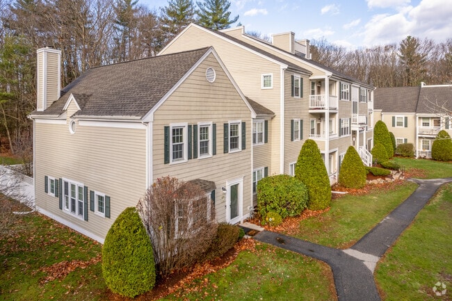
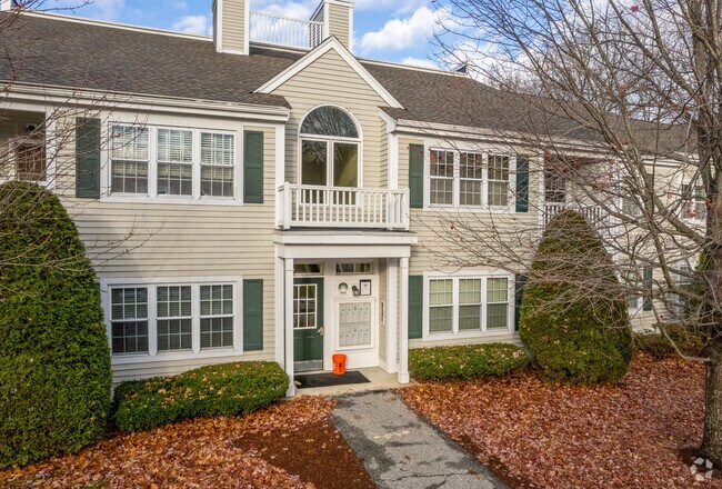
Property Record
100 Brookside Dr, Andover, MA 01810
NEARBY LISTINGS FOR SALE OR LEASE
-
-
View all Andover listings for sale on LoopNet.com
Property Detail
100 Brookside Dr
Taxexempt
Essex
X
Massachusetts
25009C0212G
72.82 AC
0
Andover
2024
Boston
254402
Boston-Cambridge-Newton, MA-NH
209,815 SF
ANDO-000127-000036
DEMOGRAPHICS near 100 Brookside Dr
1 Mile
3 Mile
5 Mile
2024 Total Population
4,349
105,111
197,839
2029 Population
4,365
102,981
195,217
Pop Growth 2024-2029
+ 0.37%
(2.03%)
(1.33%)
Average Age
38
37
39
2024 Total Households
1,564
36,287
69,202
HH Growth 2024-2029
+ 0.32%
(1.91%)
(1.28%)
Median Household Inc
$113,780
$60,642
$80,212
Avg Household Size
2.70
2.80
2.70
2024 Avg HH Vehicles
2.00
1.00
2.00
Median Home Value
$625,212
$441,265
$477,056
Median Year Built
1984
1956
1964
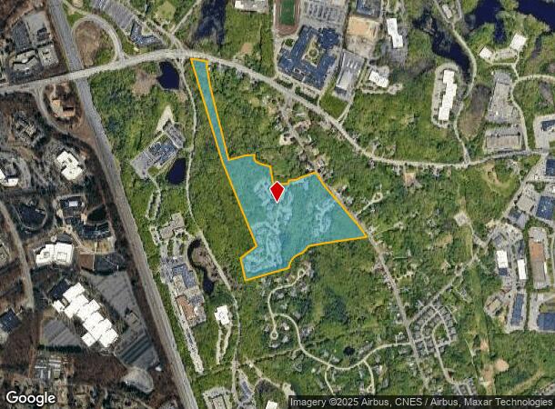
Nearby Places
Map Layers
Map Styles
 Street
 Aerial
- Restaurants
- Banks
- Shops
- Fitness
- Groceries
PUBLIC TRANSPORTATION
COMMUTER RAIL
Lawrence (Haverhill Line - Massachusetts Bay Transportation Authority Commuter Rail (Purple Line))
DRIVE
WALK
Distance
Lawrence (Haverhill Line - Massachusetts Bay Transportation Authority Commuter Rail (Purple Line))
6 min
3.3 mi
Andover (Haverhill Line - Massachusetts Bay Transportation Authority Commuter Rail (Purple Line))
DRIVE
WALK
Distance
Andover (Haverhill Line - Massachusetts Bay Transportation Authority Commuter Rail (Purple Line))
8 min
4.3 mi
AIRPORT
Manchester Boston Regional
DRIVE
WALK
Distance
Manchester Boston Regional
40 min
26.5 mi
General Edward Lawrence Logan International
DRIVE
WALK
Distance
General Edward Lawrence Logan International
39 min
28.6 mi
Freight Ports
Port of Boston
DRIVE
WALK
Distance
Port of Boston
40 min
28.3 mi
Nearby Properties
Address
Land Use
TOTAL SIZE
Lot Size
Zoning
Address
Land Use
TOTAL SIZE
Lot Size
Zoning
102 AC
IA
Address
Land Use
TOTAL SIZE
Lot Size
Zoning
52.02 AC
ID
Address
Land Use
TOTAL SIZE
Lot Size
Zoning
10.38 AC
Address
Land Use
TOTAL SIZE
Lot Size
Zoning
309.16 AC
ID2
Address
Land Use
TOTAL SIZE
Lot Size
Zoning
0.24 AC
SRC
Address
Land Use
TOTAL SIZE
Lot Size
Zoning
44.42 AC
LS
Address
Land Use
TOTAL SIZE
Lot Size
Zoning
335,482 SF
7.61 AC
Address
Land Use
TOTAL SIZE
Lot Size
Zoning
240,639 SF
2.65 AC
Address
Land Use
TOTAL SIZE
Lot Size
Zoning
144.01 AC
ID
Address
Land Use
TOTAL SIZE
Lot Size
Zoning
382,753 SF
25.86 AC
ID2
Address
Land Use
TOTAL SIZE
Lot Size
Zoning
90.21 AC
IA
Address
Land Use
TOTAL SIZE
Lot Size
Zoning
237,705 SF
33.49 AC
ID
Address
Land Use
TOTAL SIZE
Lot Size
Zoning
263.15 AC
SRB
Address
Land Use
TOTAL SIZE
Lot Size
Zoning
96.66 AC
ID
Address
Land Use
TOTAL SIZE
Lot Size
Zoning
170,116 SF
11.14 AC
Address
Land Use
TOTAL SIZE
Lot Size
Zoning
196,152 SF
20.20 AC
ID2
Address
Land Use
TOTAL SIZE
Lot Size
Zoning
332,500 SF
3.17 AC
Address
Land Use
TOTAL SIZE
Lot Size
Zoning
7.13 AC
Address
Land Use
TOTAL SIZE
Lot Size
Zoning
Address
Land Use
TOTAL SIZE
Lot Size
Zoning
208,600 SF
2.42 AC
Address
Land Use
TOTAL SIZE
Lot Size
Zoning
6.84 AC
Address
Land Use
TOTAL SIZE
Lot Size
Zoning
185,046 SF
3.06 AC
Address
Land Use
TOTAL SIZE
Lot Size
Zoning
2,552 SF
14.23 AC
Address
Land Use
TOTAL SIZE
Lot Size
Zoning
205,305 SF
1.94 AC
Address
Land Use
TOTAL SIZE
Lot Size
Zoning
124,750 SF
1.53 AC
Address
Land Use
TOTAL SIZE
Lot Size
Zoning
3,462 SF
8.14 AC
Address
Land Use
TOTAL SIZE
Lot Size
Zoning
150,000 SF
30.73 AC
LS
Address
Land Use
TOTAL SIZE
Lot Size
Zoning
130.08 AC
ID2
Address
Land Use
TOTAL SIZE
Lot Size
Zoning
2.52 AC
Address
Land Use
TOTAL SIZE
Lot Size
Zoning
105,949 SF
28.24 AC
ID2
The World's #1 Commercial Real Estate Marketplace
Connect with us
© 2026 CoStar Group
The information above has been obtained from sources believed reliable. While we do not doubt its accuracy we have not verified it and make no guarantee, warranty or representation about it. It is your responsibility to independently confirm its accuracy and completeness. Any projections, opinions, assumptions, or estimates used are for example only and do not represent the current or future performance of the property. The value of this transaction to you depends on tax and other factors which should be evaluated by your tax, financial, and legal advisors. You and your advisors should conduct a careful, independent investigation of the property to determine to your satisfaction the suitability of the property for your needs.