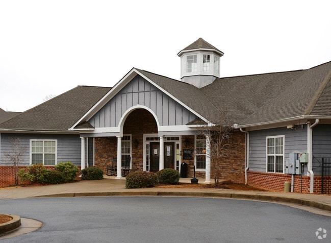
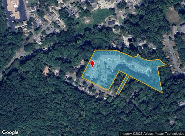
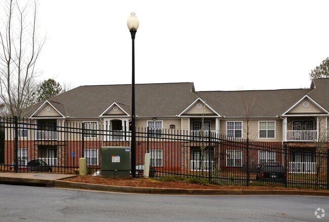
Property Record
100 Cherokee St, Canton, GA 30114
NEARBY LISTINGS FOR SALE OR LEASE
-
-
View all Canton listings for sale on LoopNet.com
Property Detail
100 Cherokee St
Atlanta-Sandy Springs-Roswell, GA
Cotton Tertile Mills
091N21-00000-004-000-0000
LL 195; 15TH D PB 64 PG 145
Apartment
Cherokee
X
Georgia
13057C0251E
6
2025
4.84 AC
2025
Cherokee County
090604
Atlanta
114,112 SF
DEMOGRAPHICS near 100 Cherokee St
1 Mile
3 Mile
5 Mile
2024 Total Population
7,284
33,471
79,323
2029 Population
8,288
38,411
90,942
Pop Growth 2024-2029
+ 13.78%
+ 14.76%
+ 14.65%
Average Age
35
38
39
2024 Total Households
2,304
11,841
27,934
HH Growth 2024-2029
+ 13.93%
+ 14.99%
+ 14.83%
Median Household Inc
$58,632
$71,890
$90,970
Avg Household Size
2.90
2.70
2.80
2024 Avg HH Vehicles
2.00
2.00
2.00
Median Home Value
$299,320
$346,447
$356,758
Median Year Built
1994
2000
2003
Nearby Places
- Restaurants
- Banks
- Shops
- Fitness
- Groceries
Nearby Properties
Address
Land Use
TOTAL SIZE
Lot Size
Zoning
Address
Land Use
TOTAL SIZE
Lot Size
Zoning
242,502 SF
41.65 AC
PD
Address
Land Use
TOTAL SIZE
Lot Size
Zoning
299,432 SF
50.55 AC
PD-MU
Address
Land Use
TOTAL SIZE
Lot Size
Zoning
244,451 SF
20.55 AC
PSC
Address
Land Use
TOTAL SIZE
Lot Size
Zoning
255,483 SF
138.30 AC
LI
Address
Land Use
TOTAL SIZE
Lot Size
Zoning
443,973 SF
70.02 AC
GC
Address
Land Use
TOTAL SIZE
Lot Size
Zoning
162,243 SF
29.44 AC
R-5
Address
Land Use
TOTAL SIZE
Lot Size
Zoning
260,621 SF
26.25 AC
RM-15
Address
Land Use
TOTAL SIZE
Lot Size
Zoning
369,520 SF
4.50 AC
ERC
Address
Land Use
TOTAL SIZE
Lot Size
Zoning
103,620 SF
19.78 AC
R-5
Address
Land Use
TOTAL SIZE
Lot Size
Zoning
313,906 SF
28.96 AC
PD
Address
Land Use
TOTAL SIZE
Lot Size
Zoning
155,341 SF
14.54 AC
R-5
Address
Land Use
TOTAL SIZE
Lot Size
Zoning
133,711 SF
22.23 AC
R-3
Address
Land Use
TOTAL SIZE
Lot Size
Zoning
80,795 SF
34.86 AC
PD-MIXED U
Address
Land Use
TOTAL SIZE
Lot Size
Zoning
239,139 SF
88 AC
PD-MU
Address
Land Use
TOTAL SIZE
Lot Size
Zoning
238,343 SF
38.77 AC
PSC
Address
Land Use
TOTAL SIZE
Lot Size
Zoning
204,826 SF
4.91 AC
PD
Address
Land Use
TOTAL SIZE
Lot Size
Zoning
241,482 SF
31.65 AC
PD
Address
Land Use
TOTAL SIZE
Lot Size
Zoning
270,248 SF
29.05 AC
PD-MU
Address
Land Use
TOTAL SIZE
Lot Size
Zoning
279,274 SF
23.46 AC
R-5
Address
Land Use
TOTAL SIZE
Lot Size
Zoning
489,988 SF
20.20 AC
LI
Address
Land Use
TOTAL SIZE
Lot Size
Zoning
24,586 SF
PD
Address
Land Use
TOTAL SIZE
Lot Size
Zoning
62,308 SF
7.57 AC
ERC
Address
Land Use
TOTAL SIZE
Lot Size
Zoning
79,672 SF
4.28 AC
PSC
Address
Land Use
TOTAL SIZE
Lot Size
Zoning
31,428 SF
10.21 AC
R-3
Address
Land Use
TOTAL SIZE
Lot Size
Zoning
149,713 SF
36.97 AC
R-80
Address
Land Use
TOTAL SIZE
Lot Size
Zoning
138,048 SF
21.40 AC
R-40
Address
Land Use
TOTAL SIZE
Lot Size
Zoning
111,630 SF
38.45 AC
LI
Address
Land Use
TOTAL SIZE
Lot Size
Zoning
159,645 SF
14.05 AC
RM-15
Address
Land Use
TOTAL SIZE
Lot Size
Zoning
191,105 SF
12.37 AC
PD
Address
Land Use
TOTAL SIZE
Lot Size
Zoning
151,121 SF
33.37 AC
GC
The World's #1 Commercial Real Estate Marketplace
Connect with us
© 2025 CoStar Group
The information above has been obtained from sources believed reliable. While we do not doubt its accuracy we have not verified it and make no guarantee, warranty or representation about it. It is your responsibility to independently confirm its accuracy and completeness. Any projections, opinions, assumptions, or estimates used are for example only and do not represent the current or future performance of the property. The value of this transaction to you depends on tax and other factors which should be evaluated by your tax, financial, and legal advisors. You and your advisors should conduct a careful, independent investigation of the property to determine to your satisfaction the suitability of the property for your needs.