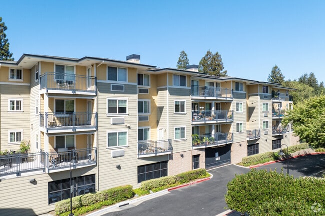
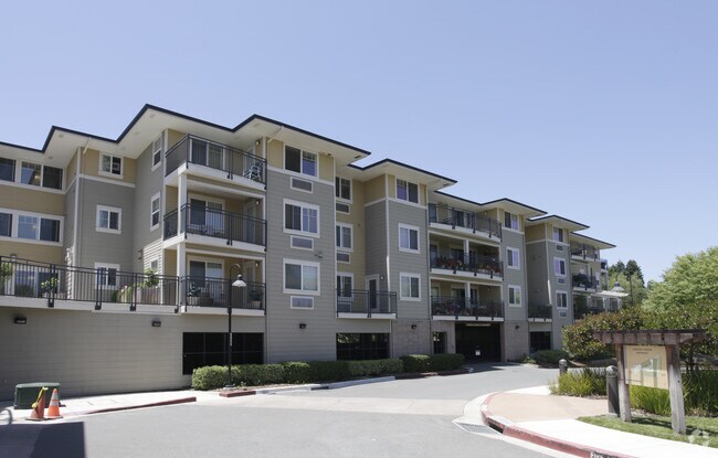
Property Record
100 Chilpancingo Pkwy, Pleasant Hill, CA 94523
NEARBY LISTINGS FOR SALE OR LEASE
Property Detail
100 Chilpancingo Pkwy
153-030-077-9
PARCEL MAP 21 PG 10 PCL B
Apartment
Contra Costa
X
California
06013C0277F
1.49 AC
2024
Concord/Pleasant Hill
2025
East Bay/Oakland
321200
Oakland-Hayward-Berkeley, CA
65,532 SF
DEMOGRAPHICS near 100 Chilpancingo Pkwy
1 Mile
3 Mile
5 Mile
2024 Total Population
10,272
128,153
239,549
2029 Population
10,180
127,154
238,000
Pop Growth 2024-2029
(0.90%)
(0.78%)
(0.65%)
Average Age
41
41
42
2024 Total Households
4,102
48,264
93,283
HH Growth 2024-2029
(0.95%)
(0.77%)
(0.62%)
Median Household Inc
$105,817
$105,870
$117,224
Avg Household Size
2.40
2.60
2.50
2024 Avg HH Vehicles
2.00
2.00
2.00
Median Home Value
$716,818
$750,141
$804,213
Median Year Built
1978
1972
1972
Nearby Places
Map Layers
Map Styles
 Street
 Aerial
- Restaurants
- Banks
- Shops
- Fitness
- Groceries
PUBLIC TRANSPORTATION
COMMUTER RAIL
Martinez (California Zephyr - Capitol Corridor Joint Powers Authority, Capitol Corridor - Capitol Corridor Joint Powers Authority, Coast Starlight - Capitol Corridor Joint Powers Authority, San Joaquins - Capitol Corridor Joint Powers Authority)
DRIVE
WALK
Distance
Martinez (California Zephyr - Capitol Corridor Joint Powers Authority, Capitol Corridor - Capitol Corridor Joint Powers Authority, Coast Starlight - Capitol Corridor Joint Powers Authority, San Joaquins - Capitol Corridor Joint Powers Authority)
11 min
7.1 mi
AIRPORT
Metro Oakland International
DRIVE
WALK
Distance
Metro Oakland International
39 min
29.0 mi
San Francisco International
DRIVE
WALK
Distance
San Francisco International
57 min
41.0 mi
Freight Ports
Port of Richmond
DRIVE
WALK
Distance
Port of Richmond
39 min
26.9 mi
Nearby Properties
Address
Land Use
TOTAL SIZE
Lot Size
Zoning
Address
Land Use
TOTAL SIZE
Lot Size
Zoning
390,693 SF
13.43 AC
Address
Land Use
TOTAL SIZE
Lot Size
Zoning
489,813 SF
38.82 AC
Address
Land Use
TOTAL SIZE
Lot Size
Zoning
34,226 SF
30 AC
Address
Land Use
TOTAL SIZE
Lot Size
Zoning
57.67 AC
HI
Address
Land Use
TOTAL SIZE
Lot Size
Zoning
12.82 AC
Address
Land Use
TOTAL SIZE
Lot Size
Zoning
31,614 SF
24.46 AC
Address
Land Use
TOTAL SIZE
Lot Size
Zoning
38,694 SF
2.33 AC
Address
Land Use
TOTAL SIZE
Lot Size
Zoning
234,624 SF
6.63 AC
Address
Land Use
TOTAL SIZE
Lot Size
Zoning
70,000 SF
25.77 AC
Address
Land Use
TOTAL SIZE
Lot Size
Zoning
112,000 SF
18.40 AC
Address
Land Use
TOTAL SIZE
Lot Size
Zoning
168,606 SF
2.42 AC
Address
Land Use
TOTAL SIZE
Lot Size
Zoning
152,581 SF
1.39 AC
Address
Land Use
TOTAL SIZE
Lot Size
Zoning
192,387 SF
17.42 AC
M17
Address
Land Use
TOTAL SIZE
Lot Size
Zoning
301,628 SF
1.49 AC
Address
Land Use
TOTAL SIZE
Lot Size
Zoning
130,000 SF
2.62 AC
Address
Land Use
TOTAL SIZE
Lot Size
Zoning
9,840 SF
5.85 AC
Address
Land Use
TOTAL SIZE
Lot Size
Zoning
12,864 SF
5.62 AC
Address
Land Use
TOTAL SIZE
Lot Size
Zoning
100,627 SF
6.47 AC
Address
Land Use
TOTAL SIZE
Lot Size
Zoning
59.41 AC
Address
Land Use
TOTAL SIZE
Lot Size
Zoning
45,744 SF
9.49 AC
Address
Land Use
TOTAL SIZE
Lot Size
Zoning
164,517 SF
3.65 AC
Address
Land Use
TOTAL SIZE
Lot Size
Zoning
154,213 SF
1.74 AC
Address
Land Use
TOTAL SIZE
Lot Size
Zoning
109,000 SF
1.98 AC
Address
Land Use
TOTAL SIZE
Lot Size
Zoning
225,367 SF
7.42 AC
Address
Land Use
TOTAL SIZE
Lot Size
Zoning
86,074 SF
2.17 AC
Address
Land Use
TOTAL SIZE
Lot Size
Zoning
92,550 SF
3.88 AC
Address
Land Use
TOTAL SIZE
Lot Size
Zoning
3,036 SF
11.11 AC
Address
Land Use
TOTAL SIZE
Lot Size
Zoning
159,013 SF
15.82 AC
Address
Land Use
TOTAL SIZE
Lot Size
Zoning
196.06 AC
HI
Address
Land Use
TOTAL SIZE
Lot Size
Zoning
81,186 SF
0.55 AC
The World's #1 Commercial Real Estate Marketplace
Connect with us
© 2025 CoStar Group
The information above has been obtained from sources believed reliable. While we do not doubt its accuracy we have not verified it and make no guarantee, warranty or representation about it. It is your responsibility to independently confirm its accuracy and completeness. Any projections, opinions, assumptions, or estimates used are for example only and do not represent the current or future performance of the property. The value of this transaction to you depends on tax and other factors which should be evaluated by your tax, financial, and legal advisors. You and your advisors should conduct a careful, independent investigation of the property to determine to your satisfaction the suitability of the property for your needs.