Property Record
100 Dettro Dr, Mattoon, IL 61938

Property Detail
100 Dettro Dr
Charleston-Mattoon, IL
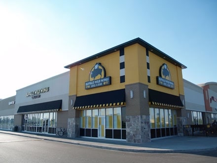
MARKETPLACE LOT 05 PETSMART HIBBETT SPORTS DOLLAR TREE BUFFALO WILD WINGS VERIZON CATO NAIL SALON
06-0-05289-000
Coles
Commercialnec
Illinois
B and X Area of moderate flood hazard, usually the area between the limits of the 100-year and 500-year floods.
5
2024
6.48 AC
2024
Effingham/Central Illinois Area
001000
Other Market Areas
75,332 SF
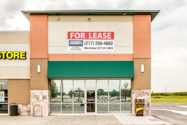
NEARBY LISTINGS FOR SALE OR LEASE
DEMOGRAPHICS near 100 Dettro Dr
1 mile
3 mile
5 mile
2025 Total Population
973
13,856
19,294
2030 Population
952
13,602
18,910
Pop Growth 2025-2030
(2.16%)
(1.83%)
(1.99%)
Average Age
48
42
42
2025 Total Households
453
6,212
8,515
HH Growth 2025-2030
(2.43%)
(1.93%)
(2.03%)
Median Household Inc
$61,210
$49,258
$54,371
Avg Household Size
1.90
2.10
2.20
2025 Avg HH Vehicles
2.00
2.00
2.00
Median Home Value
$158,962
$103,506
$115,845
Median Year Built
1968
1958
1959
Nearby Places
Map Layers
Map Styles
 Street
 Aerial
Layers
 Traffic
 Biking
Places
Listings with unknown addresses are not visible on the map
- Restaurants
- Banks
- Shops
- Fitness
- Groceries
PUBLIC TRANSPORTATION
COMMUTER RAIL
Mattoon Amtrak Station (City of New Orleans - Amtrak, Illini - Amtrak, Saluki - Amtrak)
Drive
Walk
Distance
Mattoon Amtrak Station (City of New Orleans - Amtrak, Illini - Amtrak, Saluki - Amtrak)
6 min
2.5 mi
Freight Ports
Port Milwaukee
Drive
Walk
Distance
Port Milwaukee
306 min
267.0 mi
SALE & LEASE HISTORY
LISTING DATE
SALE/LEASE

Sep 25, 2016
For Lease
Sep 01, 2017
For Lease
Mar 02, 2022
For Sale
Aug 14, 2018
For Lease
Nearby Properties
Address
Land Use
TOTAL SIZE
Lot Size
Zoning
Address
Land Use
TOTAL SIZE
Lot Size
Zoning
Address
Land Use
TOTAL SIZE
Lot Size
Zoning
199,970 SF
24.47 AC
Address
Land Use
TOTAL SIZE
Lot Size
Zoning
24,943 SF
91.27 AC
Address
Land Use
TOTAL SIZE
Lot Size
Zoning
7,500 SF
26.72 AC
Address
Land Use
TOTAL SIZE
Lot Size
Zoning
Address
Land Use
TOTAL SIZE
Lot Size
Zoning
0.92 AC
Address
Land Use
TOTAL SIZE
Lot Size
Zoning
208,184 SF
30.37 AC
Address
Land Use
TOTAL SIZE
Lot Size
Zoning
39,960 SF
1.95 AC
Address
Land Use
TOTAL SIZE
Lot Size
Zoning
Address
Land Use
TOTAL SIZE
Lot Size
Zoning
59,782 SF
6.79 AC
Address
Land Use
TOTAL SIZE
Lot Size
Zoning
95,068 SF
10.13 AC
Address
Land Use
TOTAL SIZE
Lot Size
Zoning
3,360 SF
5.96 AC
Address
Land Use
TOTAL SIZE
Lot Size
Zoning
9,888 SF
1.17 AC
Address
Land Use
TOTAL SIZE
Lot Size
Zoning
31,026 SF
34.80 AC
Address
Land Use
TOTAL SIZE
Lot Size
Zoning
9,644 SF
1.81 AC
Address
Land Use
TOTAL SIZE
Lot Size
Zoning
41,673 SF
5.40 AC
Address
Land Use
TOTAL SIZE
Lot Size
Zoning
Address
Land Use
TOTAL SIZE
Lot Size
Zoning
15,263 SF
2.80 AC
Address
Land Use
TOTAL SIZE
Lot Size
Zoning
2.61 AC
Address
Land Use
TOTAL SIZE
Lot Size
Zoning
230,400 SF
31.34 AC
Address
Land Use
TOTAL SIZE
Lot Size
Zoning
19,320 SF
1.44 AC
Address
Land Use
TOTAL SIZE
Lot Size
Zoning
38,486 SF
4.99 AC
Address
Land Use
TOTAL SIZE
Lot Size
Zoning
68,424 SF
5 AC
Address
Land Use
TOTAL SIZE
Lot Size
Zoning
171,500 SF
11.90 AC
Address
Land Use
TOTAL SIZE
Lot Size
Zoning
25,576 SF
6.60 AC
Address
Land Use
TOTAL SIZE
Lot Size
Zoning
38,414 SF
5.21 AC
Address
Land Use
TOTAL SIZE
Lot Size
Zoning
62,944 SF
0.80 AC
Address
Land Use
TOTAL SIZE
Lot Size
Zoning
27,534 SF
0.32 AC
Address
Land Use
TOTAL SIZE
Lot Size
Zoning
33,377 SF
6.20 AC
The World's #1 Commercial Real Estate Marketplace
Connect with us
© 2026 CoStar Group
The information above has been obtained from sources believed reliable. While we do not doubt its accuracy we have not verified it and make no guarantee, warranty or representation about it. It is your responsibility to independently confirm its accuracy and completeness. Any projections, opinions, assumptions, or estimates used are for example only and do not represent the current or future performance of the property. The value of this transaction to you depends on tax and other factors which should be evaluated by your tax, financial, and legal advisors. You and your advisors should conduct a careful, independent investigation of the property to determine to your satisfaction the suitability of the property for your needs.