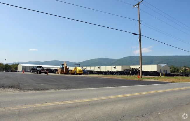
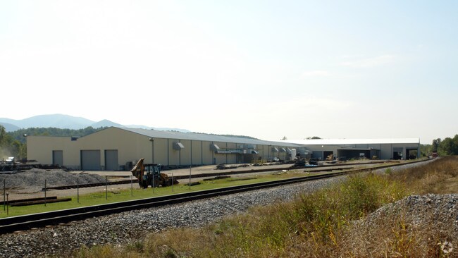
Property Record
100 Diuguids Ln, Salem, VA 24153
NEARBY LISTINGS FOR SALE OR LEASE
Property Detail
100 Diuguids Ln
208-1-1
Mcadam Road
Industrialgeneral
30.2 AC MCADAM ROAD
AE
Salem City
51161C0138G
Virginia
2025
30.20 AC
2025
Southwest Roanoke
010200
Roanoke
33,166 SF
Roanoke, VA
DEMOGRAPHICS near 100 Diuguids Ln
1 Mile
3 Mile
5 Mile
2024 Total Population
3,643
22,350
44,931
2029 Population
3,667
22,672
45,491
Pop Growth 2024-2029
+ 0.66%
+ 1.44%
+ 1.25%
Average Age
45
43
44
2024 Total Households
1,439
8,704
17,963
HH Growth 2024-2029
+ 0.76%
+ 1.57%
+ 1.35%
Median Household Inc
$85,775
$75,657
$73,450
Avg Household Size
2.50
2.40
2.30
2024 Avg HH Vehicles
2.00
2.00
2.00
Median Home Value
$262,106
$263,610
$259,608
Median Year Built
1973
1972
1972
Nearby Places
Map Layers
Map Styles
 Street
 Aerial
- Restaurants
- Banks
- Shops
- Fitness
- Groceries
PUBLIC TRANSPORTATION
AIRPORT
Roanoke/Blacksburg Regional (Woodrum Field)
DRIVE
WALK
Distance
Roanoke/Blacksburg Regional (Woodrum Field)
22 min
12.6 mi
Freight Ports
Virginia Port Authority - Richmond
DRIVE
WALK
Distance
Virginia Port Authority - Richmond
224 min
196.5 mi
Nearby Properties
Address
Land Use
TOTAL SIZE
Lot Size
Zoning
Address
Land Use
TOTAL SIZE
Lot Size
Zoning
81,148 SF
52.04 AC
CUDRSF
Address
Land Use
TOTAL SIZE
Lot Size
Zoning
288,464 SF
40.14 AC
RSF
Address
Land Use
TOTAL SIZE
Lot Size
Zoning
78,701 SF
31.20 AC
C2S
Address
Land Use
TOTAL SIZE
Lot Size
Zoning
103,882 SF
93.53 AC
R1S
Address
Land Use
TOTAL SIZE
Lot Size
Zoning
181,455 SF
6.24 AC
RMF
Address
Land Use
TOTAL SIZE
Lot Size
Zoning
95,349 SF
10.25 AC
RSF
Address
Land Use
TOTAL SIZE
Lot Size
Zoning
138,887 SF
13.03 AC
HBD
Address
Land Use
TOTAL SIZE
Lot Size
Zoning
394,937 SF
25.15 AC
I2
Address
Land Use
TOTAL SIZE
Lot Size
Zoning
161,757 SF
13.22 AC
HBD
Address
Land Use
TOTAL SIZE
Lot Size
Zoning
47,451 SF
1.58 AC
RB
Address
Land Use
TOTAL SIZE
Lot Size
Zoning
314,182 SF
22.87 AC
HM
Address
Land Use
TOTAL SIZE
Lot Size
Zoning
278,331 SF
134.03 AC
I2
Address
Land Use
TOTAL SIZE
Lot Size
Zoning
100 SF
60.09 AC
RSF
Address
Land Use
TOTAL SIZE
Lot Size
Zoning
87,526 SF
4.12 AC
RMF
Address
Land Use
TOTAL SIZE
Lot Size
Zoning
11,613 SF
11.27 AC
RMF
Address
Land Use
TOTAL SIZE
Lot Size
Zoning
74,712 SF
2.13 AC
DBD
Address
Land Use
TOTAL SIZE
Lot Size
Zoning
178,638 SF
12.01 AC
HBD
Address
Land Use
TOTAL SIZE
Lot Size
Zoning
52,011 SF
11.63 AC
HM
Address
Land Use
TOTAL SIZE
Lot Size
Zoning
76,720 SF
4.90 AC
C2S
Address
Land Use
TOTAL SIZE
Lot Size
Zoning
68,976 SF
1.77 AC
DBD
Address
Land Use
TOTAL SIZE
Lot Size
Zoning
52,390 SF
8.77 AC
C2S
Address
Land Use
TOTAL SIZE
Lot Size
Zoning
67,222 SF
0.79 AC
DBD
Address
Land Use
TOTAL SIZE
Lot Size
Zoning
50,708 SF
5.75 AC
C2S
Address
Land Use
TOTAL SIZE
Lot Size
Zoning
93,913 SF
5 AC
LM
Address
Land Use
TOTAL SIZE
Lot Size
Zoning
52,668 SF
1.86 AC
CUD
Address
Land Use
TOTAL SIZE
Lot Size
Zoning
74,168 SF
7.10 AC
HBD
Address
Land Use
TOTAL SIZE
Lot Size
Zoning
43,032 SF
15.65 AC
R1S
Address
Land Use
TOTAL SIZE
Lot Size
Zoning
123,361 SF
29.72 AC
I1
Address
Land Use
TOTAL SIZE
Lot Size
Zoning
33,616 SF
1.55 AC
CUD
The World's #1 Commercial Real Estate Marketplace
Connect with us
© 2025 CoStar Group
The information above has been obtained from sources believed reliable. While we do not doubt its accuracy we have not verified it and make no guarantee, warranty or representation about it. It is your responsibility to independently confirm its accuracy and completeness. Any projections, opinions, assumptions, or estimates used are for example only and do not represent the current or future performance of the property. The value of this transaction to you depends on tax and other factors which should be evaluated by your tax, financial, and legal advisors. You and your advisors should conduct a careful, independent investigation of the property to determine to your satisfaction the suitability of the property for your needs.