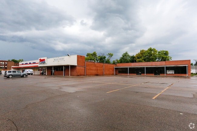
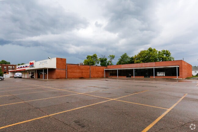
Property Record
100 E 6Th St, Franklin, OH 45005

Property Detail
100 E 6Th St
Cincinnati, OH-KY-IN
OUT LOT LOT 961,965-7
04-31-178-001
Warren
Publichealthcarefacility
Ohio
B and X Area of moderate flood hazard, usually the area between the limits of the 100-year and 500-year floods.
961
2024
2.14 AC
2025
Outlying Warren County
032502
Cincinnati/Dayton
25,196 SF
NEARBY LISTINGS FOR SALE OR LEASE
DEMOGRAPHICS near 100 E 6Th St
1 mile
3 mile
5 mile
2024 Total Population
7,161
29,794
80,614
2029 Population
7,464
31,106
83,484
Pop Growth 2024-2029
+ 4.23%
+ 4.40%
+ 3.56%
Average Age
39
42
42
2024 Total Households
3,081
11,988
32,120
HH Growth 2024-2029
+ 4.22%
+ 4.45%
+ 3.58%
Median Household Inc
$47,486
$68,257
$76,009
Avg Household Size
2.30
2.40
2.50
2024 Avg HH Vehicles
2.00
2.00
2.00
Median Home Value
$167,626
$212,088
$240,116
Median Year Built
1964
1972
1974
Nearby Places
Map Layers
Map Styles
 Street
 Aerial
Transit
 Traffic
 Biking
Places
Listings with unknown addresses are not visible on the map
- Restaurants
- Banks
- Shops
- Fitness
- Groceries
PUBLIC TRANSPORTATION
AIRPORT
James M Cox Dayton International
Drive
Walk
Distance
James M Cox Dayton International
42 min
30.7 mi
SALE & LEASE HISTORY
LISTING DATE
SALE/LEASE

Jul 19, 2017
For Lease
Nearby Properties
Address
Land Use
TOTAL SIZE
Lot Size
Zoning
Address
Land Use
TOTAL SIZE
Lot Size
Zoning
33,671 SF
8.49 AC
Address
Land Use
TOTAL SIZE
Lot Size
Zoning
36,570 SF
20.29 AC
Address
Land Use
TOTAL SIZE
Lot Size
Zoning
56.81 AC
R1
Address
Land Use
TOTAL SIZE
Lot Size
Zoning
15,228 SF
37.19 AC
R1
Address
Land Use
TOTAL SIZE
Lot Size
Zoning
17.47 AC
Address
Land Use
TOTAL SIZE
Lot Size
Zoning
11,847 SF
5.96 AC
Address
Land Use
TOTAL SIZE
Lot Size
Zoning
32,550 SF
26.11 AC
Address
Land Use
TOTAL SIZE
Lot Size
Zoning
487,924 SF
22.33 AC
Address
Land Use
TOTAL SIZE
Lot Size
Zoning
217,679 SF
25.16 AC
Address
Land Use
TOTAL SIZE
Lot Size
Zoning
868 SF
36.06 AC
Address
Land Use
TOTAL SIZE
Lot Size
Zoning
13.19 AC
Address
Land Use
TOTAL SIZE
Lot Size
Zoning
12,480 SF
14.98 AC
Address
Land Use
TOTAL SIZE
Lot Size
Zoning
147,116 SF
12.07 AC
Address
Land Use
TOTAL SIZE
Lot Size
Zoning
19,622 SF
2.94 AC
Address
Land Use
TOTAL SIZE
Lot Size
Zoning
37.26 AC
Address
Land Use
TOTAL SIZE
Lot Size
Zoning
29,500 SF
10 AC
Address
Land Use
TOTAL SIZE
Lot Size
Zoning
66,339 SF
11.52 AC
Address
Land Use
TOTAL SIZE
Lot Size
Zoning
33,324 SF
9.65 AC
Address
Land Use
TOTAL SIZE
Lot Size
Zoning
102,302 SF
6.63 AC
Address
Land Use
TOTAL SIZE
Lot Size
Zoning
28,038 SF
11.69 AC
Address
Land Use
TOTAL SIZE
Lot Size
Zoning
51,048 SF
48.12 AC
Address
Land Use
TOTAL SIZE
Lot Size
Zoning
11,764 SF
5.05 AC
Address
Land Use
TOTAL SIZE
Lot Size
Zoning
90,816 SF
10 AC
Address
Land Use
TOTAL SIZE
Lot Size
Zoning
158,792 SF
17.30 AC
Address
Land Use
TOTAL SIZE
Lot Size
Zoning
5,182 SF
12.50 AC
Address
Land Use
TOTAL SIZE
Lot Size
Zoning
68,392 SF
6.61 AC
Address
Land Use
TOTAL SIZE
Lot Size
Zoning
50,389 SF
5.84 AC
Address
Land Use
TOTAL SIZE
Lot Size
Zoning
90,000 SF
17.11 AC
R1
Address
Land Use
TOTAL SIZE
Lot Size
Zoning
115,000 SF
18.19 AC
Address
Land Use
TOTAL SIZE
Lot Size
Zoning
157,387 SF
15.31 AC
The World's #1 Commercial Real Estate Marketplace
Connect with us
© 2026 CoStar Group
The information above has been obtained from sources believed reliable. While we do not doubt its accuracy we have not verified it and make no guarantee, warranty or representation about it. It is your responsibility to independently confirm its accuracy and completeness. Any projections, opinions, assumptions, or estimates used are for example only and do not represent the current or future performance of the property. The value of this transaction to you depends on tax and other factors which should be evaluated by your tax, financial, and legal advisors. You and your advisors should conduct a careful, independent investigation of the property to determine to your satisfaction the suitability of the property for your needs.