Property Record
100 E Brazos Ave, West Columbia, TX 77486
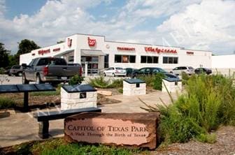
Property Detail
100 E Brazos Ave
8222-0006-000
WEST COLUMBIA BLK 2 LOT 1-2-3-4-5-1A-2A-7A-8A ACRES 1.561
Commercialnec
Brazoria
0007
Texas
B and X Area of moderate flood hazard, usually the area between the limits of the 100-year and 500-year floods.
1
2024
1.56 AC
2025
Far New Territory
662000
Houston
13,801 SF
Houston-Pasadena-The Woodlands, TX
NEARBY LISTINGS FOR SALE OR LEASE
DEMOGRAPHICS near 100 E Brazos Ave
1 mile
3 mile
5 mile
2025 Total Population
3,449
7,997
11,445
2030 Population
3,841
8,898
12,713
Pop Growth 2025-2030
+ 11.37%
+ 11.27%
+ 11.08%
Average Age
39
40
41
2025 Total Households
1,330
3,079
4,402
HH Growth 2025-2030
+ 11.65%
+ 11.56%
+ 11.36%
Median Household Inc
$77,788
$80,521
$79,240
Avg Household Size
2.60
2.60
2.60
2025 Avg HH Vehicles
2.00
2.00
2.00
Median Home Value
$223,902
$243,843
$254,045
Median Year Built
1976
1979
1984
Nearby Places
Map Layers
Map Styles
 Street
 Aerial
Transit
 Traffic
 Biking
Places
Listings with unknown addresses are not visible on the map
- Restaurants
- Banks
- Shops
- Fitness
- Groceries
Nearby Properties
Address
Land Use
TOTAL SIZE
Lot Size
Zoning
Address
Land Use
TOTAL SIZE
Lot Size
Zoning
81,946 SF
11.52 AC
0034
Address
Land Use
TOTAL SIZE
Lot Size
Zoning
227,214 SF
32.86 AC
0068
Address
Land Use
TOTAL SIZE
Lot Size
Zoning
31,683 SF
17.59 AC
0330
Address
Land Use
TOTAL SIZE
Lot Size
Zoning
48,830 SF
10.88 AC
Address
Land Use
TOTAL SIZE
Lot Size
Zoning
1.23 AC
0189
Address
Land Use
TOTAL SIZE
Lot Size
Zoning
46,400 SF
1.95 AC
0079
Address
Land Use
TOTAL SIZE
Lot Size
Zoning
22,680 SF
8.79 AC
Address
Land Use
TOTAL SIZE
Lot Size
Zoning
7,452 SF
2.81 AC
Address
Land Use
TOTAL SIZE
Lot Size
Zoning
14,102 SF
24.69 AC
Address
Land Use
TOTAL SIZE
Lot Size
Zoning
11,977 SF
1.77 AC
0022
Address
Land Use
TOTAL SIZE
Lot Size
Zoning
50,763 SF
3.09 AC
0133
Address
Land Use
TOTAL SIZE
Lot Size
Zoning
42,540 SF
1.98 AC
0172
Address
Land Use
TOTAL SIZE
Lot Size
Zoning
40,048 SF
1.60 AC
0044
Address
Land Use
TOTAL SIZE
Lot Size
Zoning
7,000 SF
10 AC
0143
Address
Land Use
TOTAL SIZE
Lot Size
Zoning
10,695 SF
1.81 AC
Address
Land Use
TOTAL SIZE
Lot Size
Zoning
33,624 SF
1.75 AC
0031
Address
Land Use
TOTAL SIZE
Lot Size
Zoning
6,060 SF
1.76 AC
0108
Address
Land Use
TOTAL SIZE
Lot Size
Zoning
33,336 SF
1.58 AC
0070
Address
Land Use
TOTAL SIZE
Lot Size
Zoning
9,900 SF
0.18 AC
0054
Address
Land Use
TOTAL SIZE
Lot Size
Zoning
33,654 SF
5.04 AC
0009
Address
Land Use
TOTAL SIZE
Lot Size
Zoning
36,498 SF
6.08 AC
0009
Address
Land Use
TOTAL SIZE
Lot Size
Zoning
15,856 SF
1.79 AC
0265
Address
Land Use
TOTAL SIZE
Lot Size
Zoning
61,996 SF
6.46 AC
0075
Address
Land Use
TOTAL SIZE
Lot Size
Zoning
5,250 SF
5 AC
Address
Land Use
TOTAL SIZE
Lot Size
Zoning
8,662 SF
1.79 AC
0072
Address
Land Use
TOTAL SIZE
Lot Size
Zoning
13,426 SF
1.66 AC
0092
Address
Land Use
TOTAL SIZE
Lot Size
Zoning
18,566 SF
2.15 AC
0065
Address
Land Use
TOTAL SIZE
Lot Size
Zoning
18,000 SF
1.43 AC
Address
Land Use
TOTAL SIZE
Lot Size
Zoning
25,949 SF
4.16 AC
The World's #1 Commercial Real Estate Marketplace
Connect with us
© 2026 CoStar Group
The information above has been obtained from sources believed reliable. While we do not doubt its accuracy we have not verified it and make no guarantee, warranty or representation about it. It is your responsibility to independently confirm its accuracy and completeness. Any projections, opinions, assumptions, or estimates used are for example only and do not represent the current or future performance of the property. The value of this transaction to you depends on tax and other factors which should be evaluated by your tax, financial, and legal advisors. You and your advisors should conduct a careful, independent investigation of the property to determine to your satisfaction the suitability of the property for your needs.