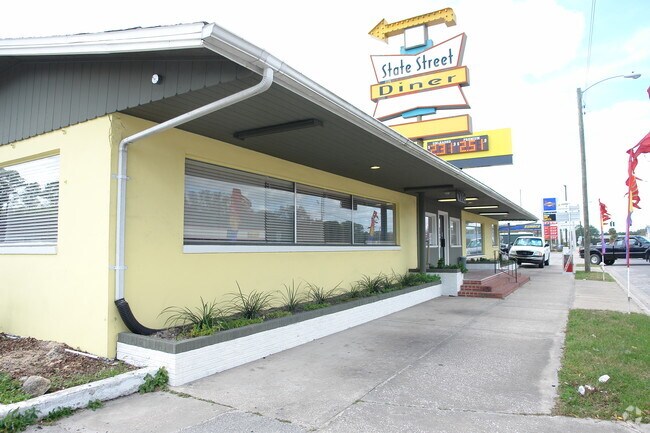
Property Record
100 E Carter St, Bunnell, FL 32110


Property Detail
100 E Carter St
10-12-30-0850-01620-0010
TOWN OF BUNNELL BLOCK 162 LOTS 1-2-3-10-11-12 LOCATED IN SECTION 14
Religious
FLAGLER
B-1
Florida
B and X Area of moderate flood hazard, usually the area between the limits of the 100-year and 500-year floods.
1
0
0.81 AC
2025
Flagler County
060207
Other Market Areas
5,680 SF
Deltona-Daytona Beach-Ormond Beach, FL
NEARBY LISTINGS FOR SALE OR LEASE
DEMOGRAPHICS near 100 E Carter St
1 mile
3 mile
5 mile
2025 Total Population
2,471
16,262
47,202
2030 Population
2,811
18,620
54,135
Pop Growth 2025-2030
+ 13.76%
+ 14.50%
+ 14.69%
Average Age
44
45
45
2025 Total Households
981
6,449
18,778
HH Growth 2025-2030
+ 14.07%
+ 14.59%
+ 14.80%
Median Household Inc
$50,457
$60,860
$64,291
Avg Household Size
2.30
2.40
2.50
2025 Avg HH Vehicles
1.00
2.00
2.00
Median Home Value
$345,698
$379,038
$373,416
Median Year Built
1992
2004
2004
Nearby Places
Map Layers
Map Styles
 Street
 Aerial
Transit
 Traffic
 Biking
Places
Listings with unknown addresses are not visible on the map
- Restaurants
- Banks
- Shops
- Fitness
- Groceries
PUBLIC TRANSPORTATION
AIRPORT
Daytona Beach International
Drive
Walk
Distance
Daytona Beach International
35 min
26.0 mi
SALE & LEASE HISTORY
LISTING DATE
SALE/LEASE

Sep 24, 2016
For Sale
Nov 30, 2018
For Sale
Feb 21, 2023
For Sale
Nearby Properties
Address
Land Use
TOTAL SIZE
Lot Size
Zoning
Address
Land Use
TOTAL SIZE
Lot Size
Zoning
913,614 SF
85.53 AC
PSP
Address
Land Use
TOTAL SIZE
Lot Size
Zoning
320,259 SF
83.19 AC
P
Address
Land Use
TOTAL SIZE
Lot Size
Zoning
217,927 SF
1,165.37 AC
I-C
Address
Land Use
TOTAL SIZE
Lot Size
Zoning
280,742 SF
16.06 AC
MPD
Address
Land Use
TOTAL SIZE
Lot Size
Zoning
236,316 SF
61.38 AC
PSP
Address
Land Use
TOTAL SIZE
Lot Size
Zoning
138,991 SF
18.66 AC
P
Address
Land Use
TOTAL SIZE
Lot Size
Zoning
121,173 SF
10 AC
AC
Address
Land Use
TOTAL SIZE
Lot Size
Zoning
64,208 SF
8.41 AC
PSP
Address
Land Use
TOTAL SIZE
Lot Size
Zoning
76,544 SF
48.85 AC
R/C
Address
Land Use
TOTAL SIZE
Lot Size
Zoning
220,314 SF
17.41 AC
MPD
Address
Land Use
TOTAL SIZE
Lot Size
Zoning
68,684 SF
9.68 AC
MPD
Address
Land Use
TOTAL SIZE
Lot Size
Zoning
89,590 SF
9.90 AC
B-1
Address
Land Use
TOTAL SIZE
Lot Size
Zoning
59,889 SF
0.75 AC
R-3A
Address
Land Use
TOTAL SIZE
Lot Size
Zoning
67,008 SF
5.34 AC
B-1
Address
Land Use
TOTAL SIZE
Lot Size
Zoning
20,990 SF
18.10 AC
Address
Land Use
TOTAL SIZE
Lot Size
Zoning
32,679 SF
101.42 AC
L-1
Address
Land Use
TOTAL SIZE
Lot Size
Zoning
163,592 SF
10 AC
IND-1
Address
Land Use
TOTAL SIZE
Lot Size
Zoning
41,710 SF
11.97 AC
L-1
Address
Land Use
TOTAL SIZE
Lot Size
Zoning
4,158 SF
3.73 AC
P
Address
Land Use
TOTAL SIZE
Lot Size
Zoning
74,470 SF
11.98 AC
MPD
Address
Land Use
TOTAL SIZE
Lot Size
Zoning
43,990 SF
4.84 AC
P
Address
Land Use
TOTAL SIZE
Lot Size
Zoning
18,852 SF
3.23 AC
COM-2
Address
Land Use
TOTAL SIZE
Lot Size
Zoning
38,420 SF
4.83 AC
C-2(F)
Address
Land Use
TOTAL SIZE
Lot Size
Zoning
60,582 SF
2.20 AC
MPD
Address
Land Use
TOTAL SIZE
Lot Size
Zoning
76,339 SF
4 AC
B-1
Address
Land Use
TOTAL SIZE
Lot Size
Zoning
10,310 SF
1.54 AC
Address
Land Use
TOTAL SIZE
Lot Size
Zoning
66,485 SF
28.20 AC
Address
Land Use
TOTAL SIZE
Lot Size
Zoning
17,901 SF
1.72 AC
COM-2
The World's #1 Commercial Real Estate Marketplace
Connect with us
© 2026 CoStar Group
The information above has been obtained from sources believed reliable. While we do not doubt its accuracy we have not verified it and make no guarantee, warranty or representation about it. It is your responsibility to independently confirm its accuracy and completeness. Any projections, opinions, assumptions, or estimates used are for example only and do not represent the current or future performance of the property. The value of this transaction to you depends on tax and other factors which should be evaluated by your tax, financial, and legal advisors. You and your advisors should conduct a careful, independent investigation of the property to determine to your satisfaction the suitability of the property for your needs.