Property Record
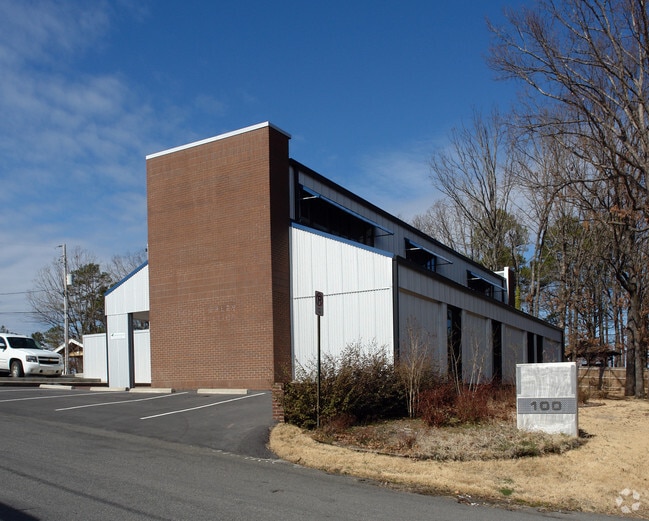
100 Gamble Rd, Little Rock, AR 72211


NEARBY LISTINGS FOR SALE OR LEASE
Property Detail
100 Gamble Rd
Little Rock-North Little Rock-Conway, AR
Hillvale
44L-071-01-019-01
PT TRACT 15 HILLVALE ADDN MPDA BEG SE COR TR 15 TH N88*5302W145 TH N150 S88*2920E145 TO ELN TR 15 TH S00*0023W149 TO POB SECT 5-1N-13
Officebuilding
Pulaski
X
Arkansas
05119C0318H
15
2025
0.49 AC
2025
West
004218
Little Rock/N Little Rock
6,704 SF
DEMOGRAPHICS near 100 Gamble Rd
1 Mile
3 Mile
5 Mile
2024 Total Population
9,652
57,851
112,989
2029 Population
9,594
57,504
112,492
Pop Growth 2024-2029
(0.60%)
(0.60%)
(0.44%)
Average Age
38
39
40
2024 Total Households
4,680
25,950
50,022
HH Growth 2024-2029
(0.71%)
(0.63%)
(0.50%)
Median Household Inc
$61,864
$66,851
$68,259
Avg Household Size
2.00
2.20
2.20
2024 Avg HH Vehicles
2.00
2.00
2.00
Median Home Value
$205,300
$232,582
$240,380
Median Year Built
1988
1985
1981
Nearby Places
Map Layers
Map Styles
 Street
 Aerial
- Restaurants
- Banks
- Shops
- Fitness
- Groceries
PUBLIC TRANSPORTATION
COMMUTER RAIL
DRIVE
WALK
Distance
14 min
8.4 mi
AIRPORT
Bill and Hillary Clinton Ntl/Adams Field
DRIVE
WALK
Distance
Bill and Hillary Clinton Ntl/Adams Field
20 min
13.1 mi
SALE & LEASE HISTORY
LISTING DATE
SALE/LEASE

Sep 25, 2016
For Lease
Sep 07, 2017
For Sale
Nov 16, 2018
For Sale
Jul 26, 2022
For Sale
Aug 29, 2022
For Lease
Aug 17, 2018
For Lease
Nearby Properties
Address
Land Use
TOTAL SIZE
Lot Size
Zoning
Address
Land Use
TOTAL SIZE
Lot Size
Zoning
1,665,090 SF
34.75 AC
Address
Land Use
TOTAL SIZE
Lot Size
Zoning
227,729 SF
36.49 AC
Address
Land Use
TOTAL SIZE
Lot Size
Zoning
333,636 SF
13.50 AC
Address
Land Use
TOTAL SIZE
Lot Size
Zoning
286,440 SF
10.79 AC
Address
Land Use
TOTAL SIZE
Lot Size
Zoning
115,378 SF
30.50 AC
Address
Land Use
TOTAL SIZE
Lot Size
Zoning
201,059 SF
49.76 AC
Address
Land Use
TOTAL SIZE
Lot Size
Zoning
143,885 SF
14.98 AC
Address
Land Use
TOTAL SIZE
Lot Size
Zoning
145,580 SF
19.89 AC
Address
Land Use
TOTAL SIZE
Lot Size
Zoning
39,635 SF
15.76 AC
Address
Land Use
TOTAL SIZE
Lot Size
Zoning
220,563 SF
12.36 AC
Address
Land Use
TOTAL SIZE
Lot Size
Zoning
140,675 SF
Address
Land Use
TOTAL SIZE
Lot Size
Zoning
54,594 SF
16.79 AC
Address
Land Use
TOTAL SIZE
Lot Size
Zoning
48,982 SF
9.06 AC
Address
Land Use
TOTAL SIZE
Lot Size
Zoning
216,869 SF
20.84 AC
Address
Land Use
TOTAL SIZE
Lot Size
Zoning
130,800 SF
7.78 AC
Address
Land Use
TOTAL SIZE
Lot Size
Zoning
172,261 SF
5.48 AC
Address
Land Use
TOTAL SIZE
Lot Size
Zoning
221,911 SF
10.31 AC
Address
Land Use
TOTAL SIZE
Lot Size
Zoning
127,020 SF
13.56 AC
Address
Land Use
TOTAL SIZE
Lot Size
Zoning
57,494 SF
9.53 AC
Address
Land Use
TOTAL SIZE
Lot Size
Zoning
102,600 SF
17.29 AC
Address
Land Use
TOTAL SIZE
Lot Size
Zoning
168,221 SF
12.02 AC
Address
Land Use
TOTAL SIZE
Lot Size
Zoning
221,204 SF
4.54 AC
Address
Land Use
TOTAL SIZE
Lot Size
Zoning
32,562 SF
13.40 AC
Address
Land Use
TOTAL SIZE
Lot Size
Zoning
73,197 SF
12.09 AC
Address
Land Use
TOTAL SIZE
Lot Size
Zoning
210,924 SF
22.66 AC
Address
Land Use
TOTAL SIZE
Lot Size
Zoning
293,057 SF
20.78 AC
Address
Land Use
TOTAL SIZE
Lot Size
Zoning
91,384 SF
8.34 AC
Address
Land Use
TOTAL SIZE
Lot Size
Zoning
54,284 SF
11.33 AC
Address
Land Use
TOTAL SIZE
Lot Size
Zoning
185,873 SF
Address
Land Use
TOTAL SIZE
Lot Size
Zoning
86,186 SF
13.24 AC
The World's #1 Commercial Real Estate Marketplace
Connect with us
© 2026 CoStar Group
The information above has been obtained from sources believed reliable. While we do not doubt its accuracy we have not verified it and make no guarantee, warranty or representation about it. It is your responsibility to independently confirm its accuracy and completeness. Any projections, opinions, assumptions, or estimates used are for example only and do not represent the current or future performance of the property. The value of this transaction to you depends on tax and other factors which should be evaluated by your tax, financial, and legal advisors. You and your advisors should conduct a careful, independent investigation of the property to determine to your satisfaction the suitability of the property for your needs.