Property Record
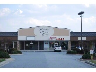
100 Hamilton Pointe Dr, Byron, GA 31008


Property Detail
100 Hamilton Pointe Dr
055D-111
LL 30 LD 5TH \ 2.894 ACRES (2.871 AC)
Stripcommercialcenter
Peach
C-3
Georgia
B and X Area of moderate flood hazard, usually the area between the limits of the 100-year and 500-year floods.
30
2025
2.87 AC
2025
Other Market Areas
040104
Warner Robins, GA
18,000 SF
NEARBY LISTINGS FOR SALE OR LEASE
DEMOGRAPHICS near 100 Hamilton Pointe Dr
1 mile
3 mile
5 mile
2025 Total Population
653
16,525
42,794
2030 Population
669
17,341
44,567
Pop Growth 2025-2030
+ 2.45%
+ 4.94%
+ 4.14%
Average Age
45
40
41
2025 Total Households
281
6,335
16,955
HH Growth 2025-2030
+ 2.49%
+ 4.91%
+ 4.16%
Median Household Inc
$102,016
$80,239
$76,005
Avg Household Size
2.30
2.60
2.50
2025 Avg HH Vehicles
2.00
2.00
2.00
Median Home Value
$258,181
$215,384
$208,408
Median Year Built
2005
1996
1995
Nearby Places
Map Layers
Map Styles
 Street
 Aerial
Transit
 Traffic
 Biking
Places
Listings with unknown addresses are not visible on the map
- Restaurants
- Banks
- Shops
- Fitness
- Groceries
SALE & LEASE HISTORY
LISTING DATE
SALE/LEASE

Sep 25, 2016
For Lease
Nearby Properties
Address
Land Use
TOTAL SIZE
Lot Size
Zoning
Address
Land Use
TOTAL SIZE
Lot Size
Zoning
10,000 SF
1,163 AC
R-AG
Address
Land Use
TOTAL SIZE
Lot Size
Zoning
10,000 SF
43.93 AC
I-1
Address
Land Use
TOTAL SIZE
Lot Size
Zoning
2,116 SF
10.10 AC
C-1
Address
Land Use
TOTAL SIZE
Lot Size
Zoning
80,825 SF
7.20 AC
I-1
Address
Land Use
TOTAL SIZE
Lot Size
Zoning
8,640 SF
12.49 AC
R-AG
Address
Land Use
TOTAL SIZE
Lot Size
Zoning
47,568 SF
1.51 AC
C-3
Address
Land Use
TOTAL SIZE
Lot Size
Zoning
42,056 SF
2.14 AC
C-3
Address
Land Use
TOTAL SIZE
Lot Size
Zoning
58,534 SF
7.82 AC
MULTI
Address
Land Use
TOTAL SIZE
Lot Size
Zoning
22,688 SF
19.01 AC
R1
Address
Land Use
TOTAL SIZE
Lot Size
Zoning
70,500 SF
18.47 AC
R1
Address
Land Use
TOTAL SIZE
Lot Size
Zoning
35,004 SF
1.45 AC
C-3
Address
Land Use
TOTAL SIZE
Lot Size
Zoning
17,388 SF
7.02 AC
MULTI
Address
Land Use
TOTAL SIZE
Lot Size
Zoning
1,800 SF
33 AC
I-1
Address
Land Use
TOTAL SIZE
Lot Size
Zoning
24,400 SF
7 AC
MULTI
Address
Land Use
TOTAL SIZE
Lot Size
Zoning
26,131 SF
5.96 AC
C-1
Address
Land Use
TOTAL SIZE
Lot Size
Zoning
57,888 SF
1.01 AC
I-1
Address
Land Use
TOTAL SIZE
Lot Size
Zoning
54,175 SF
12.72 AC
C-3
Address
Land Use
TOTAL SIZE
Lot Size
Zoning
5,110 SF
2.03 AC
C-3
Address
Land Use
TOTAL SIZE
Lot Size
Zoning
35,784 SF
6.23 AC
C-3
Address
Land Use
TOTAL SIZE
Lot Size
Zoning
4,294 SF
12 AC
R-AG
Address
Land Use
TOTAL SIZE
Lot Size
Zoning
12,026 SF
11.75 AC
R-1
Address
Land Use
TOTAL SIZE
Lot Size
Zoning
5,346 SF
2.13 AC
C-3
Address
Land Use
TOTAL SIZE
Lot Size
Zoning
11,083 SF
6.14 AC
C-2
Address
Land Use
TOTAL SIZE
Lot Size
Zoning
12,154 SF
15.06 AC
R-1
Address
Land Use
TOTAL SIZE
Lot Size
Zoning
8,810 SF
5.48 AC
C-3
Address
Land Use
TOTAL SIZE
Lot Size
Zoning
7,232 SF
5.25 AC
C-1
Address
Land Use
TOTAL SIZE
Lot Size
Zoning
44,700 SF
10.33 AC
I-1
Address
Land Use
TOTAL SIZE
Lot Size
Zoning
13,000 SF
11.68 AC
MULTI
Address
Land Use
TOTAL SIZE
Lot Size
Zoning
15,946 SF
2.26 AC
C-2
Address
Land Use
TOTAL SIZE
Lot Size
Zoning
3,000 SF
6.19 AC
C-3
The World's #1 Commercial Real Estate Marketplace
Connect with us
© 2026 CoStar Group
The information above has been obtained from sources believed reliable. While we do not doubt its accuracy we have not verified it and make no guarantee, warranty or representation about it. It is your responsibility to independently confirm its accuracy and completeness. Any projections, opinions, assumptions, or estimates used are for example only and do not represent the current or future performance of the property. The value of this transaction to you depends on tax and other factors which should be evaluated by your tax, financial, and legal advisors. You and your advisors should conduct a careful, independent investigation of the property to determine to your satisfaction the suitability of the property for your needs.