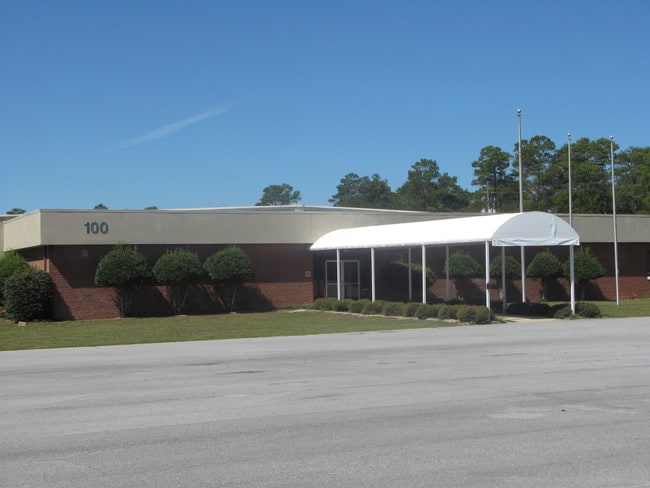
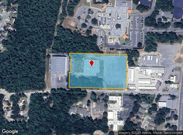
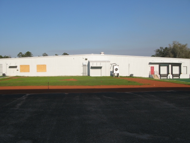
Property Record
100 Hart St, Niceville, FL 32578
NEARBY LISTINGS FOR SALE OR LEASE
Property Detail
100 Hart St
Crestview-Fort Walton Beach-Destin, FL
Niceville Hts Add
01-1S-23-0000-0001-001A
COM SE COR LOT 13 BLK 1 NICEVILLE HTS ADD N 20FT TO POB N87 DEG W 673.02FT N2 DEG E 170.24FT S87 DEG E 16FT N2 DEG E 184FT N87 DEG W 16FT N2 DEG E 34FT TO SOUTH LINE TWIN CITIES PARCEL S87 DEG E 673.19FT S2 DEG W 388.24FT TO POB LESS E 30FT
Officebuilding
Okaloosa
X
Florida
12091C0390J
13
2023
5.68 AC
2024
Fort Walton Beach
021200
Other Market Areas
30,493 SF
DEMOGRAPHICS near 100 Hart St
1 Mile
3 Mile
5 Mile
2024 Total Population
2,056
17,677
27,623
2029 Population
2,166
18,385
28,758
Pop Growth 2024-2029
+ 5.35%
+ 4.01%
+ 4.11%
Average Age
35
40
40
2024 Total Households
857
7,153
10,723
HH Growth 2024-2029
+ 5.37%
+ 3.96%
+ 4.02%
Median Household Inc
$82,272
$76,982
$87,614
Avg Household Size
2.40
2.40
2.50
2024 Avg HH Vehicles
2.00
2.00
2.00
Median Home Value
$286,131
$310,514
$348,181
Median Year Built
1984
1983
1986
Nearby Places
- Restaurants
- Banks
- Shops
- Fitness
- Groceries
PUBLIC TRANSPORTATION
AIRPORT
Eglin AFB/Destin-Ft Walton Beach
DRIVE
WALK
Distance
Eglin AFB/Destin-Ft Walton Beach
24 min
5.6 mi
Freight Ports
Port of Panama City
DRIVE
WALK
Distance
Port of Panama City
94 min
62.6 mi
Nearby Properties
Address
Land Use
TOTAL SIZE
Lot Size
Zoning
Address
Land Use
TOTAL SIZE
Lot Size
Zoning
480 AC
Address
Land Use
TOTAL SIZE
Lot Size
Zoning
766,955 SF
121.04 AC
Address
Land Use
TOTAL SIZE
Lot Size
Zoning
248,966 SF
29.88 AC
Address
Land Use
TOTAL SIZE
Lot Size
Zoning
138,251 SF
11.32 AC
Address
Land Use
TOTAL SIZE
Lot Size
Zoning
10,401 SF
7.20 AC
Address
Land Use
TOTAL SIZE
Lot Size
Zoning
75,002 SF
4.42 AC
Address
Land Use
TOTAL SIZE
Lot Size
Zoning
28,763 SF
0.23 AC
Address
Land Use
TOTAL SIZE
Lot Size
Zoning
165,059 SF
17.62 AC
Address
Land Use
TOTAL SIZE
Lot Size
Zoning
64,450 SF
10.50 AC
Address
Land Use
TOTAL SIZE
Lot Size
Zoning
54,627 SF
2.05 AC
Address
Land Use
TOTAL SIZE
Lot Size
Zoning
49,417 SF
3.19 AC
Address
Land Use
TOTAL SIZE
Lot Size
Zoning
100,515 SF
15.11 AC
Address
Land Use
TOTAL SIZE
Lot Size
Zoning
105,900 SF
8.90 AC
Address
Land Use
TOTAL SIZE
Lot Size
Zoning
33,575 SF
1.67 AC
Address
Land Use
TOTAL SIZE
Lot Size
Zoning
107,789 SF
10.47 AC
Address
Land Use
TOTAL SIZE
Lot Size
Zoning
50,288 SF
1.46 AC
Address
Land Use
TOTAL SIZE
Lot Size
Zoning
40,261 SF
6.21 AC
Address
Land Use
TOTAL SIZE
Lot Size
Zoning
113,775 SF
19.65 AC
Address
Land Use
TOTAL SIZE
Lot Size
Zoning
84,848 SF
41.85 AC
Address
Land Use
TOTAL SIZE
Lot Size
Zoning
7.72 AC
Address
Land Use
TOTAL SIZE
Lot Size
Zoning
83,644 SF
1.39 AC
Address
Land Use
TOTAL SIZE
Lot Size
Zoning
82,203 SF
7.14 AC
Address
Land Use
TOTAL SIZE
Lot Size
Zoning
57,681 SF
3.22 AC
Address
Land Use
TOTAL SIZE
Lot Size
Zoning
53,693 SF
7.68 AC
Address
Land Use
TOTAL SIZE
Lot Size
Zoning
35,516 SF
1.43 AC
Address
Land Use
TOTAL SIZE
Lot Size
Zoning
75,713 SF
20.64 AC
Address
Land Use
TOTAL SIZE
Lot Size
Zoning
47,101 SF
2.98 AC
Address
Land Use
TOTAL SIZE
Lot Size
Zoning
82,398 SF
10 AC
Address
Land Use
TOTAL SIZE
Lot Size
Zoning
72,530 SF
8.51 AC
Address
Land Use
TOTAL SIZE
Lot Size
Zoning
49,647 SF
6.07 AC
The World's #1 Commercial Real Estate Marketplace
Connect with us
© 2025 CoStar Group
The information above has been obtained from sources believed reliable. While we do not doubt its accuracy we have not verified it and make no guarantee, warranty or representation about it. It is your responsibility to independently confirm its accuracy and completeness. Any projections, opinions, assumptions, or estimates used are for example only and do not represent the current or future performance of the property. The value of this transaction to you depends on tax and other factors which should be evaluated by your tax, financial, and legal advisors. You and your advisors should conduct a careful, independent investigation of the property to determine to your satisfaction the suitability of the property for your needs.