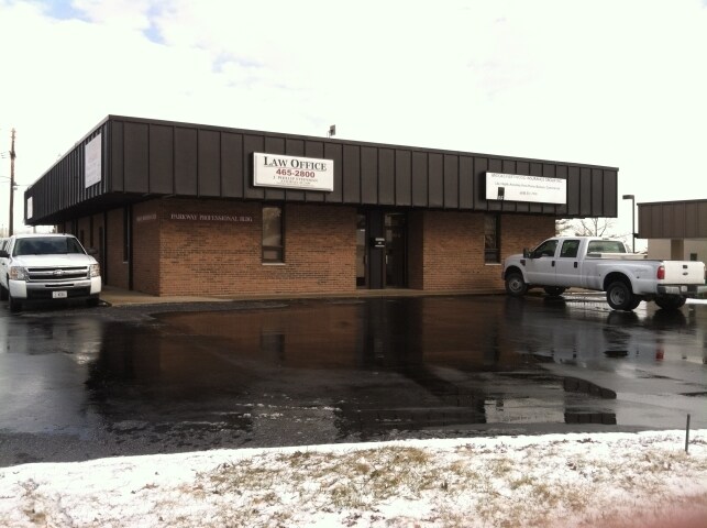
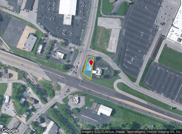
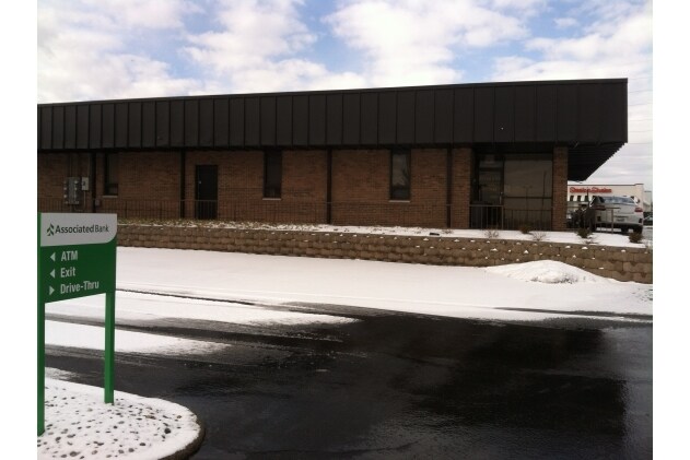
Property Record
100 Homer M Adams Pky, Alton, IL 62002
NEARBY LISTINGS FOR SALE OR LEASE
Property Detail
100 Homer M Adams Pky
St. Louis, MO-IL
TR S PT E1/2 SE
23-1-01-35-20-402-002
Madison
Officebuilding
Illinois
2024
0.44 AC
2024
Illinois
402701
St. Louis
3,523 SF
DEMOGRAPHICS near 100 Homer M Adams Pky
1 Mile
3 Mile
5 Mile
2024 Total Population
5,048
34,778
48,891
2029 Population
4,995
34,604
48,633
Pop Growth 2024-2029
(1.05%)
(0.50%)
(0.53%)
Average Age
41
43
42
2024 Total Households
2,265
15,186
20,999
HH Growth 2024-2029
(1.15%)
(0.57%)
(0.59%)
Median Household Inc
$52,076
$57,243
$58,127
Avg Household Size
2.20
2.20
2.20
2024 Avg HH Vehicles
2.00
2.00
2.00
Median Home Value
$91,110
$128,933
$126,940
Median Year Built
1962
1959
1959
Nearby Places
Map Layers
Map Styles
 Street
 Aerial
- Restaurants
- Banks
- Shops
- Fitness
- Groceries
PUBLIC TRANSPORTATION
COMMUTER RAIL
Alton Amtrak Station (Lincoln Service - Amtrak, Lincoln Service Missouri River Runner - Amtrak, Texas Eagle - Amtrak)
DRIVE
WALK
Distance
Alton Amtrak Station (Lincoln Service - Amtrak, Lincoln Service Missouri River Runner - Amtrak, Texas Eagle - Amtrak)
4 min
1.7 mi
AIRPORT
St Louis Lambert International
DRIVE
WALK
Distance
St Louis Lambert International
33 min
21.9 mi
Freight Ports
Port Milwaukee
DRIVE
WALK
Distance
Port Milwaukee
414 min
358.9 mi
Nearby Properties
Address
Land Use
TOTAL SIZE
Lot Size
Zoning
Address
Land Use
TOTAL SIZE
Lot Size
Zoning
16.14 AC
Address
Land Use
TOTAL SIZE
Lot Size
Zoning
117,520 SF
2.29 AC
Address
Land Use
TOTAL SIZE
Lot Size
Zoning
132,494 SF
18.48 AC
Address
Land Use
TOTAL SIZE
Lot Size
Zoning
Address
Land Use
TOTAL SIZE
Lot Size
Zoning
Address
Land Use
TOTAL SIZE
Lot Size
Zoning
26.24 AC
Address
Land Use
TOTAL SIZE
Lot Size
Zoning
45,834 SF
7.10 AC
Address
Land Use
TOTAL SIZE
Lot Size
Zoning
114,461 SF
9.13 AC
Address
Land Use
TOTAL SIZE
Lot Size
Zoning
87,624 SF
4.28 AC
Address
Land Use
TOTAL SIZE
Lot Size
Zoning
57,492 SF
6.54 AC
Address
Land Use
TOTAL SIZE
Lot Size
Zoning
6,146 SF
9 AC
Address
Land Use
TOTAL SIZE
Lot Size
Zoning
1.90 AC
Address
Land Use
TOTAL SIZE
Lot Size
Zoning
11,828 SF
35.88 AC
Address
Land Use
TOTAL SIZE
Lot Size
Zoning
64,260 SF
3.90 AC
Address
Land Use
TOTAL SIZE
Lot Size
Zoning
58,218 SF
2.82 AC
Address
Land Use
TOTAL SIZE
Lot Size
Zoning
56,684 SF
2.19 AC
Address
Land Use
TOTAL SIZE
Lot Size
Zoning
1.90 AC
Address
Land Use
TOTAL SIZE
Lot Size
Zoning
28,193 SF
4.23 AC
Address
Land Use
TOTAL SIZE
Lot Size
Zoning
Address
Land Use
TOTAL SIZE
Lot Size
Zoning
155,147 SF
14.37 AC
Address
Land Use
TOTAL SIZE
Lot Size
Zoning
105,137 SF
2.60 AC
Address
Land Use
TOTAL SIZE
Lot Size
Zoning
76,022 SF
4.69 AC
Address
Land Use
TOTAL SIZE
Lot Size
Zoning
100,645 SF
8.32 AC
Address
Land Use
TOTAL SIZE
Lot Size
Zoning
38,748 SF
2.32 AC
Address
Land Use
TOTAL SIZE
Lot Size
Zoning
25,152 SF
4.09 AC
Address
Land Use
TOTAL SIZE
Lot Size
Zoning
68,870 SF
9.49 AC
Address
Land Use
TOTAL SIZE
Lot Size
Zoning
51,752 SF
1.53 AC
Address
Land Use
TOTAL SIZE
Lot Size
Zoning
20,684 SF
1.32 AC
Address
Land Use
TOTAL SIZE
Lot Size
Zoning
Address
Land Use
TOTAL SIZE
Lot Size
Zoning
10,968 SF
1.01 AC
The World's #1 Commercial Real Estate Marketplace
Connect with us
© 2025 CoStar Group
The information above has been obtained from sources believed reliable. While we do not doubt its accuracy we have not verified it and make no guarantee, warranty or representation about it. It is your responsibility to independently confirm its accuracy and completeness. Any projections, opinions, assumptions, or estimates used are for example only and do not represent the current or future performance of the property. The value of this transaction to you depends on tax and other factors which should be evaluated by your tax, financial, and legal advisors. You and your advisors should conduct a careful, independent investigation of the property to determine to your satisfaction the suitability of the property for your needs.