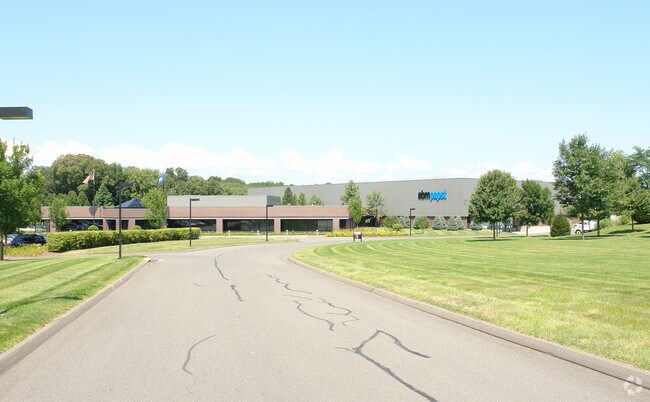
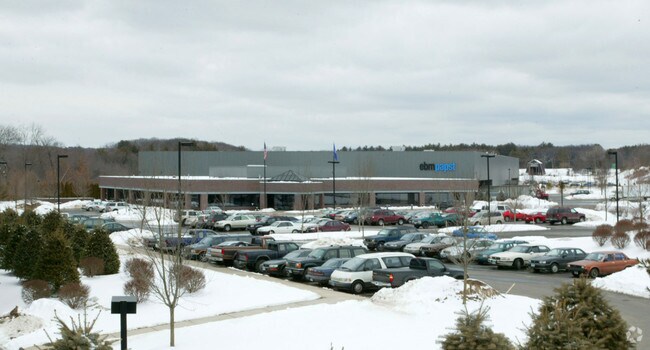
Property Record
100 Hyde Rd, Farmington, CT 06032

Property Detail
100 Hyde Rd
FARM-000148-000002A-000003B
Capitol
Warehouse
Connecticut
CR
3b
B and X Area of moderate flood hazard, usually the area between the limits of the 100-year and 500-year floods.
13 AC
2025
Farmington
2025
Hartford
460204
Hartford-West Hartford-East Hartford, CT
118,424 SF
NEARBY LISTINGS FOR SALE OR LEASE
DEMOGRAPHICS near 100 Hyde Rd
1 mile
3 mile
5 mile
2025 Total Population
3,240
46,354
151,778
2030 Population
3,351
47,363
154,934
Pop Growth 2025-2030
+ 3.43%
+ 2.18%
+ 2.08%
Average Age
45
43
42
2025 Total Households
1,371
19,818
63,583
HH Growth 2025-2030
+ 3.57%
+ 2.16%
+ 2.12%
Median Household Inc
$74,367
$91,146
$79,844
Avg Household Size
2.20
2.30
2.30
2025 Avg HH Vehicles
2.00
2.00
2.00
Median Home Value
$333,482
$294,712
$289,367
Median Year Built
1985
1969
1965
Nearby Places
Map Layers
Map Styles
 Street
 Aerial
Transit
 Traffic
 Biking
Places
Listings with unknown addresses are not visible on the map
- Restaurants
- Banks
- Shops
- Fitness
- Groceries
PUBLIC TRANSPORTATION
COMMUTER RAIL
Drive
Walk
Distance
17 min
8.8 mi
Drive
Walk
Distance
17 min
8.8 mi
AIRPORT
Bradley International
Drive
Walk
Distance
Bradley International
46 min
27.5 mi
Tweed/New Haven
Drive
Walk
Distance
Tweed/New Haven
52 min
33.7 mi
Freight Ports
Port of New Haven
Drive
Walk
Distance
Port of New Haven
47 min
31.1 mi
Nearby Properties
Address
Land Use
TOTAL SIZE
Lot Size
Zoning
Address
Land Use
TOTAL SIZE
Lot Size
Zoning
268,369 SF
13.32 AC
B1
Address
Land Use
TOTAL SIZE
Lot Size
Zoning
146,740 SF
18.23 AC
TPC
Address
Land Use
TOTAL SIZE
Lot Size
Zoning
134,488 SF
63.26 AC
GC
Address
Land Use
TOTAL SIZE
Lot Size
Zoning
64,822 SF
9.47 AC
TP
Address
Land Use
TOTAL SIZE
Lot Size
Zoning
137,242 SF
25.80 AC
R40
Address
Land Use
TOTAL SIZE
Lot Size
Zoning
145,719 SF
17.90 AC
R-15
Address
Land Use
TOTAL SIZE
Lot Size
Zoning
28 AC
CR
Address
Land Use
TOTAL SIZE
Lot Size
Zoning
11.16 AC
R30
Address
Land Use
TOTAL SIZE
Lot Size
Zoning
12 AC
R20
Address
Land Use
TOTAL SIZE
Lot Size
Zoning
120,310 SF
13.43 AC
BR
Address
Land Use
TOTAL SIZE
Lot Size
Zoning
182,930 SF
15.70 AC
SA
Address
Land Use
TOTAL SIZE
Lot Size
Zoning
28.47 AC
R-10
Address
Land Use
TOTAL SIZE
Lot Size
Zoning
48.09 AC
CR
Address
Land Use
TOTAL SIZE
Lot Size
Zoning
288,827 SF
24.01 AC
RI
Address
Land Use
TOTAL SIZE
Lot Size
Zoning
103,886 SF
10.47 AC
BR
Address
Land Use
TOTAL SIZE
Lot Size
Zoning
365.02 AC
CR
Address
Land Use
TOTAL SIZE
Lot Size
Zoning
10.10 AC
RDM
Address
Land Use
TOTAL SIZE
Lot Size
Zoning
54,904 SF
7.01 AC
A
Address
Land Use
TOTAL SIZE
Lot Size
Zoning
25.61 AC
RDM
Address
Land Use
TOTAL SIZE
Lot Size
Zoning
133,673 SF
30.40 AC
R-40
Address
Land Use
TOTAL SIZE
Lot Size
Zoning
29.05 AC
R-20
Address
Land Use
TOTAL SIZE
Lot Size
Zoning
46,768 SF
40.04 AC
R40
Address
Land Use
TOTAL SIZE
Lot Size
Zoning
143,315 SF
4.50 AC
A
Address
Land Use
TOTAL SIZE
Lot Size
Zoning
3,084 SF
14.90 AC
BG
Address
Land Use
TOTAL SIZE
Lot Size
Zoning
46,005 SF
4.60 AC
R20
Address
Land Use
TOTAL SIZE
Lot Size
Zoning
19 AC
GI
Address
Land Use
TOTAL SIZE
Lot Size
Zoning
42,516 SF
10.40 AC
BG
Address
Land Use
TOTAL SIZE
Lot Size
Zoning
168,296 SF
17.94 AC
C1
Address
Land Use
TOTAL SIZE
Lot Size
Zoning
41,011 SF
8.50 AC
BG
Address
Land Use
TOTAL SIZE
Lot Size
Zoning
152,042 SF
8.26 AC
TPC
The World's #1 Commercial Real Estate Marketplace
Connect with us
© 2026 CoStar Group
The information above has been obtained from sources believed reliable. While we do not doubt its accuracy we have not verified it and make no guarantee, warranty or representation about it. It is your responsibility to independently confirm its accuracy and completeness. Any projections, opinions, assumptions, or estimates used are for example only and do not represent the current or future performance of the property. The value of this transaction to you depends on tax and other factors which should be evaluated by your tax, financial, and legal advisors. You and your advisors should conduct a careful, independent investigation of the property to determine to your satisfaction the suitability of the property for your needs.