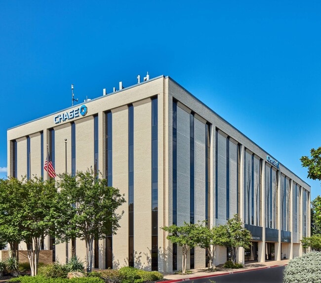
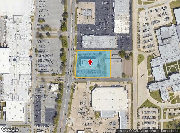
Property Record
100 Independence Pl, Tyler, TX 75703
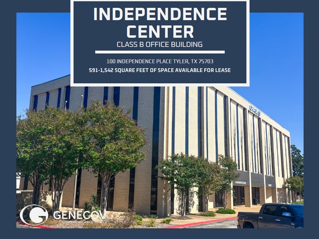
Current Lease Availabilities
NEARBY LISTINGS FOR SALE OR LEASE
Property Detail
100 Independence Pl
Tyler, TX
City Of Tyler
1-50000-1013-00-013030
CITY OF TYLERBLOCK 1013 LOT 13C
Officebuilding
Smith
X
Texas
48423C0370D
13c
2024
2.70 AC
2025
Tyler & Longview
002004
Other Market Areas
57,048 SF
DEMOGRAPHICS near 100 Independence Pl
1 Mile
3 Mile
5 Mile
2024 Total Population
7,141
63,869
109,975
2029 Population
7,682
69,185
119,737
Pop Growth 2024-2029
+ 7.58%
+ 8.32%
+ 8.88%
Average Age
43
39
38
2024 Total Households
3,167
27,068
43,583
HH Growth 2024-2029
+ 7.07%
+ 7.80%
+ 8.36%
Median Household Inc
$70,542
$63,285
$60,733
Avg Household Size
2.20
2.20
2.40
2024 Avg HH Vehicles
2.00
2.00
2.00
Median Home Value
$254,413
$224,026
$202,357
Median Year Built
1980
1982
1982
Nearby Places
- Restaurants
- Banks
- Shops
- Fitness
- Groceries
PUBLIC TRANSPORTATION
AIRPORT
Tyler Pounds Regional
DRIVE
WALK
Distance
Tyler Pounds Regional
19 min
11.1 mi
Freight Ports
Port of Shreveport
DRIVE
WALK
Distance
Port of Shreveport
125 min
110.6 mi
Nearby Properties
Address
Land Use
TOTAL SIZE
Lot Size
Zoning
Address
Land Use
TOTAL SIZE
Lot Size
Zoning
503,620 SF
11.42 AC
Address
Land Use
TOTAL SIZE
Lot Size
Zoning
1.47 AC
RMF
Address
Land Use
TOTAL SIZE
Lot Size
Zoning
33,409 SF
151.32 AC
M2
Address
Land Use
TOTAL SIZE
Lot Size
Zoning
9.98 AC
Address
Land Use
TOTAL SIZE
Lot Size
Zoning
18.37 AC
R1A
Address
Land Use
TOTAL SIZE
Lot Size
Zoning
403,396 SF
45.40 AC
C4
Address
Land Use
TOTAL SIZE
Lot Size
Zoning
49,544 SF
28.64 AC
Address
Land Use
TOTAL SIZE
Lot Size
Zoning
168,390 SF
7.51 AC
Address
Land Use
TOTAL SIZE
Lot Size
Zoning
24.83 AC
Address
Land Use
TOTAL SIZE
Lot Size
Zoning
234,762 SF
16.68 AC
Address
Land Use
TOTAL SIZE
Lot Size
Zoning
5,068 SF
18.35 AC
RMF
Address
Land Use
TOTAL SIZE
Lot Size
Zoning
448,500 SF
2.90 AC
INT
Address
Land Use
TOTAL SIZE
Lot Size
Zoning
4,333 SF
13.32 AC
Address
Land Use
TOTAL SIZE
Lot Size
Zoning
25 AC
INT
Address
Land Use
TOTAL SIZE
Lot Size
Zoning
3,149 SF
16.15 AC
RMF
Address
Land Use
TOTAL SIZE
Lot Size
Zoning
4,349 SF
33.26 AC
RMF
Address
Land Use
TOTAL SIZE
Lot Size
Zoning
213,323 SF
1.21 AC
Address
Land Use
TOTAL SIZE
Lot Size
Zoning
Address
Land Use
TOTAL SIZE
Lot Size
Zoning
163,161 SF
2.67 AC
Address
Land Use
TOTAL SIZE
Lot Size
Zoning
20,071 SF
7.43 AC
Address
Land Use
TOTAL SIZE
Lot Size
Zoning
3,189 SF
11.17 AC
RMF
Address
Land Use
TOTAL SIZE
Lot Size
Zoning
66.86 AC
R1A
Address
Land Use
TOTAL SIZE
Lot Size
Zoning
10.51 AC
Address
Land Use
TOTAL SIZE
Lot Size
Zoning
38,900 SF
20.11 AC
INT
Address
Land Use
TOTAL SIZE
Lot Size
Zoning
37,536 SF
16.81 AC
RMF
Address
Land Use
TOTAL SIZE
Lot Size
Zoning
88,964 SF
11.33 AC
Address
Land Use
TOTAL SIZE
Lot Size
Zoning
111,030 SF
1.02 AC
Address
Land Use
TOTAL SIZE
Lot Size
Zoning
1,867 SF
13.63 AC
RMF
Address
Land Use
TOTAL SIZE
Lot Size
Zoning
3,968 SF
12.04 AC
RMF
Address
Land Use
TOTAL SIZE
Lot Size
Zoning
43,692 SF
4.02 AC
The World's #1 Commercial Real Estate Marketplace
Connect with us
© 2025 CoStar Group
The information above has been obtained from sources believed reliable. While we do not doubt its accuracy we have not verified it and make no guarantee, warranty or representation about it. It is your responsibility to independently confirm its accuracy and completeness. Any projections, opinions, assumptions, or estimates used are for example only and do not represent the current or future performance of the property. The value of this transaction to you depends on tax and other factors which should be evaluated by your tax, financial, and legal advisors. You and your advisors should conduct a careful, independent investigation of the property to determine to your satisfaction the suitability of the property for your needs.