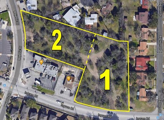
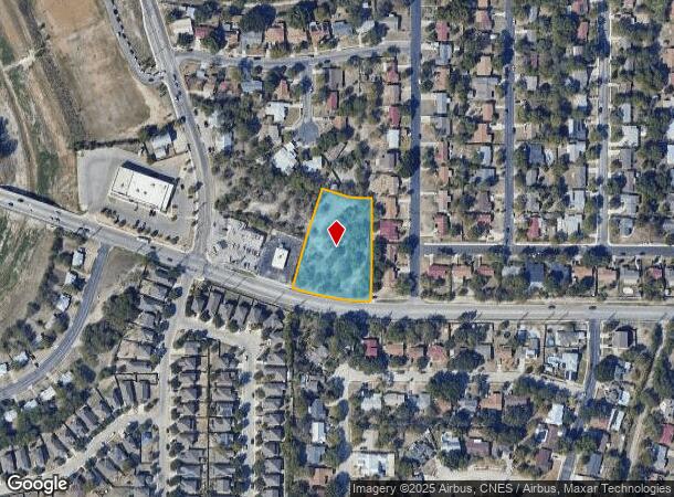
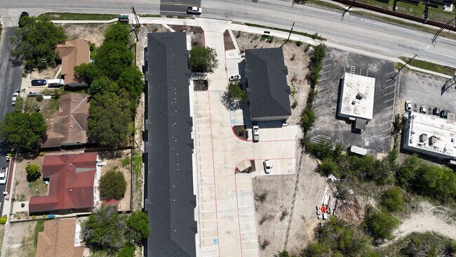
Property Record
100 Ingram Rd, San Antonio, TX 78228
NEARBY LISTINGS FOR SALE OR LEASE
Property Detail
100 Ingram Rd
San Antonio-New Braunfels, TX
Thunderbird Village Unit 3
14144-002-0110
NCB 14144 BLK 2 LOT 11
Multifamilydwelling
Bexar
X
Texas
48029C0380G
11
2024
1.37 AC
2025
Northwest
180400
San Antonio
26,282 SF
DEMOGRAPHICS near 100 Ingram Rd
1 mile
3 mile
5 mile
2024 Total Population
16,486
118,722
363,695
2029 Population
17,412
125,685
385,165
Pop Growth 2024-2029
+ 5.62%
+ 5.86%
+ 5.90%
Average Age
39
37
37
2024 Total Households
5,901
44,978
139,360
HH Growth 2024-2029
+ 5.74%
+ 6.12%
+ 6.17%
Median Household Inc
$42,067
$43,799
$46,365
Avg Household Size
2.70
2.60
2.50
2024 Avg HH Vehicles
2.00
2.00
2.00
Median Home Value
$150,972
$153,087
$158,496
Median Year Built
1975
1975
1978
Nearby Places
Map Layers
Map Styles
 Street
 Aerial
Transit
 Traffic
 Biking
Places
Listings with unknown addresses are not visible on the map
- Restaurants
- Banks
- Shops
- Fitness
- Groceries
PUBLIC TRANSPORTATION
COMMUTER RAIL
Drive
Walk
Distance
18 min
8.8 mi
AIRPORT
San Antonio International
Drive
Walk
Distance
San Antonio International
16 min
10.3 mi
SALE & LEASE HISTORY
LISTING DATE
SALE/LEASE

Sep 23, 2025
For Sale
Jul 18, 2022
For Sale
Nearby Properties
Address
Land Use
TOTAL SIZE
Lot Size
Zoning
Address
Land Use
TOTAL SIZE
Lot Size
Zoning
370,870 SF
27.27 AC
Address
Land Use
TOTAL SIZE
Lot Size
Zoning
541,776 SF
22.15 AC
Address
Land Use
TOTAL SIZE
Lot Size
Zoning
97.47 AC
Address
Land Use
TOTAL SIZE
Lot Size
Zoning
109,425 SF
30.63 AC
Address
Land Use
TOTAL SIZE
Lot Size
Zoning
324,044 SF
16.87 AC
Address
Land Use
TOTAL SIZE
Lot Size
Zoning
326,820 SF
12.57 AC
Address
Land Use
TOTAL SIZE
Lot Size
Zoning
284,359 SF
21.53 AC
Address
Land Use
TOTAL SIZE
Lot Size
Zoning
227,744 SF
3.99 AC
Address
Land Use
TOTAL SIZE
Lot Size
Zoning
213,968 SF
21.30 AC
Address
Land Use
TOTAL SIZE
Lot Size
Zoning
253,862 SF
14.78 AC
Address
Land Use
TOTAL SIZE
Lot Size
Zoning
285,150 SF
13.62 AC
Address
Land Use
TOTAL SIZE
Lot Size
Zoning
340,653 SF
19.27 AC
Address
Land Use
TOTAL SIZE
Lot Size
Zoning
243,251 SF
10 AC
Address
Land Use
TOTAL SIZE
Lot Size
Zoning
536,162 SF
25.11 AC
Address
Land Use
TOTAL SIZE
Lot Size
Zoning
291,385 SF
16.19 AC
Address
Land Use
TOTAL SIZE
Lot Size
Zoning
388,553 SF
29 AC
Address
Land Use
TOTAL SIZE
Lot Size
Zoning
441,830 SF
21.50 AC
Address
Land Use
TOTAL SIZE
Lot Size
Zoning
291,713 SF
14.51 AC
Address
Land Use
TOTAL SIZE
Lot Size
Zoning
66,404 SF
44.45 AC
Address
Land Use
TOTAL SIZE
Lot Size
Zoning
302,836 SF
15.96 AC
Address
Land Use
TOTAL SIZE
Lot Size
Zoning
279,178 SF
14.87 AC
Address
Land Use
TOTAL SIZE
Lot Size
Zoning
72.43 AC
Address
Land Use
TOTAL SIZE
Lot Size
Zoning
252,361 SF
14.35 AC
Address
Land Use
TOTAL SIZE
Lot Size
Zoning
Address
Land Use
TOTAL SIZE
Lot Size
Zoning
211,255 SF
12.36 AC
Address
Land Use
TOTAL SIZE
Lot Size
Zoning
171,986 SF
6.86 AC
Address
Land Use
TOTAL SIZE
Lot Size
Zoning
212,038 SF
14.44 AC
Address
Land Use
TOTAL SIZE
Lot Size
Zoning
186,948 SF
9.58 AC
Address
Land Use
TOTAL SIZE
Lot Size
Zoning
184,262 SF
6.13 AC
Address
Land Use
TOTAL SIZE
Lot Size
Zoning
110,468 SF
6.82 AC
The World's #1 Commercial Real Estate Marketplace
Connect with us
© 2026 CoStar Group
The information above has been obtained from sources believed reliable. While we do not doubt its accuracy we have not verified it and make no guarantee, warranty or representation about it. It is your responsibility to independently confirm its accuracy and completeness. Any projections, opinions, assumptions, or estimates used are for example only and do not represent the current or future performance of the property. The value of this transaction to you depends on tax and other factors which should be evaluated by your tax, financial, and legal advisors. You and your advisors should conduct a careful, independent investigation of the property to determine to your satisfaction the suitability of the property for your needs.