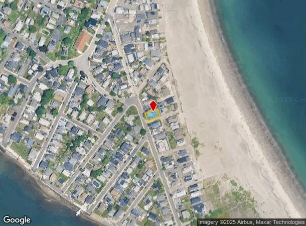
Property Record
66 Tafts Ave, Winthrop, MA 02152

Current Lease Availabilities
NEARBY LISTINGS FOR SALE OR LEASE
-
-
View all Winthrop listings for lease on LoopNet.com
Property Detail
66 Tafts Ave
Boston-Cambridge-Newton, MA-NH
Suffolk
WINT-000003-000000-000051
Massachusetts
Sfr
0.09 AC
AE
Somerville/Chelsea
25025C0101J
Boston
2,684 SF
DEMOGRAPHICS near 66 Tafts Ave
1 Mile
3 Mile
5 Mile
2024 Total Population
35,936
343,702
786,382
2029 Population
34,154
330,277
760,975
Pop Growth 2024-2029
(4.96%)
(3.91%)
(3.23%)
Average Age
37
38
37
2024 Total Households
12,470
142,457
327,133
HH Growth 2024-2029
(5.12%)
(3.86%)
(3.34%)
Median Household Inc
$68,325
$88,285
$94,483
Avg Household Size
2.70
2.30
2.20
2024 Avg HH Vehicles
1.00
1.00
1.00
Median Home Value
$454,340
$697,124
$751,165
Median Year Built
1948
1950
1949
Nearby Places
- Restaurants
- Banks
- Shops
- Fitness
- Groceries
PUBLIC TRANSPORTATION
COMMUTER RAIL
Chelsea (Newburyport/Rockport Line - MBTA)
DRIVE
WALK
Distance
Chelsea (Newburyport/Rockport Line - MBTA)
14 min
7.4 mi
South Station (Fairmount Line - Massachusetts Bay Transportation Authority Commuter Rail (Purple Line), Framingham/Worcester Line - Massachusetts Bay Transportation Authority Commuter Rail (Purple Line), Franklin Line - Massachusetts Bay Transportation Authority Commuter Rail (Purple Line), Greenbush Line - Massachusetts Bay Transportation Authority Commuter Rail (Purple Line), Kingston/Plymouth Line - Massachusetts Bay Transportation Authority Commuter Rail (Purple Line), Middleborough/Lakeville Line - Massachusetts Bay Transportation Authority Commuter Rail (Purple Line), Needham Line - Massachusetts Bay Transportation Authority Commuter Rail (Purple Line), Providence/Stoughton Line - Massachusetts Bay Transportation Authority Commuter Rail (Purple Line))
DRIVE
WALK
Distance
South Station (Fairmount Line - Massachusetts Bay Transportation Authority Commuter Rail (Purple Line), Framingham/Worcester Line - Massachusetts Bay Transportation Authority Commuter Rail (Purple Line), Franklin Line - Massachusetts Bay Transportation Authority Commuter Rail (Purple Line), Greenbush Line - Massachusetts Bay Transportation Authority Commuter Rail (Purple Line), Kingston/Plymouth Line - Massachusetts Bay Transportation Authority Commuter Rail (Purple Line), Middleborough/Lakeville Line - Massachusetts Bay Transportation Authority Commuter Rail (Purple Line), Needham Line - Massachusetts Bay Transportation Authority Commuter Rail (Purple Line), Providence/Stoughton Line - Massachusetts Bay Transportation Authority Commuter Rail (Purple Line))
16 min
8.4 mi
AIRPORT
General Edward Lawrence Logan International
DRIVE
WALK
Distance
General Edward Lawrence Logan International
12 min
6.6 mi
Freight Ports
Port of Boston
DRIVE
WALK
Distance
Port of Boston
18 min
9.2 mi
Nearby Properties
Address
Land Use
TOTAL SIZE
Lot Size
Zoning
Address
Land Use
TOTAL SIZE
Lot Size
Zoning
171,791 SF
166.88 AC
E
Address
Land Use
TOTAL SIZE
Lot Size
Zoning
164,959 SF
96.81 AC
E
Address
Land Use
TOTAL SIZE
Lot Size
Zoning
102.18 AC
E
Address
Land Use
TOTAL SIZE
Lot Size
Zoning
10.52 AC
C
Address
Land Use
TOTAL SIZE
Lot Size
Zoning
154.16 AC
E
Address
Land Use
TOTAL SIZE
Lot Size
Zoning
5,668 SF
20.05 AC
A
Address
Land Use
TOTAL SIZE
Lot Size
Zoning
391,884 SF
108.79 AC
C
Address
Land Use
TOTAL SIZE
Lot Size
Zoning
28,858 SF
32.04 AC
E
Address
Land Use
TOTAL SIZE
Lot Size
Zoning
214,895 SF
3.30 AC
A
Address
Land Use
TOTAL SIZE
Lot Size
Zoning
192,031 SF
8.34 AC
Address
Land Use
TOTAL SIZE
Lot Size
Zoning
81.22 AC
E
Address
Land Use
TOTAL SIZE
Lot Size
Zoning
84,855 SF
10.25 AC
Address
Land Use
TOTAL SIZE
Lot Size
Zoning
135,379 SF
15.05 AC
RB
Address
Land Use
TOTAL SIZE
Lot Size
Zoning
157,000 SF
3.25 AC
I
Address
Land Use
TOTAL SIZE
Lot Size
Zoning
84,614 SF
1.28 AC
Address
Land Use
TOTAL SIZE
Lot Size
Zoning
101,304 SF
3.09 AC
E
Address
Land Use
TOTAL SIZE
Lot Size
Zoning
189,098 SF
0.24 AC
Address
Land Use
TOTAL SIZE
Lot Size
Zoning
87,150 SF
26.62 AC
E
Address
Land Use
TOTAL SIZE
Lot Size
Zoning
24.56 AC
E
Address
Land Use
TOTAL SIZE
Lot Size
Zoning
44,360 SF
1.35 AC
E
Address
Land Use
TOTAL SIZE
Lot Size
Zoning
39.99 AC
Address
Land Use
TOTAL SIZE
Lot Size
Zoning
22.95 AC
E
Address
Land Use
TOTAL SIZE
Lot Size
Zoning
57,766 SF
1.86 AC
I
Address
Land Use
TOTAL SIZE
Lot Size
Zoning
10,124 SF
10.26 AC
Address
Land Use
TOTAL SIZE
Lot Size
Zoning
97,988 SF
0.69 AC
GB
Address
Land Use
TOTAL SIZE
Lot Size
Zoning
100 SF
2.97 AC
EA
Address
Land Use
TOTAL SIZE
Lot Size
Zoning
27.71 AC
E
Address
Land Use
TOTAL SIZE
Lot Size
Zoning
28,477 SF
0.32 AC
Address
Land Use
TOTAL SIZE
Lot Size
Zoning
110,651 SF
2.54 AC
Address
Land Use
TOTAL SIZE
Lot Size
Zoning
41,388 SF
1.26 AC
E
The World's #1 Commercial Real Estate Marketplace
Connect with us
© 2025 CoStar Group
The information above has been obtained from sources believed reliable. While we do not doubt its accuracy we have not verified it and make no guarantee, warranty or representation about it. It is your responsibility to independently confirm its accuracy and completeness. Any projections, opinions, assumptions, or estimates used are for example only and do not represent the current or future performance of the property. The value of this transaction to you depends on tax and other factors which should be evaluated by your tax, financial, and legal advisors. You and your advisors should conduct a careful, independent investigation of the property to determine to your satisfaction the suitability of the property for your needs.