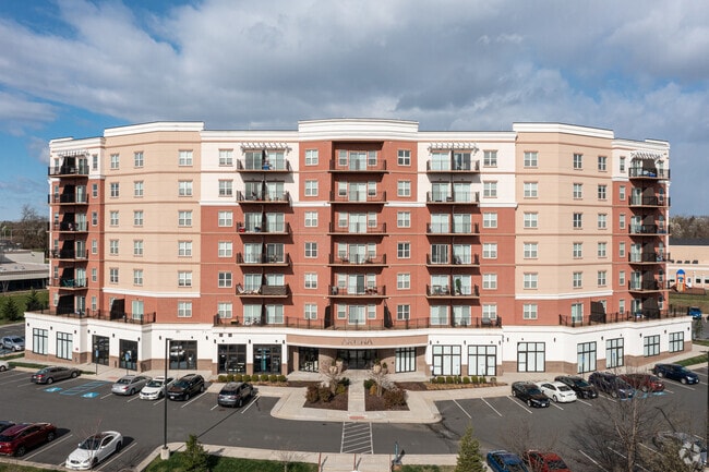
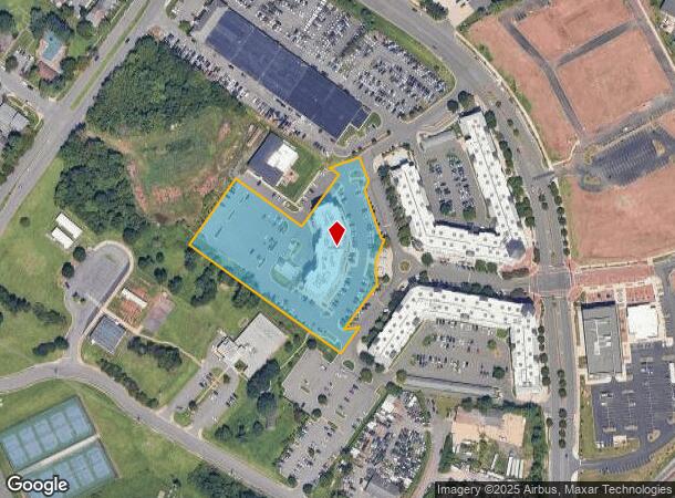
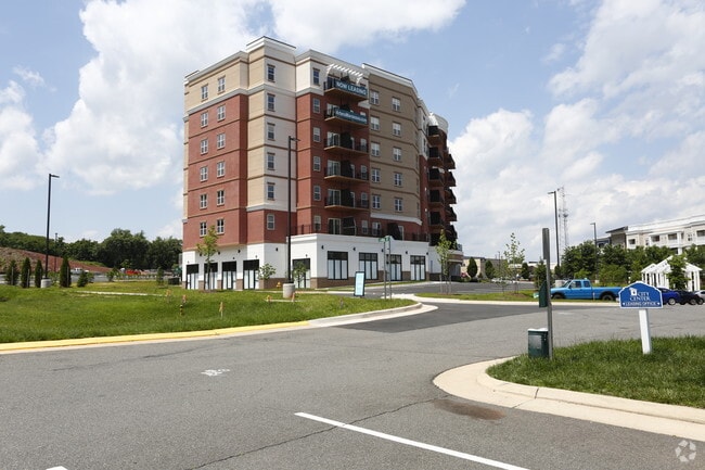
Property Record
100 Lara St, Manassas, VA 20111
NEARBY LISTINGS FOR SALE OR LEASE
Property Detail
100 Lara St
Washington-Arlington-Alexandria, DC-VA-MD-WV
Park Center
24-A-1A
Manassas Park
Apartment
Virginia
X
1a
51059C0240E
3.43 AC
0
Manassas Park
2025
Washington, DC
9019004
DEMOGRAPHICS near 100 Lara St
1 Mile
3 Mile
5 Mile
2024 Total Population
14,503
87,179
178,350
2029 Population
14,275
86,996
178,648
Pop Growth 2024-2029
(1.57%)
(0.21%)
+ 0.17%
Average Age
36
36
36
2024 Total Households
4,853
27,079
57,380
HH Growth 2024-2029
(1.69%)
(0.28%)
+ 0.11%
Median Household Inc
$96,189
$100,934
$109,353
Avg Household Size
2.90
3.10
3.00
2024 Avg HH Vehicles
2.00
2.00
2.00
Median Home Value
$422,102
$390,815
$425,337
Median Year Built
1998
1984
1987
Nearby Places
- Restaurants
- Banks
- Shops
- Fitness
- Groceries
SALE & LEASE HISTORY
LISTING DATE
SALE/LEASE

Jun 30, 2017
For Lease
Feb 06, 2019
For Lease
Nearby Properties
Address
Land Use
TOTAL SIZE
Lot Size
Zoning
Address
Land Use
TOTAL SIZE
Lot Size
Zoning
347,876 SF
23.23 AC
PBD
Address
Land Use
TOTAL SIZE
Lot Size
Zoning
233,757 SF
15.54 AC
PBD
Address
Land Use
TOTAL SIZE
Lot Size
Zoning
216,067 SF
15.85 AC
PBD
Address
Land Use
TOTAL SIZE
Lot Size
Zoning
213,320 SF
31.06 AC
PBD
Address
Land Use
TOTAL SIZE
Lot Size
Zoning
824,085 SF
120.07 AC
MIXED
Address
Land Use
TOTAL SIZE
Lot Size
Zoning
127,000 SF
12.40 AC
M2
Address
Land Use
TOTAL SIZE
Lot Size
Zoning
440,331 SF
61.47 AC
M1
Address
Land Use
TOTAL SIZE
Lot Size
Zoning
270,540 SF
13.65 AC
PBD
Address
Land Use
TOTAL SIZE
Lot Size
Zoning
382,368 SF
18.40 AC
PMR
Address
Land Use
TOTAL SIZE
Lot Size
Zoning
402,295 SF
8.50 AC
A1
Address
Land Use
TOTAL SIZE
Lot Size
Zoning
23.93 AC
PUD
Address
Land Use
TOTAL SIZE
Lot Size
Zoning
203,544 SF
20.90 AC
GENERAL CO
Address
Land Use
TOTAL SIZE
Lot Size
Zoning
529,436 SF
24.63 AC
MIXED
Address
Land Use
TOTAL SIZE
Lot Size
Zoning
10.62 AC
PUD
Address
Land Use
TOTAL SIZE
Lot Size
Zoning
18,128 SF
MULTI-FAMI
Address
Land Use
TOTAL SIZE
Lot Size
Zoning
198,708 SF
16.21 AC
MULTI-FAMI
Address
Land Use
TOTAL SIZE
Lot Size
Zoning
349,608 SF
60.83 AC
A1
Address
Land Use
TOTAL SIZE
Lot Size
Zoning
31,032 SF
15.29 AC
MULTI-FAMI
Address
Land Use
TOTAL SIZE
Lot Size
Zoning
3.49 AC
MU-D
Address
Land Use
TOTAL SIZE
Lot Size
Zoning
23.26 AC
PBD
Address
Land Use
TOTAL SIZE
Lot Size
Zoning
205,000 SF
37.08 AC
LOW DENSIT
Address
Land Use
TOTAL SIZE
Lot Size
Zoning
3.41 AC
MU-D
Address
Land Use
TOTAL SIZE
Lot Size
Zoning
140,188 SF
12.76 AC
CITY CENTE
Address
Land Use
TOTAL SIZE
Lot Size
Zoning
325,000 SF
27.97 AC
SMALL LOTS
Address
Land Use
TOTAL SIZE
Lot Size
Zoning
45,585 SF
17.95 AC
GENERAL CO
Address
Land Use
TOTAL SIZE
Lot Size
Zoning
74,450 SF
2.91 AC
CITY CENTE
Address
Land Use
TOTAL SIZE
Lot Size
Zoning
159,940 SF
30 AC
R4
Address
Land Use
TOTAL SIZE
Lot Size
Zoning
71,303 SF
0.54 AC
GENERAL CO
Address
Land Use
TOTAL SIZE
Lot Size
Zoning
8,562 SF
13.50 AC
MULTI-FAMI
Address
Land Use
TOTAL SIZE
Lot Size
Zoning
188,800 SF
17.11 AC
M2
The World's #1 Commercial Real Estate Marketplace
Connect with us
© 2025 CoStar Group
The information above has been obtained from sources believed reliable. While we do not doubt its accuracy we have not verified it and make no guarantee, warranty or representation about it. It is your responsibility to independently confirm its accuracy and completeness. Any projections, opinions, assumptions, or estimates used are for example only and do not represent the current or future performance of the property. The value of this transaction to you depends on tax and other factors which should be evaluated by your tax, financial, and legal advisors. You and your advisors should conduct a careful, independent investigation of the property to determine to your satisfaction the suitability of the property for your needs.