Property Record
100 Lorentz Ave, Peoria, IL 61614


NEARBY LISTINGS FOR SALE OR LEASE
Property Detail
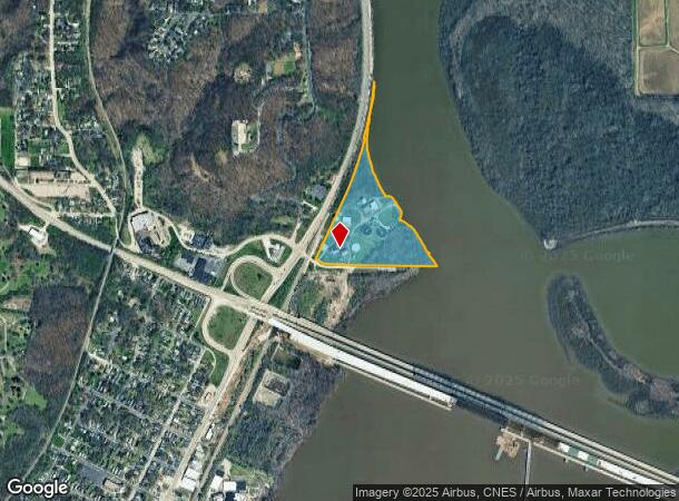
100 Lorentz Ave
Peoria, IL
SE 1/4 SEC 26-9-8E 17.415 AC ALL OF THE SE 1/4 SEC 26 LYING ELY OF E LN CRI&P (NOW L&R) RR ROW (EXC ROUTE 150 ROW AS DESC PER DOC #95- 19588)
14-26-476-001
Peoria
Utilities
Illinois
2024
17.42 AC
2024
North Peoria
002600
Peoria
DEMOGRAPHICS near 100 Lorentz Ave
1 Mile
3 Mile
5 Mile
2024 Total Population
1,455
39,782
107,051
2029 Population
1,447
39,349
105,447
Pop Growth 2024-2029
(0.55%)
(1.09%)
(1.50%)
Average Age
39
39
40
2024 Total Households
592
16,907
45,754
HH Growth 2024-2029
(1.18%)
(1.34%)
(1.70%)
Median Household Inc
$35,878
$48,358
$49,704
Avg Household Size
2.30
2.20
2.20
2024 Avg HH Vehicles
1.00
2.00
2.00
Median Home Value
$79,577
$109,120
$126,116
Median Year Built
1952
1952
1958
Nearby Places
Map Layers
Map Styles
 Street
 Aerial
- Restaurants
- Banks
- Shops
- Fitness
- Groceries
PUBLIC TRANSPORTATION
AIRPORT
General Downing - Peoria International
DRIVE
WALK
Distance
General Downing - Peoria International
19 min
9.7 mi
Freight Ports
Port Milwaukee
DRIVE
WALK
Distance
Port Milwaukee
264 min
221.7 mi
Nearby Properties
Address
Land Use
TOTAL SIZE
Lot Size
Zoning
Address
Land Use
TOTAL SIZE
Lot Size
Zoning
22.13 AC
Address
Land Use
TOTAL SIZE
Lot Size
Zoning
0.91 AC
Address
Land Use
TOTAL SIZE
Lot Size
Zoning
0.57 AC
Address
Land Use
TOTAL SIZE
Lot Size
Zoning
1.32 AC
Address
Land Use
TOTAL SIZE
Lot Size
Zoning
0.22 AC
Address
Land Use
TOTAL SIZE
Lot Size
Zoning
Address
Land Use
TOTAL SIZE
Lot Size
Zoning
5.50 AC
Address
Land Use
TOTAL SIZE
Lot Size
Zoning
Address
Land Use
TOTAL SIZE
Lot Size
Zoning
Address
Land Use
TOTAL SIZE
Lot Size
Zoning
18.21 AC
Address
Land Use
TOTAL SIZE
Lot Size
Zoning
80,102 SF
2 AC
Address
Land Use
TOTAL SIZE
Lot Size
Zoning
69,113 SF
9.83 AC
Address
Land Use
TOTAL SIZE
Lot Size
Zoning
0.94 AC
Address
Land Use
TOTAL SIZE
Lot Size
Zoning
283,737 SF
23.37 AC
Address
Land Use
TOTAL SIZE
Lot Size
Zoning
69,777 SF
2.92 AC
Address
Land Use
TOTAL SIZE
Lot Size
Zoning
21.34 AC
Address
Land Use
TOTAL SIZE
Lot Size
Zoning
47,352 SF
Address
Land Use
TOTAL SIZE
Lot Size
Zoning
5.73 AC
Address
Land Use
TOTAL SIZE
Lot Size
Zoning
Address
Land Use
TOTAL SIZE
Lot Size
Zoning
Address
Land Use
TOTAL SIZE
Lot Size
Zoning
0.90 AC
Address
Land Use
TOTAL SIZE
Lot Size
Zoning
Address
Land Use
TOTAL SIZE
Lot Size
Zoning
114,680 SF
7.34 AC
Address
Land Use
TOTAL SIZE
Lot Size
Zoning
Address
Land Use
TOTAL SIZE
Lot Size
Zoning
0.82 AC
Address
Land Use
TOTAL SIZE
Lot Size
Zoning
Address
Land Use
TOTAL SIZE
Lot Size
Zoning
1.12 AC
Address
Land Use
TOTAL SIZE
Lot Size
Zoning
26.62 AC
The World's #1 Commercial Real Estate Marketplace
Connect with us
© 2026 CoStar Group
The information above has been obtained from sources believed reliable. While we do not doubt its accuracy we have not verified it and make no guarantee, warranty or representation about it. It is your responsibility to independently confirm its accuracy and completeness. Any projections, opinions, assumptions, or estimates used are for example only and do not represent the current or future performance of the property. The value of this transaction to you depends on tax and other factors which should be evaluated by your tax, financial, and legal advisors. You and your advisors should conduct a careful, independent investigation of the property to determine to your satisfaction the suitability of the property for your needs.