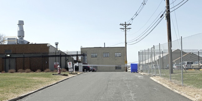
Property Record
100 Mettlers Rd, Somerset, NJ 08873

NEARBY LISTINGS FOR SALE OR LEASE
Property Detail
100 Mettlers Rd
08-00512-0000-00011-01
Somerset
Vacantlandnec
New Jersey
X
11.4
34035C0164F
10.36 AC
2024
Somerset
2025
Northern New Jersey
053501
Newark, NJ-PA
3,897 SF
DEMOGRAPHICS near 100 Mettlers Rd
1 Mile
3 Mile
5 Mile
2024 Total Population
2,528
35,520
138,103
2029 Population
2,548
35,473
138,204
Pop Growth 2024-2029
+ 0.79%
(0.13%)
+ 0.07%
Average Age
66
45
42
2024 Total Households
1,357
13,977
51,619
HH Growth 2024-2029
+ 0.81%
(0.13%)
+ 0.10%
Median Household Inc
$90,547
$111,226
$107,959
Avg Household Size
1.90
2.50
2.60
2024 Avg HH Vehicles
2.00
2.00
2.00
Median Home Value
$458,449
$417,973
$387,487
Median Year Built
2007
1988
1977
Nearby Places
Map Layers
Map Styles
 Street
 Aerial
- Restaurants
- Banks
- Shops
- Fitness
- Groceries
PUBLIC TRANSPORTATION
COMMUTER RAIL
Bound Brook (Raritan Valley Line - NJ Transit Commuter Rail (NJ Transit))
DRIVE
WALK
Distance
Bound Brook (Raritan Valley Line - NJ Transit Commuter Rail (NJ Transit))
13 min
4.9 mi
Bridgewater (Raritan Valley Line - NJ Transit Commuter Rail (NJ Transit))
DRIVE
WALK
Distance
Bridgewater (Raritan Valley Line - NJ Transit Commuter Rail (NJ Transit))
16 min
6.6 mi
AIRPORT
Trenton Mercer
DRIVE
WALK
Distance
Trenton Mercer
51 min
27.9 mi
Newark Liberty International
DRIVE
WALK
Distance
Newark Liberty International
50 min
35.9 mi
Freight Ports
New York Container Terminal
DRIVE
WALK
Distance
New York Container Terminal
44 min
30.2 mi
Nearby Properties
Address
Land Use
TOTAL SIZE
Lot Size
Zoning
Address
Land Use
TOTAL SIZE
Lot Size
Zoning
6,625 SF
22.51 AC
B-I
Address
Land Use
TOTAL SIZE
Lot Size
Zoning
70.22 AC
B-I
Address
Land Use
TOTAL SIZE
Lot Size
Zoning
17.01 AC
B-I
Address
Land Use
TOTAL SIZE
Lot Size
Zoning
19.46 AC
B-I
Address
Land Use
TOTAL SIZE
Lot Size
Zoning
31.50 AC
B-I
Address
Land Use
TOTAL SIZE
Lot Size
Zoning
22.36 AC
PAC
Address
Land Use
TOTAL SIZE
Lot Size
Zoning
2,450 SF
26.84 AC
B-I
Address
Land Use
TOTAL SIZE
Lot Size
Zoning
153 AC
Address
Land Use
TOTAL SIZE
Lot Size
Zoning
26.23 AC
B-I
Address
Land Use
TOTAL SIZE
Lot Size
Zoning
32.92 AC
B-I
Address
Land Use
TOTAL SIZE
Lot Size
Zoning
Address
Land Use
TOTAL SIZE
Lot Size
Zoning
82.79 AC
M-2
Address
Land Use
TOTAL SIZE
Lot Size
Zoning
2,488 SF
16.46 AC
PAC
Address
Land Use
TOTAL SIZE
Lot Size
Zoning
26.53 AC
B-I
Address
Land Use
TOTAL SIZE
Lot Size
Zoning
7,475 SF
20.98 AC
B-I
Address
Land Use
TOTAL SIZE
Lot Size
Zoning
17.65 AC
B-I
Address
Land Use
TOTAL SIZE
Lot Size
Zoning
235,855 SF
14.48 AC
B-I
Address
Land Use
TOTAL SIZE
Lot Size
Zoning
19.63 AC
B-I
Address
Land Use
TOTAL SIZE
Lot Size
Zoning
7,580 SF
22 AC
B-I
Address
Land Use
TOTAL SIZE
Lot Size
Zoning
34.20 AC
B-I
Address
Land Use
TOTAL SIZE
Lot Size
Zoning
34.43 AC
B-I
Address
Land Use
TOTAL SIZE
Lot Size
Zoning
605 SF
26.79 AC
B-I
Address
Land Use
TOTAL SIZE
Lot Size
Zoning
14.06 AC
GV
Address
Land Use
TOTAL SIZE
Lot Size
Zoning
15.24 AC
B-I
Address
Land Use
TOTAL SIZE
Lot Size
Zoning
9,880 SF
17.36 AC
B-I
Address
Land Use
TOTAL SIZE
Lot Size
Zoning
152,175 SF
22.04 AC
B-I
Address
Land Use
TOTAL SIZE
Lot Size
Zoning
12,003 SF
14 AC
B-I
Address
Land Use
TOTAL SIZE
Lot Size
Zoning
48.12 AC
B-I
Address
Land Use
TOTAL SIZE
Lot Size
Zoning
27.06 AC
GV
Address
Land Use
TOTAL SIZE
Lot Size
Zoning
329,614 SF
23.82 AC
B-I
The World's #1 Commercial Real Estate Marketplace
Connect with us
© 2026 CoStar Group
The information above has been obtained from sources believed reliable. While we do not doubt its accuracy we have not verified it and make no guarantee, warranty or representation about it. It is your responsibility to independently confirm its accuracy and completeness. Any projections, opinions, assumptions, or estimates used are for example only and do not represent the current or future performance of the property. The value of this transaction to you depends on tax and other factors which should be evaluated by your tax, financial, and legal advisors. You and your advisors should conduct a careful, independent investigation of the property to determine to your satisfaction the suitability of the property for your needs.