Property Record
100 Mount Clinton Pike, Harrisonburg, VA 22802
NEARBY LISTINGS FOR SALE OR LEASE
Property Detail
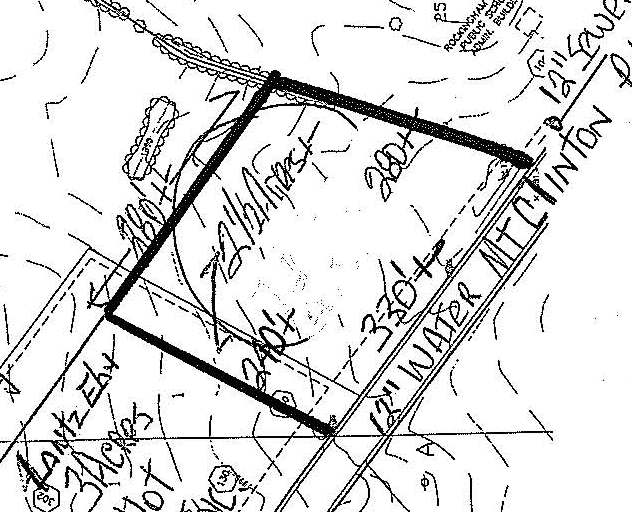
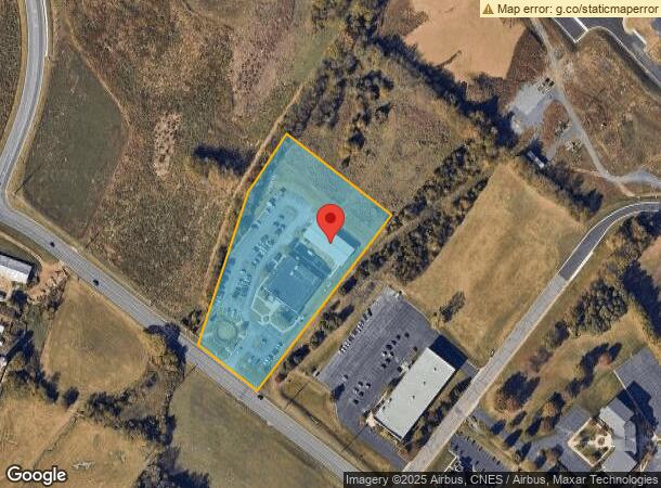
100 Mount Clinton Pike
044-A-25
QUADRANT 2 NS MT CLINTON PIKE
Governmentalpublicusegeneral
Harrisonburg
X
Virginia
51165C0403D
3.24 AC
2024
Staunton & Harrisonburg
2025
Other Market Areas
000401
Harrisonburg, VA
33,457 SF
DEMOGRAPHICS near 100 Mount Clinton Pike
1 Mile
3 Mile
5 Mile
2024 Total Population
4,389
39,071
67,850
2029 Population
4,286
38,535
67,747
Pop Growth 2024-2029
(2.35%)
(1.37%)
(0.15%)
Average Age
34
33
34
2024 Total Households
1,623
12,519
23,478
HH Growth 2024-2029
(2.53%)
(1.61%)
(0.15%)
Median Household Inc
$50,481
$54,922
$57,806
Avg Household Size
2.70
2.50
2.50
2024 Avg HH Vehicles
2.00
2.00
2.00
Median Home Value
$177,022
$251,260
$274,655
Median Year Built
1985
1982
1989
Nearby Places
Map Layers
Map Styles
 Street
 Aerial
- Restaurants
- Banks
- Shops
- Fitness
- Groceries
SALE & LEASE HISTORY
LISTING DATE
SALE/LEASE

Sep 24, 2016
For Sale
Nearby Properties
Address
Land Use
TOTAL SIZE
Lot Size
Zoning
Address
Land Use
TOTAL SIZE
Lot Size
Zoning
143.09 AC
MULTI DWEL
Address
Land Use
TOTAL SIZE
Lot Size
Zoning
68.88 AC
GENERAL IN
Address
Land Use
TOTAL SIZE
Lot Size
Zoning
114.53 AC
MULTI DWEL
Address
Land Use
TOTAL SIZE
Lot Size
Zoning
9.63 AC
MULTI DWEL
Address
Land Use
TOTAL SIZE
Lot Size
Zoning
100,172 SF
0.79 AC
MULTI DWEL
Address
Land Use
TOTAL SIZE
Lot Size
Zoning
219,561 SF
55.38 AC
GENERAL IN
Address
Land Use
TOTAL SIZE
Lot Size
Zoning
40,887 SF
24.09 AC
MULTI DWEL
Address
Land Use
TOTAL SIZE
Lot Size
Zoning
1,656 SF
36.28 AC
GENERAL IN
Address
Land Use
TOTAL SIZE
Lot Size
Zoning
11.07 AC
RESIDENTIA
Address
Land Use
TOTAL SIZE
Lot Size
Zoning
236,916 SF
3.72 AC
MULTI DWEL
Address
Land Use
TOTAL SIZE
Lot Size
Zoning
172,594 SF
0.65 AC
MULTI DWEL
Address
Land Use
TOTAL SIZE
Lot Size
Zoning
86,400 SF
37.26 AC
GENERAL BU
Address
Land Use
TOTAL SIZE
Lot Size
Zoning
14,856 SF
168 AC
MULTI DWEL
Address
Land Use
TOTAL SIZE
Lot Size
Zoning
95,500 SF
12.96 AC
GENERAL IN
Address
Land Use
TOTAL SIZE
Lot Size
Zoning
27,572 SF
MULTI DWEL
Address
Land Use
TOTAL SIZE
Lot Size
Zoning
32,592 SF
4.17 AC
COMMERCIAL
Address
Land Use
TOTAL SIZE
Lot Size
Zoning
78,560 SF
3.41 AC
MULTI DWEL
Address
Land Use
TOTAL SIZE
Lot Size
Zoning
420 SF
88 AC
MULTI DWEL
Address
Land Use
TOTAL SIZE
Lot Size
Zoning
54,943 SF
19.68 AC
GENERAL BU
Address
Land Use
TOTAL SIZE
Lot Size
Zoning
146,940 SF
32.91 AC
SINGLE FAM
Address
Land Use
TOTAL SIZE
Lot Size
Zoning
138.58 AC
I1
Address
Land Use
TOTAL SIZE
Lot Size
Zoning
78,833 SF
3.76 AC
GENERAL BU
Address
Land Use
TOTAL SIZE
Lot Size
Zoning
107,978 SF
20.45 AC
MULTI DWEL
Address
Land Use
TOTAL SIZE
Lot Size
Zoning
4,374 SF
17.93 AC
COMMERCIAL
Address
Land Use
TOTAL SIZE
Lot Size
Zoning
236,070 SF
2.40 AC
GENERAL IN
Address
Land Use
TOTAL SIZE
Lot Size
Zoning
12,276 SF
120 AC
MULTI DWEL
Address
Land Use
TOTAL SIZE
Lot Size
Zoning
13,939 SF
98 AC
CENTRAL BU
Address
Land Use
TOTAL SIZE
Lot Size
Zoning
28,776 SF
2.05 AC
CENTRAL BU
Address
Land Use
TOTAL SIZE
Lot Size
Zoning
206,055 SF
4.08 AC
GENERAL IN
Address
Land Use
TOTAL SIZE
Lot Size
Zoning
86,703 SF
1.42 AC
CENTRAL BU
The World's #1 Commercial Real Estate Marketplace
Connect with us
© 2025 CoStar Group
The information above has been obtained from sources believed reliable. While we do not doubt its accuracy we have not verified it and make no guarantee, warranty or representation about it. It is your responsibility to independently confirm its accuracy and completeness. Any projections, opinions, assumptions, or estimates used are for example only and do not represent the current or future performance of the property. The value of this transaction to you depends on tax and other factors which should be evaluated by your tax, financial, and legal advisors. You and your advisors should conduct a careful, independent investigation of the property to determine to your satisfaction the suitability of the property for your needs.