Property Record
100 Mueller Dr, Lumberton, NC 28358
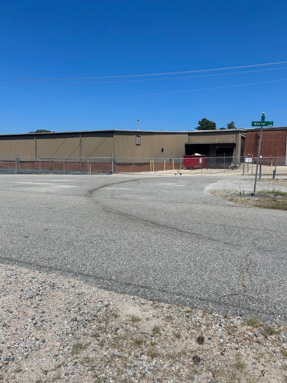


Property Detail
100 Mueller Dr
3245-05-001
A APPROX BUILDINGS RFC
Lightindustrial
ROBESON
M1
North Carolina
B and X Area of moderate flood hazard, usually the area between the limits of the 100-year and 500-year floods.
10 AC
2025
North Carolina Southeast Area
2025
Other Market Areas
961200
Lumberton, NC
148,162 SF
NEARBY LISTINGS FOR SALE OR LEASE
DEMOGRAPHICS near 100 Mueller Dr
1 mile
3 mile
5 mile
2025 Total Population
4,123
20,486
31,309
2030 Population
4,267
21,324
32,458
Pop Growth 2025-2030
+ 3.49%
+ 4.09%
+ 3.67%
Average Age
38
37
39
2025 Total Households
1,654
7,931
12,027
HH Growth 2025-2030
+ 3.51%
+ 4.24%
+ 3.82%
Median Household Inc
$41,495
$39,376
$45,292
Avg Household Size
2.40
2.40
2.40
2025 Avg HH Vehicles
1.00
2.00
2.00
Median Home Value
$95,094
$109,360
$120,934
Median Year Built
1966
1974
1979
Nearby Places
Map Layers
Map Styles
 Street
 Aerial
Layers
 Traffic
 Biking
Places
Listings with unknown addresses are not visible on the map
- Restaurants
- Banks
- Shops
- Fitness
- Groceries
PUBLIC TRANSPORTATION
AIRPORT
Fayetteville Regional/Grannis Field
Drive
Walk
Distance
Fayetteville Regional/Grannis Field
40 min
30.1 mi
Freight Ports
Port of Wilmington
Drive
Walk
Distance
Port of Wilmington
105 min
72.5 mi
Nearby Properties
Address
Land Use
TOTAL SIZE
Lot Size
Zoning
Address
Land Use
TOTAL SIZE
Lot Size
Zoning
59,810 SF
7.69 AC
R7
Address
Land Use
TOTAL SIZE
Lot Size
Zoning
116,616 SF
10.18 AC
B6
Address
Land Use
TOTAL SIZE
Lot Size
Zoning
82,115 SF
39.22 AC
R15
Address
Land Use
TOTAL SIZE
Lot Size
Zoning
134,160 SF
0.26 AC
B6
Address
Land Use
TOTAL SIZE
Lot Size
Zoning
128,531 SF
22.20 AC
B4
Address
Land Use
TOTAL SIZE
Lot Size
Zoning
418,000 SF
31.52 AC
M2
Address
Land Use
TOTAL SIZE
Lot Size
Zoning
120,000 SF
17.10 AC
M2
Address
Land Use
TOTAL SIZE
Lot Size
Zoning
297,300 SF
128.80 AC
M2
Address
Land Use
TOTAL SIZE
Lot Size
Zoning
24,984 SF
41.13 AC
R11
Address
Land Use
TOTAL SIZE
Lot Size
Zoning
67,728 SF
1.50 AC
B1
Address
Land Use
TOTAL SIZE
Lot Size
Zoning
69,765 SF
9.51 AC
B4
Address
Land Use
TOTAL SIZE
Lot Size
Zoning
2,187 SF
18.75 AC
R3
Address
Land Use
TOTAL SIZE
Lot Size
Zoning
4,048 SF
12.73 AC
R3
Address
Land Use
TOTAL SIZE
Lot Size
Zoning
88,710 SF
1.11 AC
B1
Address
Land Use
TOTAL SIZE
Lot Size
Zoning
95,143 SF
7.55 AC
B4
Address
Land Use
TOTAL SIZE
Lot Size
Zoning
12,938 SF
115.63 AC
RA
Address
Land Use
TOTAL SIZE
Lot Size
Zoning
51,003 SF
8.49 AC
B3
Address
Land Use
TOTAL SIZE
Lot Size
Zoning
62,404 SF
12.88 AC
Address
Land Use
TOTAL SIZE
Lot Size
Zoning
59,635 SF
10.24 AC
R11
Address
Land Use
TOTAL SIZE
Lot Size
Zoning
75,704 SF
7.60 AC
R3
Address
Land Use
TOTAL SIZE
Lot Size
Zoning
5,784 SF
903.32 AC
RA
Address
Land Use
TOTAL SIZE
Lot Size
Zoning
24,880 SF
19.30 AC
R20
Address
Land Use
TOTAL SIZE
Lot Size
Zoning
149,800 SF
66.53 AC
M2
Address
Land Use
TOTAL SIZE
Lot Size
Zoning
1,232 SF
10.68 AC
R7
Address
Land Use
TOTAL SIZE
Lot Size
Zoning
7,700 SF
10.66 AC
M1
Address
Land Use
TOTAL SIZE
Lot Size
Zoning
39,439 SF
1.10 AC
B5
Address
Land Use
TOTAL SIZE
Lot Size
Zoning
35,650 SF
9.25 AC
Address
Land Use
TOTAL SIZE
Lot Size
Zoning
13,367 SF
6.09 AC
R7
Address
Land Use
TOTAL SIZE
Lot Size
Zoning
373,485 SF
102.67 AC
RA
Address
Land Use
TOTAL SIZE
Lot Size
Zoning
59,800 SF
11.64 AC
B4
The World's #1 Commercial Real Estate Marketplace
Connect with us
© 2026 CoStar Group
The information above has been obtained from sources believed reliable. While we do not doubt its accuracy we have not verified it and make no guarantee, warranty or representation about it. It is your responsibility to independently confirm its accuracy and completeness. Any projections, opinions, assumptions, or estimates used are for example only and do not represent the current or future performance of the property. The value of this transaction to you depends on tax and other factors which should be evaluated by your tax, financial, and legal advisors. You and your advisors should conduct a careful, independent investigation of the property to determine to your satisfaction the suitability of the property for your needs.